Weekly Outlook January 2-8, 2017

We’ve flipped the calendar and are ready to start fresh in 2017. Of course, some things never change, like us entertaining and informing you about the upcoming weather. That’s the reason you’re here, right? So, let’s get right to it.

The two things we’re mainly looking at this week are a storm system and an arctic airmass. Since they both won’t be here at the same time, we’re not looking at a snowstorm for the middle of the week. (The end of the week could be a different story. More on that in a moment.) High pressure slides offshore today, and a weak system moves off the Mid-Atlantic coastline. Right now, it looks like it may stall too far south to have much, if any, impact around here, but a few showers are possible, with some freezing drizzle well inland. A strong system moves through later on Tuesday. This should bring us some rainfall for a good chunk of Tuesday and Tuesday night. Breezy and colder conditions follow for Wednesday and Thursday, with a few snow showers not out of the question on Thursday. High pressure builds in for Thursday, then a weak system moves in Thursday night and early Friday, with some light snow possible. This will be more of a nuisance than anything else, if it even materializes. High pressure returns on Saturday, then we get to Sunday.

sfct_anom-conus
Tuesday is looking awfully mild east of the Mississippi River. Across the Plains and Northern Rockies? Not so much. Temperatures could be up to 50 degrees below normal there. That’s cold. Image provided by Pivotal Weather.

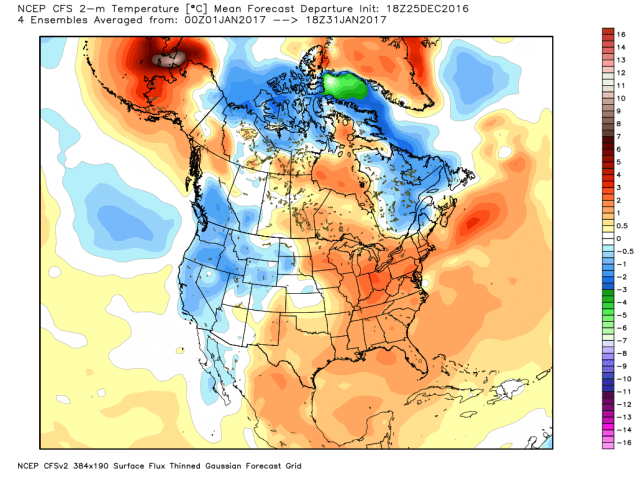
Sunday *could* be interesting. Notice that we said “could”, because at this point, it’s 7 days away, and there are plenty of conflicting signals in the models. One model says that high pressure will build in, with sunshine and cold temperatures. One model says that there will be a system passing offshore, with some light snow possible along the coast. One model says we’ll have a classic East Coast snowstorm, impacting all the major cities from Boston to Washington. So as, you can see, we’ve got something to keep an eye on this week. As you’ll see below, our forecast for now is going to be very vague because, as we already said, there’s a lot of uncertainty, and its way too early to make any kind of call. As the week goes on, if it is looking like something is up, we’ll be sure to let you know.

ndfd_snow_norcal_12
If you’re really looking for heavy snow, might we suggest a ski trip to the Sierra Nevada? Some places could get in excess of 2-3 feet by midweek. Image provided by WeatherBell.

Monday: Becoming partly to mostly cloudy. High 36-43.

Monday night: Mostly cloudy with a few spotty showers or some freezing drizzle possible. Low 29-36 in the evening, then temperatures may rise a bit at night.

Tuesday: Cloudy and becoming breezy with showers likely, becoming a steady rain late in the day. High 40-47.

Tuesday night: Breezy with rain likely, heavy at times, tapering off towards daybreak. Temperatures may rise into the 50s across southeastern Massachusetts during the evening, but will drop everywhere after midnight, settling to a morning low of 33-40.

Wednesday: Intervals of clouds and sunshine, breezy, slight chance for a shower. High 42-49.

Thursday: Partly to mostly cloudy with a chance for a few snow showers or some light snow, mainly late in the day and at night. High 28-35.

Friday: More clouds than sun, chance for some light snow or snow showers, especially early in the day. High 27-34.

Saturday: A mix of sun and clouds. High 25-32.

Sunday: Partly to mostly cloudy with a chance of snow. High 23-30.

Weekly Outlook: December 26, 2016 – January 1, 2017

As we head down the home stretch of 2016, we’ve got plenty going on in the weather department. In fact, we’re looking at three separate storms over the next seven days. So, let’s get right to it.

Storm #1 impacts the region later today into Tuesday. For the most part, this storm will not be a big deal, with some light rain for much of the region. However, when the precipitation moves in this afternoon, temperatures will be on the chilly side. We may see some flurries or sleet in a few spots, but it should all change to rain by mid-to-late afternoon. That’s good if you’re south of Boston. If you’re north and west of Boston, it’s bad, because temperatures will likely still be below freezing, meaning, we’re looking at some freezing drizzle or freezing rain for much of the afternoon. Warmer air will eventually spread northward, with temperatures rising above freezing as we head into the evening, but it may be close to midnight across central and southern New Hampshire before that happens. The rain ends by midday Tuesday, then we dry out for Wednesday, though it will remain on the chilly side. This brings us to Storm #2.

hiresp_ptype_boston_25
The Monday evening commute could be a slippery one north and west of Boston. Image provided by WeatherBell.

Storm #2 will impact the region Thursday, and there are still plenty of questions with this storm that we can’t answer definitively right now. What we do know is that a storm will move across the Great Lakes and into central Quebec. A secondary storm system will develop off the Mid-Atlantic coast and head northeastward. How quickly that secondary system develops and where it actually tracks will have a big impact on the forecast. Right now, it looks like most of our area will see mainly rain, with the best chance for some snow across areas north and west of Boston. The farther north and west you go, the better the chance for more snow.That storm heads into Atlantic Canada on Friday and really gets cranked up, which means we’re looking at a windy and cold day. A few flurries are even possible.High pressure builds in for Saturday, before Storm #3 comes calling on Sunday.

Storm #3 is the weakest of the bunch, but that doesn’t mean it won’t cause problems, especially since it’ll be New Year’s Day. The precipitation should start out as snow before daybreak, so if you’re out REALLY late on New Year’s Eve, you may have to watch out. However, it will likely change over to rain across much of the region before ending in the early afternoon hours.

As always, if any of these systems become a bigger threat, we’ll have a more detailed post in advance of it. Right now, the Thursday system is the one we’d be most concerned about that being the case.

Monday: Becoming cloudy with some spotty flurries or sleet around near midday, then some freezing drizzle or freezing rain likely in the afternoon, changing to plain rain across much of eastern Mass by evening. High 27-34 north and west of Boston, 34-41 south and east..

Monday night: Any remaining freezing rain across southern NH and the Merrimack Valley changes over to plain rain by midnight, with light rain and showers across the rest of the area. Becoming windy, especially across Cape Cod and southeastern Mass. Temperatures gradually rise overnight.

Tuesday: Showers ending in the morning, some clearing takes place in the afternoon. Breezy. High 48-55 before midday, then temperatures drop in the afternoon.

Tuesday night: Clear to partly cloudy, still breezy. Low 23-30.

Wednesday: Partly to mostly sunny. High 34-41.

Thursday:Becoming cloudy with rain likely, changing to snow across central/southern NH and into central MA, tapering off and ending late at night. High 37-44.

Friday: Intervals of clouds and sunshine, breezy, chance for a few snow showers. High 32-39.

New Year’s Eve:A mix of sun and clouds, still breezy. Light snow develops towards daybreak, except rain along the South Coast and across the Cape. High 26-33.

New Year’s Day: Cloudy with any snow changing over to light rain across the region, ending late in the day. High 36-43.

What will January bring? Well, at least one model says that temperatures will be above normal, with near normal precipitation. That likely means we wouldn’t see a lot of snow around here.

cfs_anom_t2m_noram_2016122518_m2
The CFS model says that January will be warmer than normal. Will that be the case? We’ll find out. Image provided by WeatherBell.

Weekly Outlook December 19-25, 2016

“I’m dreaming of a White Christmas, just like the ones I used to know.”

Sorry Bing, it looks like you’ll need to keep dreaming again this year. It’s not going to be in the 60s like last year, but it’s probably not going to be white either. The week will start off quiet though, which is a welcome change from the rollercoaster we’ve been on for the past few days. High pressure builds in with dry and cold conditions for Monday, but temperatures will gradually moderate Tuesday and Wednesday as high pressure slides off to the south and east of New England. Another system passes to our north on Thursday, with some snow or rain showers expected. High pressure returns for Friday and Saturday, giving us some nice weather for those last-minute trips to the mall, so that you can finally start your Christmas or Hanukkah shopping. As for Christmas Day itself, for now, it looks to start off dry, but another storm system will be moving across the Great Lakes, possibly sending some rain or snow into the region at night. We’ll have more on that system latr in the week as the details become a bit clearer.

161219052847
Remember how warm Christmas was last year? Yeah, it won’t be that warm this year. Image provided by Plymouth State University.

If you’re wondering when we might be looking at another snowstorm, you can probably flip your calendar to 2017. The final week of 2016 looks mild for now, though we’ll need to keep an eye on the timeframe around New Year’s Eve, as at least one model is hinting that something could be brewing around then.

814temp-new
The week in between Christmas and New Year’s looks like it may feature above normal temperatures. Image provided by NOAA.


Monday: Partly to mostly sunny. High 22-29.

Monday night: Clear skies. Low 7-14.

Tuesday: Sunshine and some afternoon clouds. High 28-35.

Tuesday night: Partly cloudy. Low 22-29.

Wednesday: A mix of sun and clouds. High 36-43.

Thursday: Mostly cloudy with rain or snow showers possible. High 39-46.

Friday: Plenty of sunshine. High 37-44.

Saturday: Partly sunny. High 40-47.

Sunday: Becoming mostly cloudy, chance of rain or snow at night. High 39-46.

Here at Storm HQ, we’d like to wish a Happy Christmakwanzakah to you and yours! (And a joyous Festivus to the rest of us!)

This Ride Probably Won’t Thrill You

“Get in, sit down, shut up, and hold on” – Toby Keith

Ladies and gentlemen, please make sure your safety belts are securely fastened, as this rollercoaster is ready to go. Yup, the weather will go through several changes over the next few days, giving us a little of everything – howling winds, bitterly cold wind chills, snow squalls, sleet, freezing rain, heavy rain, unseasonably mild temperatures. And that’s just before the weekend is over.

We’ll start with Thursday. A series of arctic cold fronts will cross the region. Some snow squalls may accompany the fronts, so you’ll need to be prepared for that if you’re out and about during the day. These are the winter equivalent of summer thunderstorms. They’re impossible to predict ahead of time, usually don’t last too long, but can have severe impacts if you get caught in one. Visibility can drop to near zero in an instant, a quick inch or two of snow could accumulate, and the next town over could see nothing at all.

winds
Very strong winds are likely Thursday night behind the cold front. Might be a good idea to bring some of those Christmas decorations inside for a few days. Image provided by National Weather Service – Taunton.

While the snow squalls can be a high-impact but localized event, the strong winds and bitterly cold temperatures will be felt region-wide. Northwest winds of 15-30 mph are likely, with gusts upwards of 50-60 mph possible, especially Thursday afternoon into Friday morning. High Wind Watches have been posted for parts of the region. If you have any loose objects outside, such as trash barrels, Christmas decorations, small children, etc, you may want to consider bringing them inside, so that they don’t blow away.

gfs_t2min_boston_9
GFS model forecast for low temperatures across the region Friday morning. Yes, those are in Fahrenheit, not Celsius. Image provided by WeatherBell.

These gusty winds will also usher some of the coldest air so far this winter into the region. Most days, the day starts off cool, warms up until mid-afternoon, then cools off again as the sun goes down. Thursday will not be one of those days. We’ll start the day with temperatures in the 30s, but temperatures will drop into the 20s by midday, then keep dropping. By Friday morning, most places will see temperatures in the single numbers, with some sub-zero readings possible. When you factor in the wind, the wind chill will be 15 to 25 below zero in many areas. Make sure you’re all bundled up if you have to head outside for any reason at all. Better yet, stay inside, it’s easier.

sfctwc-us_ne
Wind chills of 15 to 25 degrees below zero are expected Friday morning, Bundle up if you have to head outside for anything. Image provided by Pivotal Weather.

The good news is, the cold air will be short-lived. The bad news is, the transition from the arctic air will be rather messy. A storm system will head up the St. Lawrence Valley this weekend. Precipitation will develop ahead of this system before sunrise Saturday morning. That precipitation will start as snow, but as warmer air moves in aloft, it will start to change over. How quick that changeover occurs is the big question mark.

gfs_mslp_pcpn_frzn_neus_fh60-120
GFS model forecast for the progression of a storm system across the Northeast this weekend. Loop provided by Tropical Tidbits.

Cold air will likely remain entrenched at the surface, especially away from the coastline. With warm air moving in aloft, that means we’ll likely see a changeover to sleet and/or freezing rain across the interior Saturday afternoon. Along the coast, a quick change to rain is likely, as water temperatures remain in the 40s, which will help warm things up fairly quickly near the shoreline. Eventually, that warmer air will move in at the surface across the entire area, with a change to plain rain expected overnight. Before that changeover happens, we’ll probably see snowfall accumulations of 1-3″ south and east of I-95, including the Boston and Providence metropolitan areas. North and west of I-95, we’re looking at 2-5″ of snow, with the possibility of some sleet or ice accretion. Please keep this in mind if you have plans in this region Saturday afternoon/evening.

gfs_t2max_boston_17
Temperatures will be quite mild when you wake up Sunday morning, but more changes are coming. Image provided by WeatherBell.

OK, so it warms up Saturday night and everything changes to rain. End of story, right? Nope, the ride isn’t over yet. By Sunday morning, temperatures will be in the 40s to lower 50s north and west of Boston, with 50s and possibly even some 60s from Boston southward. So, Sunday will be a nice warm day, right? Nope. Temperatures will peak in the morning, then drop again throughout the day as the system drags a strong cold front across the region. In fact, if the rain is slow to depart, it could change back over to some snow or sleet before ending in the afternoon. It probably won’t accumulate, but with wet roads and sharply falling temperatures, we could see some black ice develop on many area roadways. Again, just one more thing to keep in mind in you are heading out and about late Sunday afternoon or evening.

Things start to calm down after that. Monday will be quite chilly again, with highs only in the 20s, and gusty winds keeping wind chills close to zero. Temperatures start to moderate next week, and a late-week system could bring in some rain. Right now, it’s not looking like a White Christmas, but things can still change. Beyond that? Well, the GFS model gave us a good laugh this afternoon.

gfs_mslp_pcpn_frzn_neus_51
The GFS model is having delusions this afternoon. Sure, it’s a possibility, but we’re not putting much stock in this forecast. It is fun to look at though. Image provided by Tropical Tidbits.

Weekly Outlook: December 12-18, 2016

Well, after a week of sunshine and summer-like warmth in Florida and the Bahamas, it’s back to reality for your favorite forecasters here at Storm HQ. And man, is that reality going to be harsh.

As this post is being written, snow is breaking out across Southern New England, with a change to rain already occurring across the Cape. That rain/snow line will gradually head northward early Monday morning, reaching southern New Hampshire by mid-to-late morning, though we could see a period of sleet and/or freezing rain before everything goes over to all rain. It looks like everything ends by early afternoon. While we’re not looking at a lot of snow, the combination of snow and or mixed precipitation will make a mess of the morning commute, so keep that in mind when you head out the door in the morning.

hiresp_snow_boston_22
Expected snowfall before a change to rain occurs Monday. Many of you won’t even need to shovel. Image provided by WeatherBell.

Once the storm pulls away, high pressure builds in for Monday night and Tuesday, with drier and seasonably cool conditions expected. Wednesday could be an interesting day. Right now, it looks like we’ll stay dry as a storm system passes south of the region. However, some of the models bring the storm a little farther north, which could result in some rain or snow, especially south of Boston. Once that passes by, an arctic cold front will cross the region on Thursday. Some snow squalls may accompany the front, but what’s behind it will get your attention. While Thursday will be a rather chilly day, Thursday night and Friday will feature some of the coldest air so far this season, with lows possibly dropping into the single numbers virtually everywhere Friday morning, and highs Friday afternoon staying in the teens and lower 20s. Wind chills will be well below zero, especially in the morning. The good news is that the cold air will be short-lived. As a storm system heads into the Great Lakes next weekend, south to southwest winds will pump warmer air into the region. Snow will develop ahead of the system on Saturday, but should change over to rain as warmer air moves in both aloft and at the surface. In fact, Sunday could even feature above normal temperatures, though it could also be accompanied by some rainfall. We’ll worry about that storm later i n the week.

sfctwc-us_ne
Break out the arctic gear Friday morning. Wind chills will be below zero. Image provided by Pivotal Weather.

Monday: A wintry mix of snow, sleet, and freezing rain changing to all rain from south to north during the morning, ending by mid-afternoon. Some clearing developing late in the day. High 36-43 from the Merrimack Valley northward, 43-50 south of the Merrimack Valley.

Monday night: Becoming mostly clear. Low 24-31.

Tuesday: Sunshine and a few clouds, breezy. High 34-41.

Tuesday night: Partly cloudy. Low 21-28.

Wednesday: A mix of sun and clouds, slight chance for rain or snow south of Boston late in the day and at night. High 33-4o.

Thursday: Partly to mostly cloudy, chance for snow squalls. High 21-28.

Friday: Partly to mostly sunny, windy, and cold. High 14-21.

Saturday: Becoming cloudy with snow developing, likely changing to a wintry mix and eventually plain rain at night. High 30-37.

Sunday: Cloudy and breezy with rain tapering off and ending. High 40-47, though there is the potential for temperatures to jump well into the 50s, especially from Boston southward..

Weekly Outlook?

By now, you’re probably wondering why the weekly outlook hasn’t been posted, especially since it was snowing. Here at StormHQ, we’re taking a little time off, for a vacation in the tropics. Don’t worry, we’ll be back next week. Until then, enjoy the snow (or complain about it), while we enjoy sunshine and temperatures in the 80s in Florida and the Bahamas.

Weekly Outlook: November 28-December 4, 2016

Here we are, in the final days of November and the beginning of December, ad we’re staring at not one but two storms this week that could bring us heavy precipitation. Of course, that precipitation will be nearly all rain, but we definitely need it, as we’re still in the midst of a drought.

m6pdpt_ma_oct16
To say that rainfall has been below normal around here for quite some time would be a big understatement. Image provided by the Northeast Regional Climate Center.

The week starts off on a sunny but chilly note thanks to high pressure. You’d better enjoy that sunshine though, because once it disappears behind afternoon clouds, you won’t see it again until Thursday. The first storm system moves through on Tuesday, giving us a good dose of rainfall. Things could be tricky to start though. The rain may arrive before daybreak on Tuesday. With cool weather still in place, temperatures may be close to freezing across central and southern New Hampshire when the rain arrives. This could result in a little freezing rain in some areas, so you may want to be careful heading out the door early Tuesday morning. Temperatures should be above freezing across the region by late morning, ending any potential icing threat. South of Boston, it could be a much different story. Gusty southerly winds could send temperatures well into the 50s on Tuesday. The rain tapers off and ends Tuesday evening, but the next storm will be quickly approaching from the west. This storm will likely head up the St. Lawrence Valley, keeping the entire region mild, but with another round of heavy rain late Wednesday into Thursday morning. Colder air settles in behind that storm, and with an upper-level low pressure area moving through, we could see a few rain or snow showers on Friday. High pressure then builds in for the weekend with dry and cool conditions.

qpf_acc-us_ne
The GFS model is forecasting 1.5-3″ of rain across the region through late Thursday. We need even more to break the drought. Image provided by Pivotal Weather.

Monday: Plenty of sunshine, dimmed by afternoon cloudiness. High 39-46.

Monday night: Becoming cloudy with rain developing towards daybreak, possibly starting as some freezing rain in central and southern New Hampshire. Low 28-35.

Tuesday: Rain likely, possibly heavy at times. Becoming breezy along the south coast. High 45-52 north of Route 2, 52-59 south of Route 2.

Tuesday night: Mostly cloudy with rain tapering off and ending in the evening. Low 39-46.

Wednesday: Cloudy and becoming breezy with rain redeveloping by midday. High 48-55.

Thursday: Any lingering showers ending in the morning, otherwise becoming partly sunny and breezy. High 48-55, except 55-60 south and east of I-95.

Friday: A mix of sun and clouds, slight chance for a rain or snow shower. High 43-50.

Saturday: Partly sunny. High 39-46.

Sunday: Intervals of sun and clouds. High 37-44.

We do need to keep an eye on the start of the following week. Most of the models are indicating that a storm system may impact the region Monday into Tuesday. However, there is very little agreement among the models on how strong the storm might be, how heavy the precipitation might be, and what type of precipitation may fall. So, we’re not going to go into any more details at this time. We’re just giving you the heads up to keep an eye on future forecasts.

Thanksgiving Forecast

(borrowed from Elliot Abrams)

Turkeys will finish thawing Thanksgiving morning, then warm in the oven to a high near 190 in the afternoon. The kitchen will turn hot and humid, and if you bother the cook, be ready for a severe squall or a cold shoulder.

During the late afternoon and early evening hours, the cold front of a knife will slice through the turkey and cause it to accumulate 1-2 inches on plates. Mashed potatoes will drift across one side while cranberry sauce creates slippery spots on the other, especially if it mixes in as you turn to the green bean casserole. Please pass the gravy.

A weight watch has been issued for the entire area and we expect intervals of indigestion, with increasing stuffiness around the beltway. During the evening the turkey will diminish and taper off to leftovers and drop to a low of 34 in the refrigerator.

Looking ahead to Friday and Saturday: high pressure to eat sandwiches; flurries of leftovers can be expected both days with a 50% chance of scattered soup during the midday hours. We expect a warming trend baste on where soup develops.

bcde5ea6309d6f288e8db52fd9bf4d95

Weekly Outlook: November 21-27, 2016

If you’re planning to head “over the river and through the woods to grandfather’s house” for your Thanksgiving dinner, well, you won’t need a sleigh to get there. You will probably need a coat and maybe an umbrella too.

If the snowflakes that many of us saw Sunday evening weren’t enough of a hint, the wind chill when you step outside today will be a bigger one – we’re moved into a colder pattern. Don’t worry, there still aren’t any big snowstorms in the immediate future, but there also aren’t any days where you can walk around in shorts and be comfortable.

hires_wchill_boston_13
Wind chills will be in the upper teens and 20s when many of you head out to work or school Monday morning. Image provided by WeatherBell.

We start the week off with low pressure moving across Northern New England and into Atlantic Canada. This will result in blustery (there’s a word you only hear used in the winter) and cool conditions for Monday and Tuesday. A few more snow showers are possible on Monday as an upper-level low pressure area swings through the region.High pressure briefly builds in for Wednesday, but the next storm system will be moving eastward right on its heels. Thanksgiving will be mainly cloudy with a few showers possible, and some wet snow could mix in if the showers arrive early enough in the day, mainly north and west of Boston. Black Friday starts off dry (if you’re heading out for the Midnight Specials), but another weak system will quickly approach, with more showers possible by evening, continuing into Saturday when a period of steadier rain is possible. Blustery (there’s that word again!) and cool conditions return on Sunday.

Monday: Intervals of clouds and sunshine, windy, chance for a few snow or rain showers. High 33-40.

Monday night: Partly cloudy to clear, breezy. Low 26-33.

Tuesday: Partly to mostly sunny, still breezy. High 36-43.

Tuesday night: Mostly clear skies. Low 25-32.

Wednesday: A sunny start, then clouds return in the afternoon. High 37-44.

Thursday: Mostly cloudy with a chance of showers, possibly mixed with some wet snow early in the day. High 39-46.

Friday: Plenty of clouds, chance for a few showers, especially late in the day and at night. High 43-50.

Saturday: Rain tapers off to showers before ending late in the day. High 42-49.

Sunday:A mix of sun and clouds, breezy. High 40-47.

Before you complain about how cold it is, just remember, it could be a LOT worse. Over in Siberia, Mongolia, and Kazakhstan, temperatures today will be 20 to 40 below zero. That’s 30 to 50 or more degrees below normal. Our temperatures, while chilly, will “only” be 10-15 degrees below normal today.

sfct_anom_c-as
Temperatures in Central and Eastern Asia will be 15-30 degrees C (25-50F) below normal today. Image provided by Pivotal Weather.

Winter Finally Is Arriving in the Plains

Just in time for Thanksgiving, it looks like all the ingredients are in place for Mother Nature to cook up a Plains Blizzard.

ncep_cfsr_noram_t2m_anom
To say that November has been warm across the nation would be a BIG understatement. Image provided by WeatherBell.


A storm system will move out of the Rockies and across the Plains states over the next few days. Ahead of the system, warm, moist air will be drawn northward from the Gulf of Mexico. High temperatures on Thursday will be in the 70s as far north as Chicago and Des Moines, with record high temperatures expected across much of the Mississippi Valley. The warmth won’t last too much longer though, as a strong cold front will be marching eastward across the Great Plains.

ndfd_record_hi_mc_2
Numerous record high temperatures are expected on Thursday across the Mississippi Valley. Image provided by WeatherBell.


Behind the front, much cooler air will settle southward from Canada. With plenty of moisture being drawn northward, it will fall as snow on the backside of the low from the Central Rockies and Central Plains northeastward into the Upper Midwest. Some of the snow could be heavy, especially in parts of South Dakota and Minnesota, where snowfall totals of 10-15 inches are expected by Saturday evening, with some heavier amounts possible. As you might expect, Winter Storm Watches have been posted from eastern Wyoming and northern Nebraska northeastward to Minnesota.

snku_acc-us_nc
Snowfall forecast through Saturday evening from the GFS model. Image provided by Pivotal Weather.


Snow isn’t the only hazard with this system. As it strengthens, it will create strong winds across much of the Plains states. Sustained winds of 20-30 mph with gusts to 50 mph or more are expected, especially from the Dakotas into Nebraska. The combination of high winds and snow may result in blizzard conditions at times. A blizzard watch has been issued for southwestern Minnesota, northeastern South Dakota, and extreme southeastern North Dakota.

warn
Yup, that’s a Blizzard Watch for parts of Minnesota and the Dakotas. Image provided by NOAA.

Once the system moves into southern Canada this weekend, some of the coldest air so far this season will settle into the region. While these temperatures aren’t that unusual for late November, they will be quite a change from the recent warmth that has enveloped the area. Low temperatures will likely drop into the teens and 20s across the region this weekend, with single digits possible. In some of the locations with fresh snowcover some sub-zero readings are possible. The cool air will be short-lived, as temperatures will likely warm back up to above normal readings by early next week. Current indications are that the unseasonably mild weather will persist for the most part well into December across the region.

As the system heads up into Canada, it will drag a strong cold front across our region on Sunday. Enjoy the mild air for the next few days, because things will change by late Sunday. In fact, on Monday, with temperatures expected to stay in the upper 30s and 40s at best, and some precipitation around thanks to an upper-level low pressure area, we could see some wet snowflakes falling. We’re not expecting any accumulation right now, because the ground is still much too warm, but we’re not going to rule out seeing snow showers at this point.