Humidity remains in place for several more days this week, but the heat will also make a comeback.

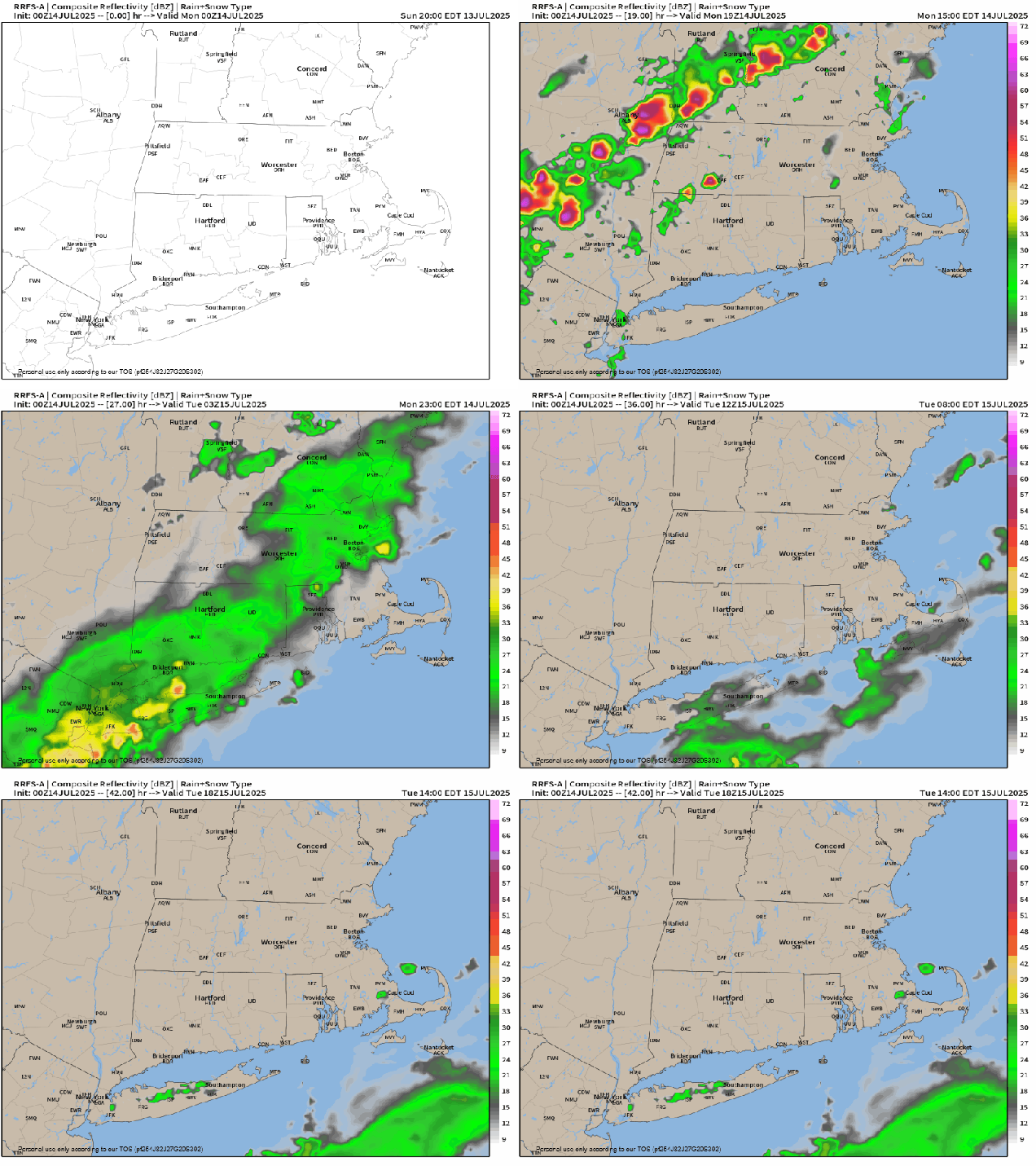
High pressure remains off to our southeast today, with a trough of low pressure moving toward the region. The result will be southwest winds bringing very warm and humid air into the region. As the trough gets nearer, we’ll see some showers and thunderstorms moving in late in the day and into the evening hours. While there could be a few strong storms, the timing will likely be a little too late in the day for any widespread severe weather. However, any storms that do form will likely be fairly slow-moving, so they could dump a lot of rain in localized areas, which could result in some flash flooding in spots. Now this won’t be like what we’ve see in Texas recently, and it probably won’t be as bad as we say south of Boston this past Thursday morning, but it’s something to keep in mind if you’ll be out and about this evening.

Some of the showers could linger into Tuesday morning across parts of eastern and southeastern Massachusetts until the trough moves offshore, but once it does, humidity levels won’t drop much, if at all, and we set the stage for some hot weather to return. Once the sun breaks out on Tuesday, temperatures should get well into the 80s, with dewpoints in the 60s, resulting in a heat index likely reaching the lower 90s in many spots in the afternoon. The heat and humidity really return for Wednesday and Thursday, with many locations getting near or above 90 degrees, but with dewpoints creeping up even higher, the heat index may approach or exceed 100 each afternoon. A couple of widely scattered showers and thunderstorms may provide a little relief on Wednesday, with coverage or showers and storms expanding a bit more on Thursday. Again, some of these storms could be slow-moving, so localized flash flooding is possible.

Friday is the day with the biggest question marks at this point. A cold front will be heading towards the region, with very warm and very humid air remaining in place ahead of it. The question is – how warm? Some models give us enough sunshine to allow temperatures to get near or above 90 once again, others have enough cloudcover to keep us in the 80s. As the front moves in, showers and thunderstorms are likely. The timing of the front and the amount of sunshine we get will help determine whether we can expect any severe weather or not. High pressure builds in with cooler and drier weather for Saturday. Another system could start to move in by later Sunday, but it also could hold off until Sunday night or Monday. We’ll have a better idea of what to expect from that when we get to our Weekend Outlook, which will be published on Wednesday this week instead of Thursday.

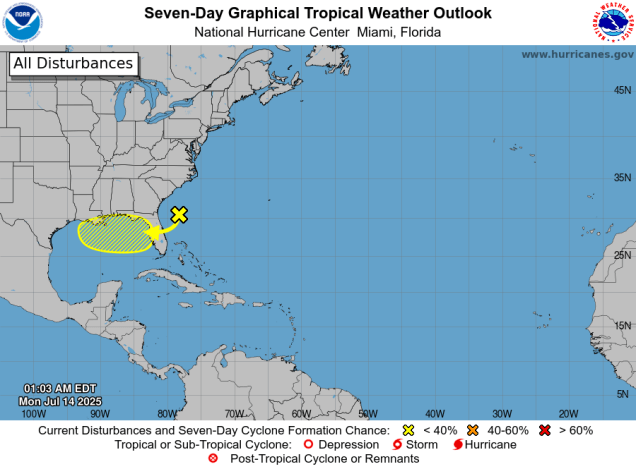
We’re also keeping an eye on the tropics. An area of disturbed weather currently off the Southeast coast is expected to drift towards northern Florida over the next few days, bringing some heavy rain to parts of the Sunshine State. After that, it should continue westward and into the northeastern Gulf. Some models show the potential for the system to develop as it moves westward across the northern Gulf, others don’t do much with it. Water temperatures are plenty warm, so that won’t be a factor. This is something we’ll be keeping an eye on over the next several days.

Monday: Some low clouds and fog early, then becoming partly sunny, humid, showers and thunderstorms possible late in the day. High 80-87, a little cooler across the South Coast and Cape Cod.
Monday night: Any lingering showers or storms end in the evening, remaining partly to mostly cloudy with another shower or two and some patchy fog possible. Low 66-73.
Tuesday: Morning clouds, maybe a shower or two across southeastern Massachusetts, then becoming partly to mostly sunny, still humid. High 83-90, a little cooler across the South Coast and Cape Cod.
Tuesday night: Partly cloudy. Low 65-72.
Wednesday: A mix of sun and clouds, very humid, slight chance for a pop-up shower or thunderstorm during the afternoon. High 86-93, cooler across the South Coast and Cape Cod.
Wednesday night: Partly to mostly cloudy and muggy with some patchy fog. Low 68-75.
Thursday: Partly sunny and quite humid, some afternoon and evening showers and thunderstorms possible, breezy in the afternoon. High 84-91, a little cooler across the South Coast and Cape Cod.
Thursday night: Partly cloudy, muggy. Low 69-76.
Friday: Partly sunny and humid with showers and thunderstorms developing in the afternoon, ending in the evening. High 86-93.
Saturday: A mix of sun and clouds, not as humid. High 78-85.
Sunday: Intervals of clouds and sun, chance for late-day showers and thunderstorms. High 79-86.