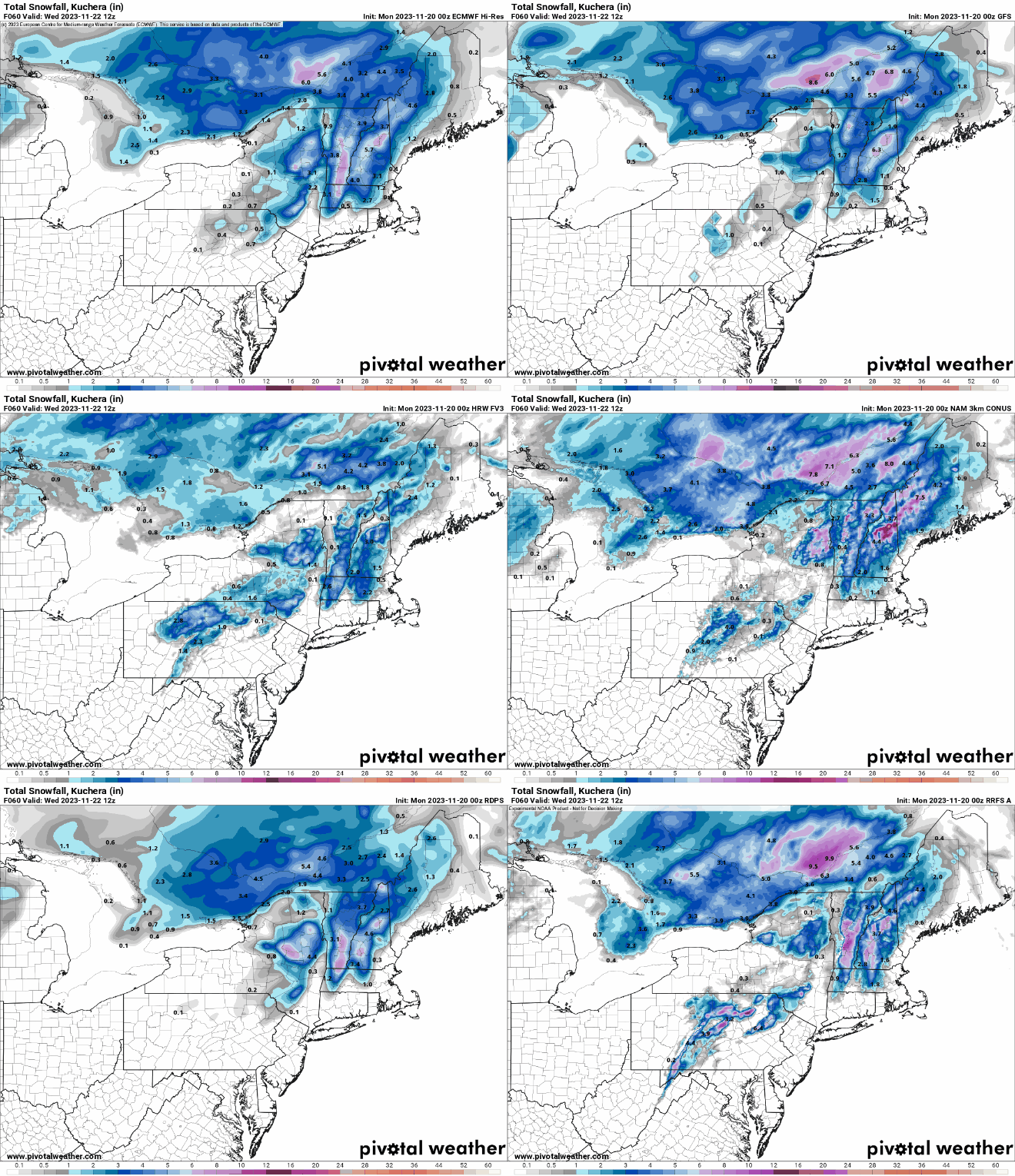
Thanksgiving week has arrived, but before we get to the holiday we’ve got a complicated forecast.

The week starts off simple enough with high pressure bringing us sunshine and cool conditions. It’ll be breezy at times, making it feel even cooler, with wind chills in the 20s and lower 30s. Tuesday starts off chilly, but we’ll see clouds start to move in as low pressure heads towards the Great Lakes. A secondary area of low pressure will develop off of the Mid-Atlantic coast Tuesday evening, passing near or just south of the South Coast on Wednesday while the main low passes by to the north. They’ll combine to bring us a windy and wet day on Wednesday, also known as the busiest travel day of the year. However, the rain and wind isn’t the entire story. We’ve left out a big detail, one that many of you probably won’t like. The precipitation will move in towards midnight Tuesday night, and temperatures at that time will probably be close to freezing. That means that it will likely start as snow (or sleet), especially north and west of Boston. Once you get outside of I-495, there could even be some accumulation before the change to rain washes everything away. Once you get into the hills of Worcester County and the Monadnocks of southwestern New Hampshire, there could be a few inches before the changeover. Yes folks, it’s that time of year, whether you like it or not, to use an overused phrase – “Winter is Coming.”

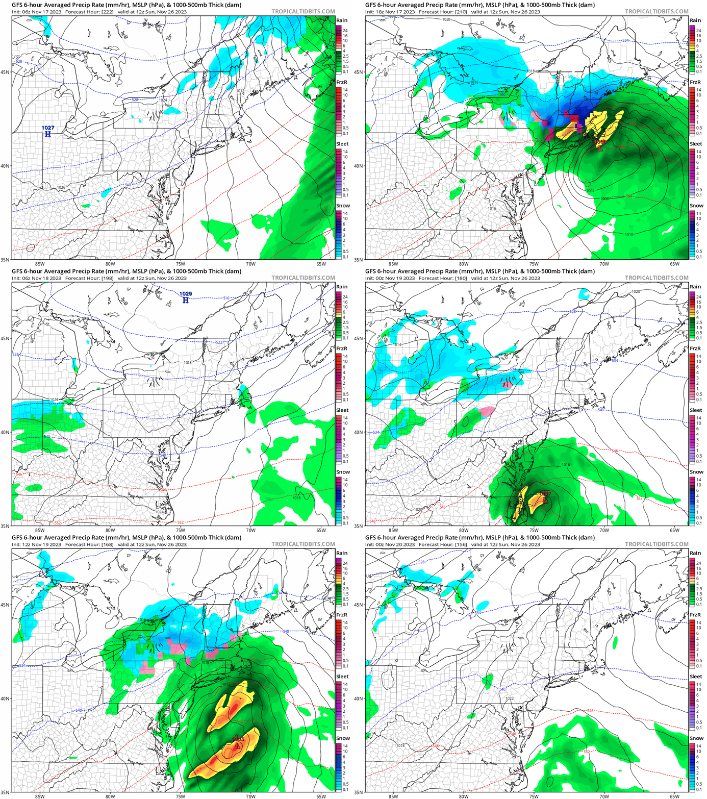
The rain tapers off Wednesday afternoon, but likely doesn’t completely end until evening, but then high pressure builds in with sunshine and cool temperatures again for Thanksgiving. So, if you’re traveling locally, you shouldn’t have any issues, but if you’re heading out to one of the high school football games make sure you dress appropriately, because it will be on the chilly side. Friday looks similar to Thanksgiving with dry and cool conditions once again, but the weekend isn’t looking as nice. Another system will likely move up the coast, and this one *should* be mostly rain, but the various forecast models don’t agree on much with this storm, including how strong it will be, the track it will take, or even whether it will impact us on Saturday or Sunday or not at all. We’ll take a deeper dive on that system when we publish our Weekend Outlook, which will be out on Wednesday this week instead of the usual Thursday.

Monday: Plenty of sunshine, a little breezy at times. High 34-41.
Monday night: Clear skies through the evening, some clouds start to move in after midnight. Low 18-25.
Tuesday: Becoming mostly cloudy. High 36-43.
Tuesday night: Cloudy and becoming windy snow developing around midnight north and west of Boston, changing to sleet and rain before daybreak, rain developing elsewhere. Low 30-37 during the evening, temperatures rise after midnight.
Wednesday: Cloudy and windy with rain likely, possibly heavy at times in the morning, tapering off to showers by early afternoon, ending in the evening. High 46-53, possibly a little warmer across southeastern Massachusetts and Cape Cod.
Thanksgiving: Mostly sunny, breezy. High 43-50.
Friday: Partly sunny. High 42-49.
Saturday: Mostly cloudy, breezy, chance of rain. High 39-46.
Sunday: Partly to mostly cloudy, breezy, chance of rain. High 39-46.