Hurricane Lee and Tropical Storm Margot continue to slowly move across the Atlantic Ocean this evening.
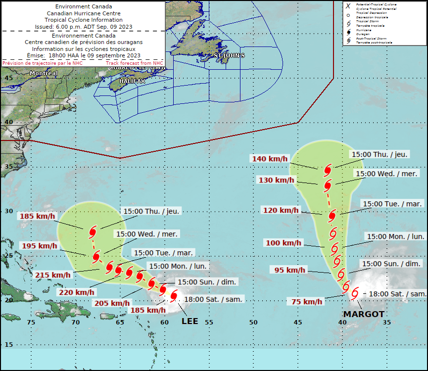
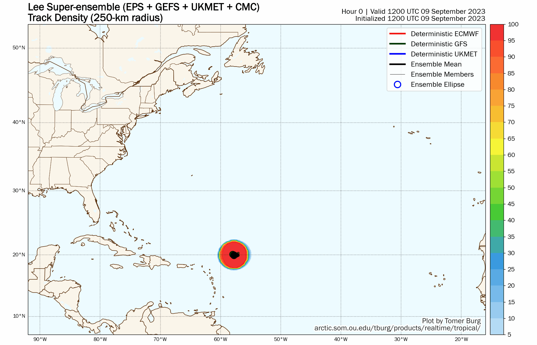
Hurricane Lee has generated plenty of hype over the past several days, and will continue to do so into next week. As of 5pm Saturday, Lee was centered about 310 miles northeast of the Northern Leeward Islands, moving toward the west-northwest at 10 mph. After peaking as a Category 5 hurricane a couple of days ago some shear has taken its toll on Lee, reducing maximum sustained winds down to 115 mph. Lee should continue west-northwestward for the next day or two, passing safely north of the Greater Antilles, but generating some rough surf. The rough surf will spread to Bermuda and the East Coast over the next couple of days as well. Southwesterly shear is forecast to continue for another day or so (possibly longer), which means that rapid restrengthening is not likely. In fact, it wouldn’t be a surprise if Lee weakened a little more despite passing over very warm waters.

By the beginning of the upcoming week, Lee will turn more toward the northwest and then north as an upper-level trough of low pressure moves off the East Coast. Exactly where it makes the turn will be the key to determining if Lee will have any impact on land. Historically, the odds are strongly against that happening already. Lee has already moved north of 20 degrees North latitude before reaching 60 degrees West longitude. A colleague did some research on this and found that over the past 30 years, storms that pass north and east of that 20/60 point have just a 14% chance of making landfall in the United States.

Lee should head northward, passing west of Bermuda, but possibly close enough to bring tropical storm conditions to the island. After that, another upper-level trough will be moving into the eastern U.S., and the position and strength of that trough will be crucial in determining whether Lee turns northeastward and heads out to sea, or continues northward towards Atlantic Canada. Yes, there is still a small chance that Lee impacts eastern New England, especially Maine, but the odds of this happening are very low at this point. When it does get this far north, whether it heads out to sea or into Atlantic Canada (or New England), it absolutely will NOT be as strong as it is now. In fact, there’s a very good chance it might not even be hurricane strength at that point. It also could be undergoing transition into an extratropical system. Bottom line, there’s a better chance of the Patriots winning the Super Bowl this season than there is of Lee ending New England’s hurricane drought, currently at 32 years and counting.
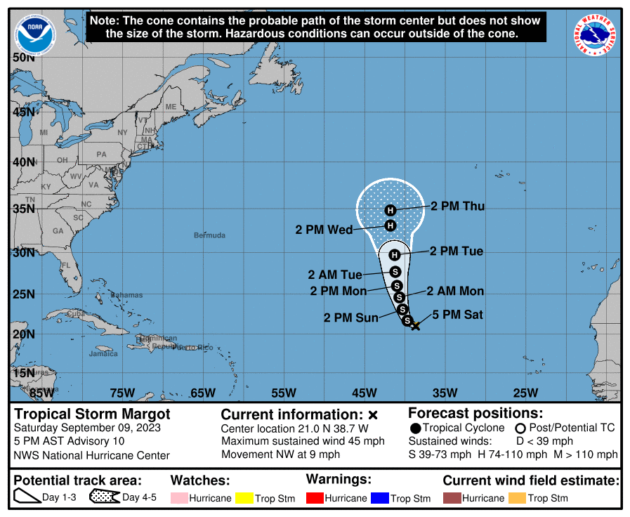
Farther to the east lies Tropical Storm Margot. As of 5pm, Margot was centered about 1020 miles west-northwest of the Cabo Verde Islands, moving toward the northwest at 9pm. Maximum sustained winds were near 45 mph. Margot is also undergoing some wind shear right now, but it should lessen as Margot turns more toward the north over the next day or so. Margot should start to strengthen, and could become a hurricane by early in the week. Margot should continue northward over open water, without impacting and land areas over the next several days.
Another tropical wave has also moved off the west coast of Africa. Some of the models show the potential for this wave to develop, so we’ll keep a close eye on it as it makes its way across the Atlantic over the next several days.
