Our early summer preview will last for another day for parts of the region, but April will be coming back rather quickly.
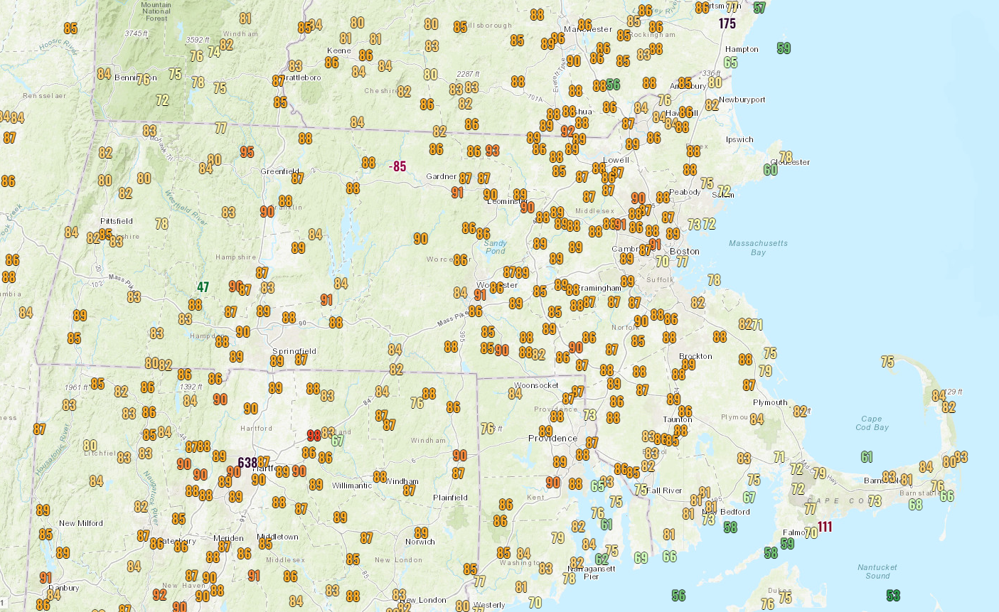
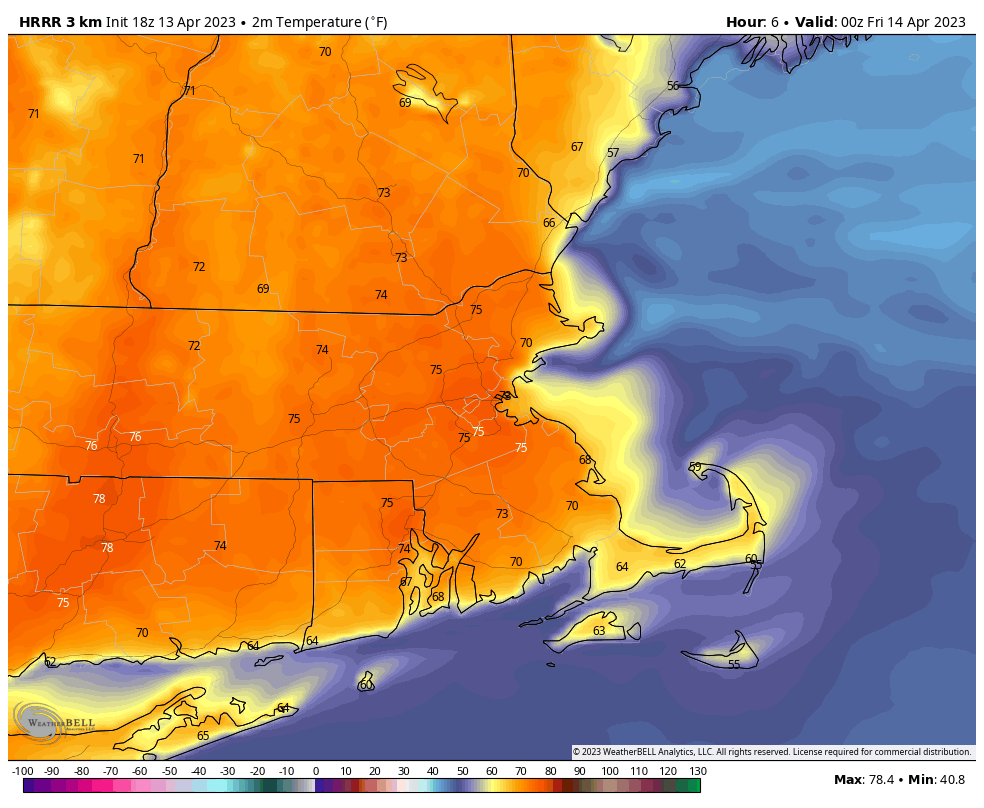
High pressure remains in place offshore, keeping most of the region very warm for the rest of today and tonight, and into the day on Friday. However, a backdoor cold front will start to move inland during the day on Friday, which means that coastal areas will quickly turn cooler, with inland areas likely staying warm again Friday, cooling off late in the day. While some inland locations could make a run at 90 during the afternoon, coastal locations may drop into the 50s at the same time. That front likely stalls out at some point on Saturday, keeping most of us on the cooler side, with temperatures in the 50s to lower 60s, which is close to normal for mid-April. South and west of the front, it’ll be another warm day, but this is mostly likely for areas from the Connecticut Valley south and west. A weak disturbance moves through for Saturday night and Sunday with a few showers, mainly south of the Mass Pike. However, with plenty of clouds and some showers around, temperatures will stay in the 50s for most of us.
This brings us to Monday – Patriots Day, when weather will be very important, since we have both the Boston Marathon and the Red Sox traditional 11am game, as well as other assorted activities such as the reenactments of Paul Revere’s ride and the first shots of the Revolution in Lexington and Concord. We also have the Bruins 1st playoff game at night, but the weather won’t impact that. A cold front will bring moving into the region, bringing some rain, but the timing is still in question. Some models have showers in the morning, some hold off the rain until afternoon. Obviously, that makes a huge difference, so we’ll be keeping an eye on that as we go through the weekend.

Thursday night: Clear through the evening, some clouds may start to drift in after midnight. Low 56-63.
Friday: Partly to mostly sunny. High 72-79 along the coast, 80-87 inland, but temperatures will drop sharply in the afternoon, especially closer to the coast.
Friday night: Increasing clouds. Low 44-51.
Saturday: More clouds than sun, a few showers possible late in the day, mainly south of the Mass Pike. High 57-64 near the coast, 65-72 inland.
Saturday night: Mostly cloudy with some showers likely, again mostly south of the Mass Pike. Low 45-52.
Sunday: Mostly cloudy and breezy with showers likely, mainly across eastern Massachusetts and Rhode Island and mainly during the morning. High 52-59.
Sunday night: Mostly cloudy. Low 44-51.
Patriots Day: Mostly cloudy and breezy with showers likely, especially during the afternoon. High 59-66, cooler along the coast.
