Much of the upcoming week will feature some weather that is rather typical for July.
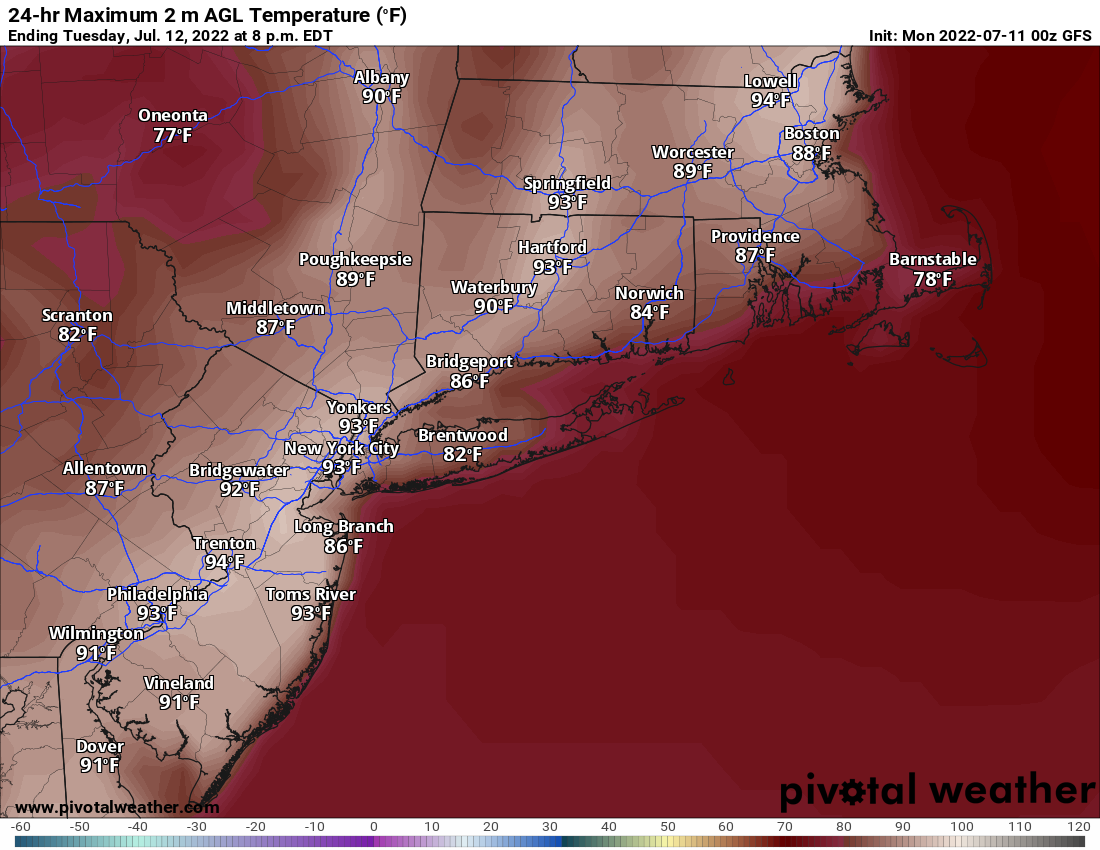
High pressure moves offshore today, with southwest winds increasing this afternoon, bringing warmer, and more humid air into the region. You probably won’t notice the humidity until tonight, but you will certainly notice it on Tuesday, when hot and humid weather moves in ahead of a cold front. That front may produce showers and thunderstorms late in the day and at night. Right now, it looks like most of the severe weather should stay well to the west, but a few storms could produce some gusty winds and downpours Tuesday night. The front pushes offshore Wednesday morning, but it will remain quite warm, with humidity levels dropping during the day.
High pressure builds in for Thursday and Friday with seasonably warm and dry conditions. We’ll start to warm up and become more humid again on Saturday, then the next frontal system approaches on Sunday, with a chance for more showers and thunderstorms.

Monday: Sunshine and a few clouds, breezy during the afternoon. High 82-89, a little cooler along the South Coast.
Monday night: Clear skies. Low 62-69.
Tuesday: Partly sunny, breezy, humid, chance for some late-day showers and thunderstorms. High 86-93, a little cooler along the South Coast.
Tuesday night: Partly cloudy, showers and thunderstorms possible, especially during the evening. Low 63-70.
Wednesday: Becoming mostly sunny. High 85-92.
Thursday: Partly sunny. High 81-88.
Friday: A mix of sun and clouds. High 78-85.
Saturday: Intervals of sun and clouds. High 81-88.
Sunday: Partly sunny, humid, chance for a shower or thunderstorm. High 82-89.
