We’ve got a fairly quiet week coming up for the first time in a while.
Low pressure pulls away from the region this morning, with rain coming to an end. We’ll see some clearing this afternoon, but an upper-level low pressure area will move through on Tuesday with more clouds and possibly a shower or two. High pressure builds in for Wednesday and Thursday with generally dry conditions and a warming trend.
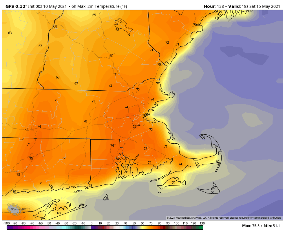
The end of the week is a little uncertain at the moment, but it doesn’t look that bad. Another upper-level low will move into the Northeast, so we’ll have more cloudcover at times, with a few showers possible each afternoon. Most of these won’t be that heavy, and they shouldn’t be that widespread, so overall, the weekend shouldn’t be that bad. Temperatures should be on the mild side, likely near to above normal for mid-May.
Monday: Showers end early, some afternoon sunny breaks. High 56-63.
Monday night: Partly to mostly cloudy. Low 40-47.
Tuesday: Intervals of clouds and sun, chance for a shower or two, breezy. High 57-64.
Tuesday night: Partly cloudy. Low 37-44.
Wednesday: A mix of sun and clouds. High 56-63.
Thursday: Sunshine and some afternoon clouds. High 62-69.
Friday: A mix of sun and clouds, chance for an afternoon shower. High 63-70.
Saturday: Partly sunny, showers possible during the afternoon. High 64-71.
Sunday: Intervals of clouds and sun, chance for a few showers. High 64-71.
