We’re still under the influence of a blocking pattern, which means that changes in our weather will be slow to take place, but there are changes coming.
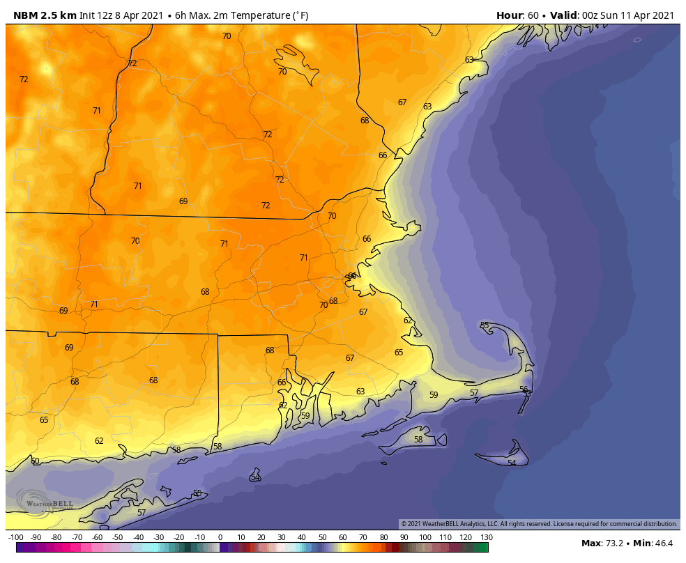
Right now, we’re on the “good side” on the block, with high pressure in place. That will give us dry and mild to warm conditions through Saturday. Seabreezes will keep coastal areas much cooler, since ocean temperatures are still in the 40s, but away from the coast, temperatures will get well into the 60s and 70s for the next few days.
As everything slides eastward. changes occur later in the weekend. We’ll see clouds start streaming in late Saturday and Saturday night as low pressure starts to move out of the Midwest. Some rain will move in ahead of the system on Sunday, though the day itself probably won’t be a washout. The main storm system will remain in the Midwest, but a secondary area of low pressure will develop and pass south of New England Sunday night and Monday, with some additional showers possible.
With the cloudcover and shower activity, it goes without saying that Sunday and especially Monday should be significantly cooler than Friday and Saturday, though Sunday is a bit of a wild card. Most of the models have a backdoor cold front move through around daybreak on Sunday, which results in a chilly day with east winds and temperatures holding steady in the 40s to lower 50s. There is one exception though. The Canadian model (full disclaimer: It’s not usually a good model), delays that backdoor cold front until mid-afternoon Sunday. While this isn’t much of a change in timing, it has a significant effect on the forecast. Instead of temperatures in the 40s and lower 50s, it has temperatures in the lower to middle 70s on Sunday ahead of the front, but then they quickly plunge into the 40s during the afternoon as the front moves through. For now, this is an outlier, but given the pattern that we’re in, a delay of 6-12 hours isn’t that far-fetched. With that in mind, we’re going to lean a little warmer than most of the models for Sunday (for now). If the rest of them are correct, then our forecast is too warm. If the Canadian model is right, then our forecast could be as much as 10-20 degrees too cool.

Thursday night: Clear to partly cloudy. Low 37-44.
Friday: Sunshine and a few clouds. High 64-71, cooler along the coast.
Friday night: Partly cloudy. Low 40-47.
Saturday: Partly sunny. High 66-73, cooler along the coast.
Saturday night: Mostly cloudy. Low 43-50.
Sunday: Cloudy with showers likely. High 54-61.
Sunday night: Mostly cloudy with a few showers possible. Low 36-43.
Monday: Cloudy with a chance of showers. High 51-58.
