We’ve got a fantastic stretch of weather coming up for a good chunk of the upcoming week thanks to a large area of high pressure.
Dry and mild conditions are expected through at least the first part of Wednesday thanks to a large area of high pressure. Along the coast, temperatures will be cooler, thanks to a seabreeze each of the next few afternoons, but once you get inland, temperatures should reach the 60s each day. Things could be a little tricky on Wednesday however. Low pressure will meander off to the south for the first half of the week, with little impact on us. However, by late Wednesday it will start to lift out, sending some clouds in along with the possibility of a few showers. If the showers are more widespread than we currently expect or the clouds are thicker, temperatures could end up quite a bit cooler than our forecast currently shows.

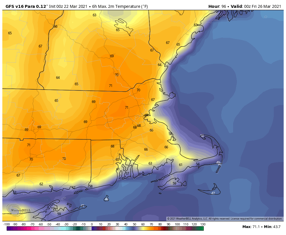
High pressure then builds back in south of the region, resulting in southwesterly winds bringing even milder air in for Thursday, possibly right to the coastline. Unfortunately, we’ll also have more cloudcover, as another low pressure area makes its way into the eastern Great Lakes. With enough sunshine, temperatures could top 70 degrees in many spots. That system will bring us some rain for Thursday night into Friday as it passes to our north and west, before a cold front crosses the region during the day on Friday. Friday’s temperatures will be dependent on the timing of the front, the later it moves through, the more likely that it’ll be warmer. If the rain lingers long enough and the cold air moves in fast enough, some wet snow could mix in before everything winds down. We don’t expect this to be the case, but can’t completely rule it out just yet.
Behind that front, more seasonable conditions are expected for Saturday, but Sunday is where things could get interesting again. Another low pressure system will head toward the region, with some rain possible by late Sunday or Sunday night. The problem is, we’ll have some cold air nearby, so it may not be just rain, at least for part of the region. There’s a chance we could have some snow from this system, especially the farther north and west you go from Boston. This is hardly a lock, and things will change numerous times between now and then, but it’s just another example that even though it’s now Spring, that doesn’t mean we’re entirely done with Winter just yet.

Monday: Lots of sunshine. High 57-64, cooler along the coast.
Monday night: Clear skies. Low 30-37.
Tuesday: Sunshine and some afternoon high clouds. High 57-64, cooler along the coast.
Tuesday night: Partly cloudy. Low 33-40.
Wednesday: Thickening clouds with some showers possible during the afternoon and evening. High 52-59, cooler along the coast.
Thursday: More clouds than sunshine. High 62-69, cooler along the South Coast and Cape Cod.
Friday: Cloudy and breezy with showers likely, possibly mixing with wet snow before ending at night. High 58-65, cooler along the South Coast and Cape Cod.
Saturday: Intervals of clouds and sun, cooler. High 53-60.
Sunday: Early sun, then becoming cloudy with rain possible late in the day and at night, possibly mixed with some wet snow well to the north and west. High 49-56.
