As you stare outside at all of the snow that fell yesterday, we’ve got some a tidbit to show you that despite what it looks like, Spring is right around the corner.
Yes, the Groundhog said we’re going to have six more weeks of winter, but we’ve got a sure sign for you that Spring is coming soon. Today is Red Sox Truck Day. It’s the day that the big truck leaves Fenway with all of the equipment to head to Fort Myers for Spring Training. Now, the team was largely forgettable last year, and this year isn’t looking a lot better, but if we’re talking about Spring Training starting soon (we hope), then can there really be a lot of winter left? (You really don’t want the answer to that question).

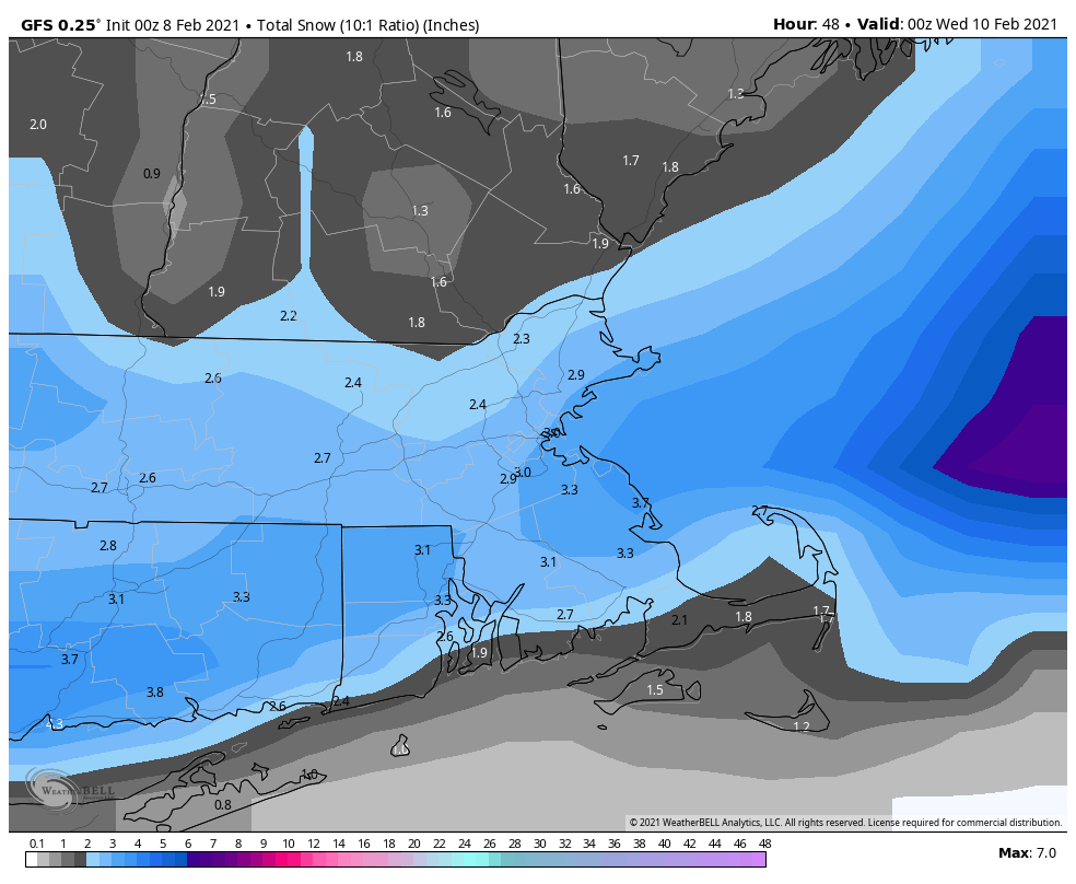
As for the weather this week, we’re starting off with sunshine and chilly conditions as high pressure settles into the region today. It won’t last that long, as we’re in a fairly active pattern right now, with systems moving in every 2-3 days, but none of them look to be substantial, at least for now. However, if you get enough little systems over a short period, and it does add up. Sort of like “Death by 1000 Paper Cuts.” The next one sends clouds in tonight, with some light snow likely on Tuesday, possibly mixed with rain along the South Coast. This will not be a big storm, but another 2-4 inches seems likely. It will likely fall during the day, so it could impact both the morning and afternoon commutes, for those of you not working from home.
High pressure builds back in for Wednesday with drier and cooler conditions. Again, this won’t last long, as another system approaches on Thursday. This storm will also pass south of the region, so we’re looking at another period of light snow sometime Thursday into Friday. The models differ a bit on the timing of this storm, and some of the models show the high pressure area to the north building in, which would keep the snow confined to areas south of the Mass Pike. These are details that can’t be worked out that precisely 5 days in advance, especially since the models have performed rather poorly more than 2-3 days in advance lately, so we’re just going to include a chance of snow for the entire region. Obviously, we have some time to work out the details. High pressure returns on Saturday with colder weather, but then another storm may move in for Sunday with more light snow or a wintry mix possible. It’s obviously WAY too early for any details on that system.
Monday: Sunshine with some afternoon clouds. High 22-29.
Monday night: Becoming mostly cloudy. Low 8-15.
Tuesday: Cloudy with light snow likely, possibly mixed with some rain along the South Coast and Cape Cod. High 27-34.
Tuesday night: Becoming clear to partly cloudy. Low 14-21.
Wednesday: A mix of sun and clouds. High 25-32.
Thursday: Cloudy with a chance of light snow. High 23-30.
Friday: Partly to mostly cloudy with a chance for light snow. High 22-29.
Saturday: Some early sun, then clouds return. High 24-31.
Sunday: Cloudy with a chance for snow or a wintry mix. High 20-27.
