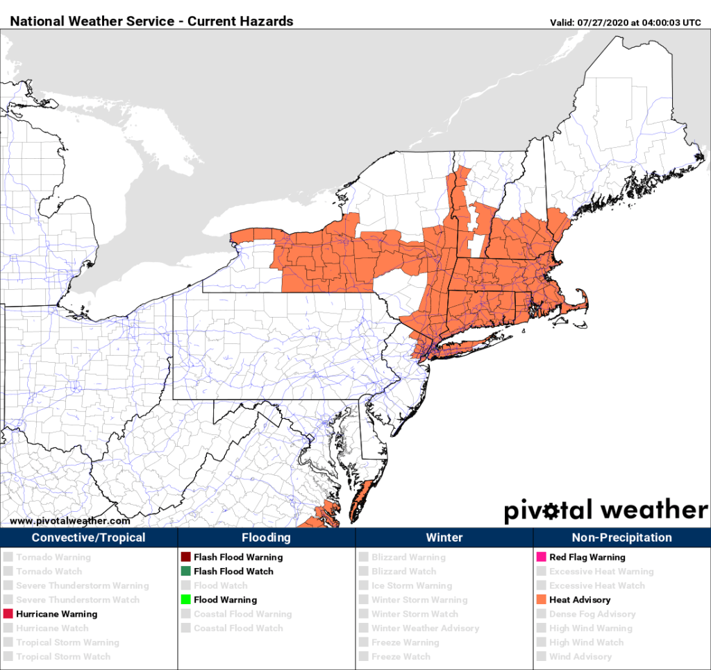
Heat and humidity continue across the region for a couple more days before relief arrives on Wednesday.

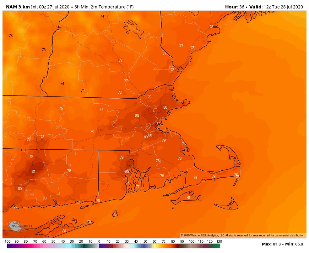
A ridge of high pressure remains in control, so stifling heat and humidity will remain in place until Tuesday. Today looks to be the hottest day, with temperatures well into the 90s. A few places could reach 100, but triple-digit heat shouldn’t be widespread. It will be very humid as well, sending the heat index well above 100 across the region, but dewpoints may actually drop a bit during the afternoon. Tonight will be downright uncomfortable without air conditioning, as low temperatures will only drop into the middle to upper 70s in many areas, and some urban areas, especially Boston, may not drop below 80.

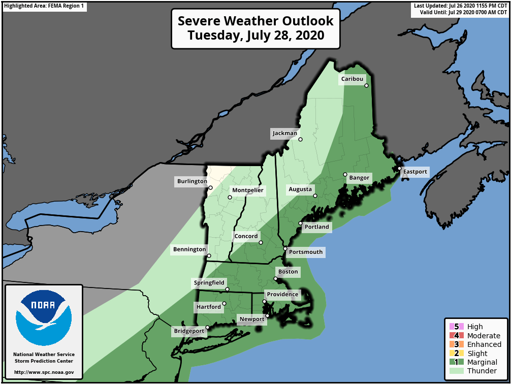
Tuesday will start off very warm and humid, so it won’t take much to send temperatures above 90 once again, but clouds will also start to increase in the afternoon as a cold front approaches the region. This front may produce a few showers and thunderstorms late in the day and at night. Some of these storms may produce some heavy downpours and gusty winds, but we’re not expecting widespread severe weather.

The front slides offshore early Wednesday, then high pressure builds in for the rest of the week and into the weekend. It be a bit cooler, but still near to a little above normal for the end of July, but the more noticeable effect will be that it is drier, with dewpoints only in the 50s to lower 60s.
Monday: Sunshine and some high clouds around, hot and humid. High 92-99.
Monday night: Clear to partly cloudy. Low 72-79.
Tuesday: Sunny early, then clouds move in with some showers and thunderstorms possible late in the day. High 90-97.
Tuesday night: Showers ending during the evening, though possibly lingering for much of the night near the South Coast. Low 67-74.
Wednesday: Lingering clouds along the South Coast early, otherwise becoming partly to mostly sunny and not as humid. High 85-92.
Thursday: Sunshine and some afternoon clouds. High 83-90.
Friday: A mix of sun and clouds. High 81-88.
Saturday: Partly to mostly sunny. High 81-88.
Sunday: Partly sunny. High 82-89.

Finally, we’ll mention the tropical disturbance in the Central Atlantic, since the hype train is already getting set to leave the station. Yes, there are a few models that show a potential threat to the East Coast in about 7-10 days. These should be treated the same as model forecasts in January that show a raging blizzard 7-10 days out. The probability of it happening is still fairly low. The system itself hasn’t even become a tropical depression yet. That may occur later Monday or Tuesday. If (when?) it does, we’ll write a blog post about the storm and it’s future. For now, it has our attention, but that’s it.