An approaching storm system will make for quite the interesting Thursday across New England.
The low pressure system that will generate severe weather across parts of the Mississippi and Ohio Valleys this afternoon and evening will head northeastward tonight, and pass right over New England on Thursday. It will produce a variety of weather across our six-state region, depending on where you’re located. Across southern New England, we’ll have heavy rain, possibly some thunderstorms, and strong winds. Across northern New England, this could turn out to be quite a snowstorm.

Starting with southern New England, we’ll see showes developing during the morning, becoming a steady rain during the afternoon. With warmer air moving at the surface, thunderstorms may develop as the system moves in. Some of these storms may produce gusty winds, and hail, as there will be plenty of cold air aloft with an upper-level low pressure system moving into the Northeast.
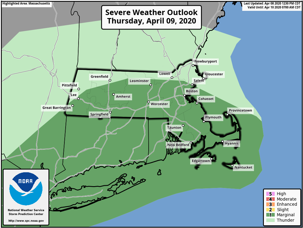
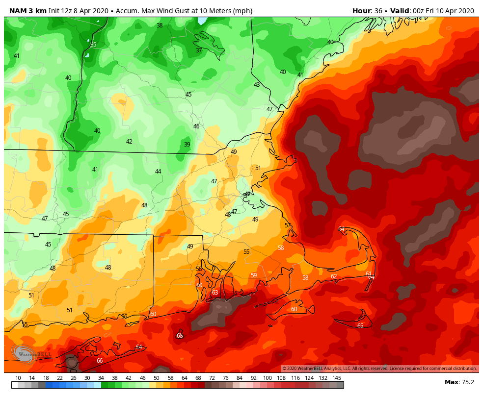
The rain and thunderstorms should come to an end by late afternoon, but that’s only half of the threat. A cold front will cross the region, with strong winds likely behind it. Sustained winds of 20-30 mph, with gusts of 40-50 mph or higher are likely. These winds may diminish a bit overnight, but will likely pick back up on Friday as the storm continues to intensify across eastern Canada. That upper-level low pressure area will also be overhead, so we’ll have plenty of clouds and a few showers popping up. With the cold air aloft, some of those showers could produce some small hail or graupel.
While we are dealing with strong winds and thunderstorms, it’ll be a completely different story across northern New England. Temperatures will be much cooler across Maine, New Hampshire, and Vermont, with much of the precipitation falling in the form of snow, especially in the mountains. Some of the snow will be quite heavy, with a foot or more possible, especially across Maine and northern New Hampshire. Winter Storm Watches are in effect for parts of the region. The snow will also be accompanied by strong winds, gusts to 40 mph or more, which may create blizzard conditions at times. There’s already little travel going on due to the pandemic, but there should be even less over the next few days.

The snow should wind down on Friday, but with the upper-level low in place, snow showers may continue. Some of those snow showers may spread into the Berkshires as colder air works its way in. Some wet snow is even possible into the Worcester Hills and Monadnocks.
High pressure will build in for the weekend with drier weather, but our next system looks to move in on Monday. That one looks like a rain-maker right now, and it might produce a decent amount of rainfall. We’ve been a bit dry this winter, so we need all the rain we can get right now to avoid slipping into a drought.
