A pair of storm systems are heading our way, but for most of us, snow will be the least of our concerns. Your Thursday morning commute will be a mess however.

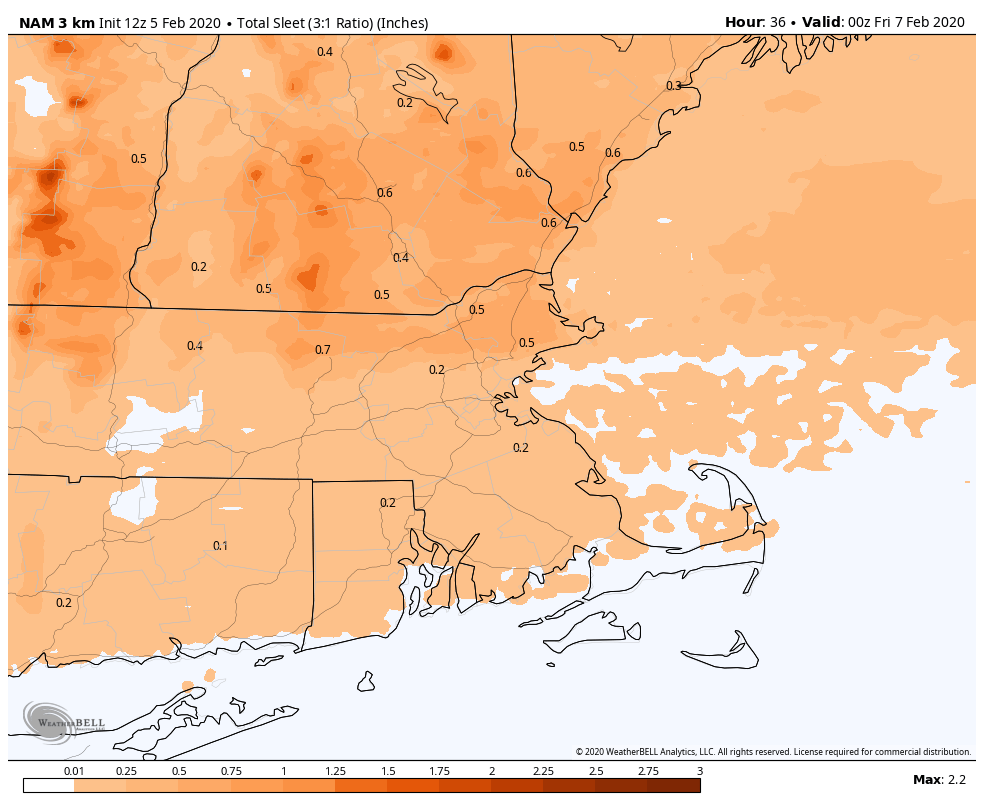
Low pressure will ride along a frontal system that is stalled out south of New England tonight and Thursday. Meanwhile, high pressure is in place to the north, bringing some colder air into the area. As the precipitation shield ahead of the low moves in after midnight, it will fall in the form of snow across most of the area, except along the South Coast, where it will be mainly rain with some sleet mixed in. This snow won’t last too long though, as warmer air will be moving in aloft. This will change the snow to sleet and then freezing rain from south to north as the morning progresses. We’re not expecting much snow accumulation, but the combination of snow, sleet and freezing rain will make a mess out of the morning commute.
The warmer air eventually pushes in at the surface by early afternoon for most of us, changing everything to plain rain. Across southern New Hampshire, things could get tricky. Temperatures may not get much above freezing, or even above freezing at all, which would keep the freezing rain going, resulting in very slippery conditions. The precipitation should taper off by late afternoon, with only some drizzle or freezing drizzle through the evening and the first part of the overnight.

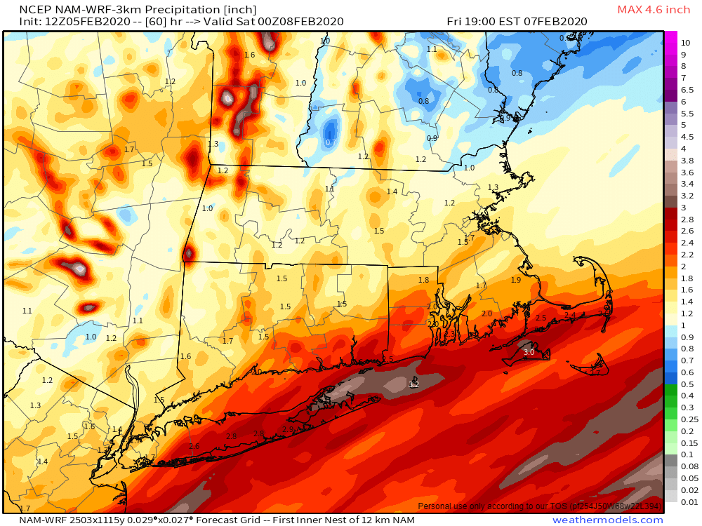
This brings us to the 2nd part of our double whammy. The storm that is producing severe weather across the Gulf Coast today will head towards Southern New England on Friday. Rain will redevelop after daybreak, and it could be heavy for a while during the morning. This will have some impact on the Friday morning commute, but not to the extent of the wintry mix on Thursday. Across southern New Hampshire, we may have some more significant problems though. We may still have cold air in place at the surface, which could lead to more freezing rain and sleet as the heavier precipitation moves back in. If the precipitation is heavier enough, it could drag some of the warmer air aloft down to the surface, changing everything to plain rain, but the Friday morning commute could be a mess along I-93 and US-3 north of the Massachusetts border.
As the low moves across Southern New England, places south of the center of the low, mainly Connecticut, Rhode Island, and southeastern Massachusetts, will see temperatures jump into the 40s or even the 50s. However, as the low passes by, colder air will quickly move in both at the surface and aloft. This will allow the precipitation to change to snow from northwest to southeast. The cold air will be moving in as the precipitation comes to an end though, which will limit any accumulations.

If you’re a skier, you’ll be happy, as this storm will be mainly snow and sleet up north, with significant accumulations possible in ski country.

The pattern we’re in will be active for a while, with storm systems coming in every 2-3 days for the next week or two. Some of these will contain wintry precipitation, it is February after all.
