As we head into the home stretch of 2019, it looks like the year is going to end with a wintry mess.

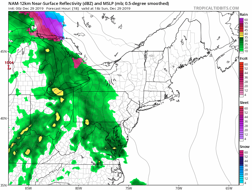
The storm system that produced heavy snow in the Plains and strong to severe thunderstorms in the Mississippi Valley on Saturday will head into the Great Lakes on Sunday, then just mill around in the Midwest for Monday and early Tuesday. Clouds will stream into our area later Sunday ahead of the system, but as is usually the case with a storm that far west, the warmer air that we usually find on the east side of a storm system won’t make it in here, at least at the surface (that becomes important later on).
Sunday will be a mild day (by late December standards) as high pressure moves out, but temperatures should drop below freezing during the evening. We’ll see precipitation start to break out before midnight across much of the area. While there will still be cold air in place at the surface, warmer air will be starting to move in aloft. So, we should see sleet and some freezing rain developing, with some snowflakes, mainly from central and southern New Hampshire northward. Some accumulations are possible, especially from the Seacoast up into the Lakes Region, but only a few inches at most before a change to sleet occurs. Along the South Coast, this will be mainly rain with temperatures above freezing.
With a frontal system stalled out south of New England, we’ll have generally east to northeast winds on Monday. This will allow parts of southeastern Massachusetts and Rhode Island (mainly south and east of Interstate 95), to warm above freezing as somewhat milder air moves in off the ocean. Across inland areas, it’ll be a much different story.
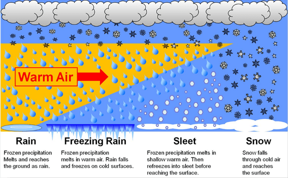
Cold air will remain in place for most of the day on Monday and into Monday night. Meanwhile, a few thousand feet above the ground, warmer air will be moving in. This will mean sleet at first, but as that warmer air layer grows thicker, the sleet should transition over to freezing rain. When that transition occurs is still a bit of a question mark.
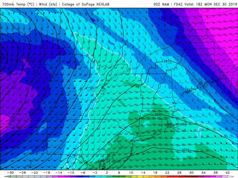
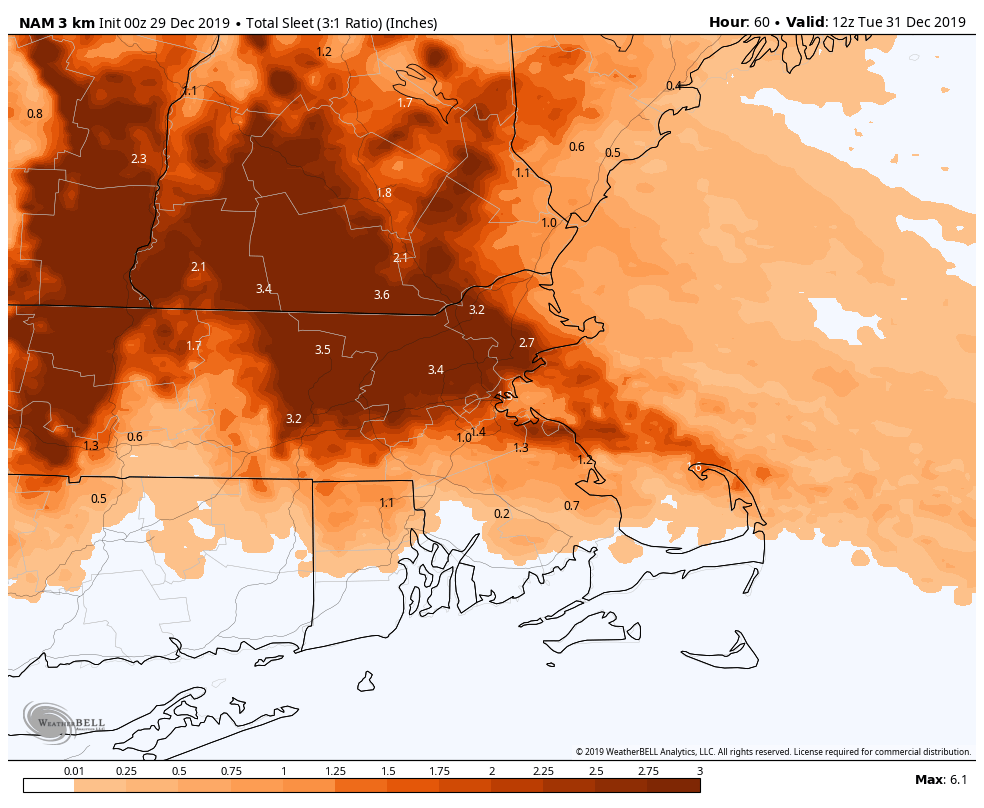
Some models are showing the potential for significant amounts of sleet from interior eastern Massachusetts into southern New Hampshire, with significant ice accretion from freezing rain across the Worcester Hills, Monadnocks, and the Berkshires. No matter what happens, travel will be very slippery across the interior on Monday,
By Monday night, a secondary area of low pressure should develop south of Long Island, and it will head northeast, moving across Cape Cod early Tuesday, then into the Gulf of Maine. As it moves close to the area, it should help force the warm air farther inland, allowing temperatures to rise above freezing across most of the area. However, once it moves into the Gulf of Maine, colder air will settle in behind it, both at the surface and aloft, changing everything back to snow showers before the precipitation winds down Tuesday morning.

We’ll update this forecast as well as a look at New Year’s Eve and New Year’s Day in our Weekly Outlook early Monday morning.
