Winter’s back, and it’s not going anywhere for a while. We’ve got more snow on the way in the next 24 hours, so we’ll get right to it.
We went into great detail yesterday, so we won’t spend too much time on today. Basically, the daylight will be fairly quiet as the low move towards the Gulf of Maine. We’ll have some occasional showers and/or drizzle across eastern Massachusetts, with freezing drizzle or a few flurries farther inland and up into southern New Hampshire. Late in the day, temperatures will start to drop, so things could get icy across eastern Massachusetts as well.
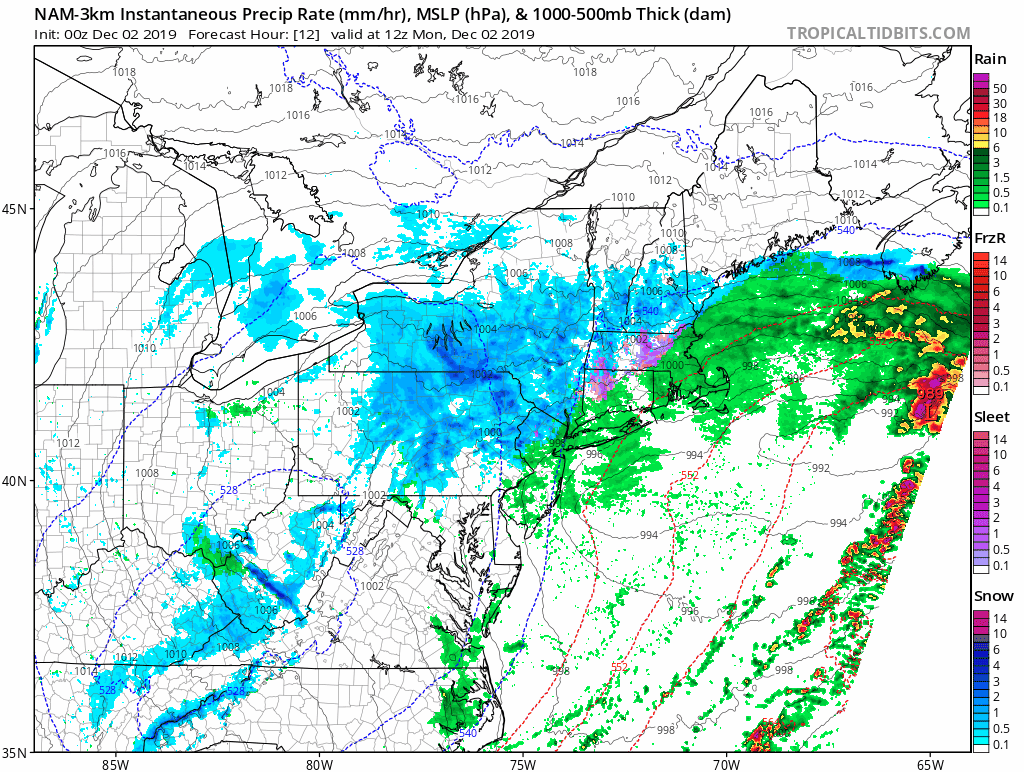
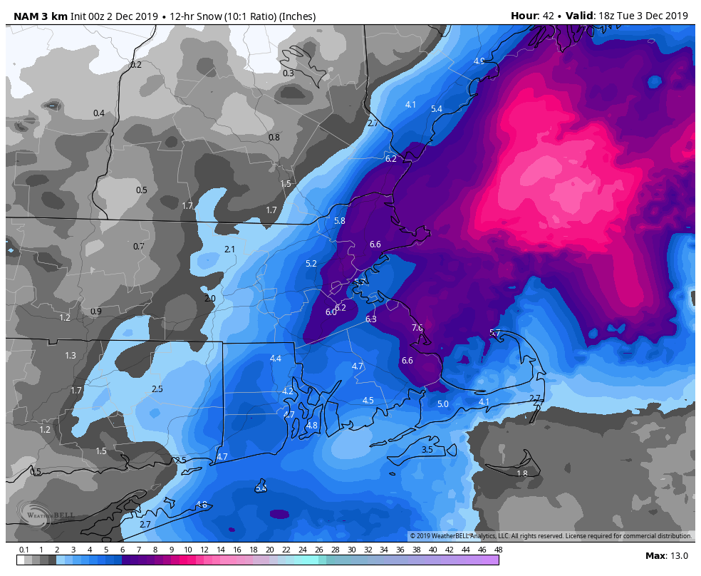
Tonight is when things get interesting again. As the low pressure area moves into the Gulf of Maine it will intensify and become a pretty potent system. With gusty north to northwest winds keeping most of the area quite chilly, we’ll snow moving in from the ocean, on the backside of the storm. It is still uncertain how far inland that snow will get and how much will fall. We’re fairly confident that there’s going to be a band of heavy snow that sets up, but we’re still thinking that the heaviest stays just offshore. Still, with light to occasionally moderate snow going through Tuesday afternoon, we’ll still see some decent amounts, especially close to the coast. How much more? We think that much of the region could see 3-6″ between Monday night and Tuesday afternoon, with lesser amounts into southern New Hampshire. From the North Shore up into the New Hampshire Seacoast , another 4-7″ may fall.
Everything winds down Tuesday night, then high pressure builds in for Wednesday and Thursday with dry and chilly conditions. An Arctic front will move across the region late Friday, with a few snow showers or squalls ahead of it. After that, high pressure returns next weekend with even colder weather on Saturday. By Sunday, the high will slide offshore and temperatures will start to moderate, but will likely still be below normal for early December.

Monday: Cloudy and breezy with showers and drizzle across eastern Massachusetts, flurries and freezing drizzle elsewhere. High 29-36 north and west of I-95, 37-44 south and east of I-95, though temperatures in this area will start to drop in the afternoon.
Monday night: Cloudy and breezy with precipitation becoming steady light to occasionally moderate snow. Low 24-31.
Tuesday: Cloudy and breezy at times with snow ending by early afternoon, some sunshine may develop in the afternoon the farther west you go. Additional accumulation 1-3″ in southern NH, 3-6″ most elsewhere, except 4-7″ from the North Shore to the NH Seacoast. High 30-37.
Tuesday night: Partly to mostly cloudy. Low 18-25.
Wednesday: More clouds than sunshine. High 34-41.
Thursday: A mix of sun and clouds. High 32-39.
Friday: Partly to mostly cloudy with some late-day snow showers or squalls possible. High 34-41.
Saturday: Sunshine and a few clouds, breezy. High 26-33.
Sunday: A mix of sun and clouds. High 36-43.
