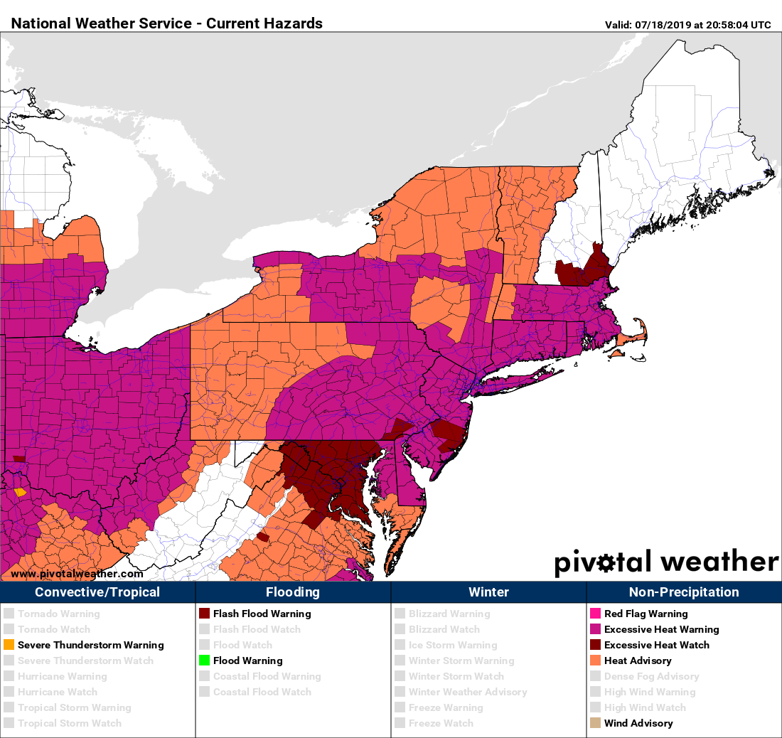
We warned you in our Weekly Outlook that it was coming, and it’s just about here – some brutal heat and humidity is expected for the next few days.

Friday will start out with some lingering clouds and a little fog, but the sun will return and as winds shift into the southwest, so will the heat and humidity. Many locations will reach 90 on Friday, but not everyone. Dewpoints will get into the lower 70s, sending the heat index well into the 90s across the region. At night, with plenty of humidity around, temperatures likely won’t drop below the middle 70s across the region, making for an uncomfortable sleeping night if you don’t have air conditioning. This sets the stage for Saturday.
Saturday will likely be the hottest day we’ve had around here in several years. Add in the high humidity (dewpoints again in the lower to middle 70s), and well, it’ll be downright brutal outside. Since it will already be warm to start, with plenty of sunshine, temperatures will quickly jump in the morning, with many locations likely reaching 90 by lunchtime, but it won’t stop there. Temperatures will likely get into the upper 90s, with some spots, especially in the Merrimack Valley, possibly topping 100 degrees.

How rare is a 100-degree reading? Since the Merrimack Valley is the likeliest spot, here is some data for Lowell. In the 131 years of temperature records for Lowell, the city has topped 100 degrees just 35 times, or about once every four years. However, it’s actually been 8 years since Lowell hit 100, with a high of 102 on July 22, 2011. Before that, you have to go back to 2002, when it hit 101 on August 14, and 100 on July 3. So that’s just 3 times in the past 17 years. Skewing that average of once every 4 years is the fact that Lowell reached 100 5 times in 1911, 4 times in 1949, and 5 times in 1952. That’s 14 among those 3 years alone. July 22, 2011 was also the last time it reached 100 at Logan Airport in Boston, where they’ve only hit 100 25 times in 147 years of records.
With temperatures in the upper 90s (or higher), and dewpoints in the lower to middle 70s, that means that the heat index will be in the range of 105 to 110 degrees or higher during the hottest part of the day. If you have any plans to be outside, whether it be by the pool, at the beach, at the NASCAR activities in Loudon, or anywhere else, make sure you try to stay hydrated, and take plenty of breaks in the shade if you can.
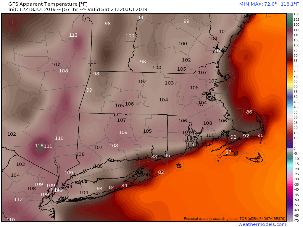
Saturday night will be another uncomfortable night, with low temperatures only dropping into the middle to upper 70s. Some of the urban locations, like Boston, may not drop below 80. This leads in to another brutally hot and humid day on Sunday. Once again, most places will likely reach 90 by lunchtime and keep going. High temperatures will again get into the upper 90s across the area, with some 100-degree readings possible. Dewpoints will remain in the upper 60s to lower 70s, so we’re looking at heat indices in the 105 to 110 degree range once again.

By late Sunday, a cold front will start to approach, and it may produce some showers and thunderstorms during the evening and overnight. Behind it, much more seasonable air and lower humidity settles in for Monday. There may be a little relief in spots before that as well. Thunderstorm complexes in the Midwest will ride along the top of the upper-level ridge, as it typical in the summer. Right now, it looks like this may happen both late Friday and late Saturday. Unfortunately, it looks like these may fizzle before reaching the Northeast, and if they don’t, they will likely pass southwest of our area. So, we’re not holding out hope for these to help cool us off.
Long range forecasts show that some heat may return late next week into next weekend, but not nearly to the extent of what we’ll be dealing with for the next few days.
