We just had an absolutely perfect weekend weather-wise, capped off by a convincing Bruins win to force a Game 7. Next weekend looks like it might be almost as good, but wouldn’t a parade make it better? Before we go there, let’s go through the week first.

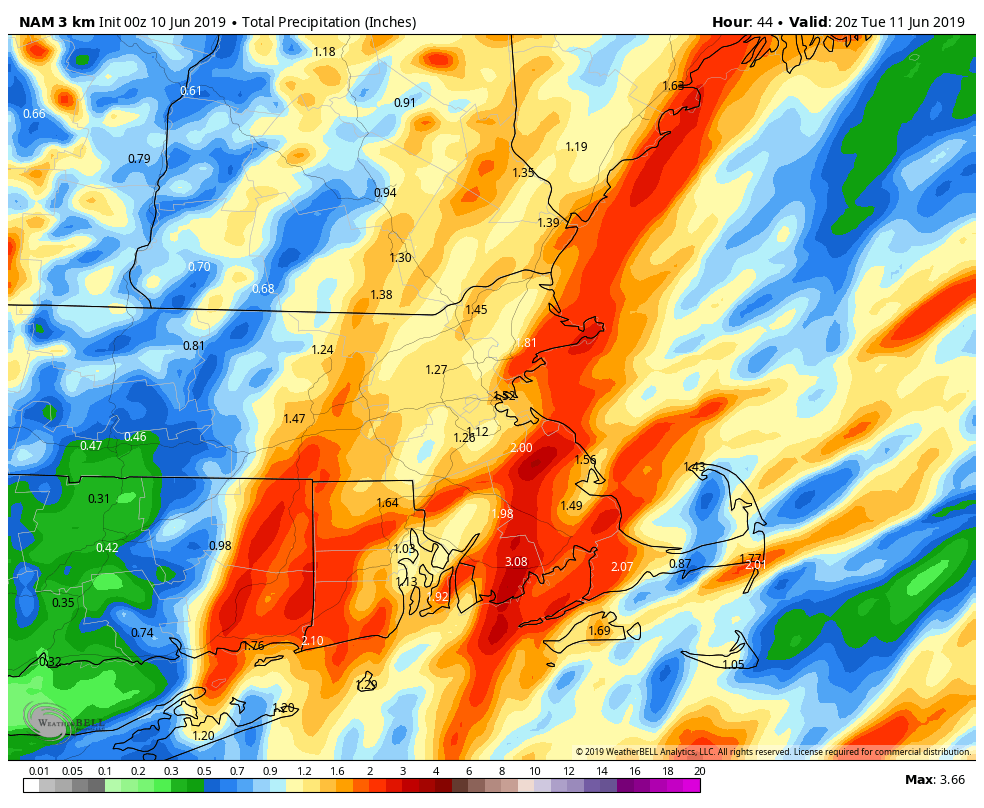
We start the week off with high pressure sliding offshore, so the sunshine we’re starting the day off with will disappear behind clouds this afternoon. A warm front will move towards the region, bringing in some showers and maybe some thunderstorms tonight into Tuesday morning. The showers will end around midday as a cold front moves across the area. Some of the rain could be heavy, especially if thunderstorms develop. This is good news, as we’ve actually been a little dry lately, and need some rain to keep everything nice and green out there. Skies will clear out behind the front Tuesday afternoon and evening.
High pressure builds in for Wednesday with sunshine and mild weather, but clouds will move back in late in the day ahead of another warm front. That night, while the Bruins are attempting to end the region’s torturous 129-day championship drought, showers will move in ahead of another warm front. Hopefully, the only Blues were talking about the next morning is from people depressed that it will be a cool damp day as low pressure moves across the region.
High pressure builds back in for Friday and Saturday with dry conditions once again. Friday may still be a little on the cool side, but Saturday should be warmer. Sunshine and warm temperatures are a great combination for a parade, right? They were in June of 2011. Another system will move towards the region on Sunday, with clouds and some showers moving in. There’s some question as to how quick they move in, so Sunday could end up being another dry or mostly dry day. We’ll have a better idea on that later in the week.
Monday: Sunshine to start the day, clouds move in during the afternoon. Showers are possible towards evening. High 73-80.
Monday night: Cloudy with showers likely, maybe a rumble of thunder. Low 57-64.
Tuesday: Showers and thunderstorms ending towards midday, then skies start to clear out during the afternoon, becoming breezy. High 71-78.
Tuesday night: Becoming mostly clear. Low 49-56.
Wednesday: Mostly sunny, clouds return at night. High 72-79.
Thursday: Periods of rain and showers likely, ending overnight. High 64-71.
Friday: Sunshine and a few afternoon clouds, breezy. High 68-75.
Saturday: Mostly sunny and breezy. High 72-79.
Sunday: Becoming mostly cloudy with a chance of showers, mainly late in the day. High 73-80.
