Another storm system is set to move into the region later today and into Wednesday. While this one will produce a wintry mess across parts of the area, for the majority of us, it won’t be a big deal.
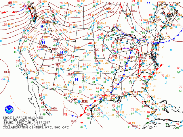
A low pressure system is currently moving into Michigan. This is the same system that brought heavy snow to the central and southern Rockies and a significant ice storm to the central and southern Plains and parts of the Mississippi valley over the past few days. This storm will head towards the eastern Great Lakes this evening and start to weaken, while at the same time, a secondary area of low pressure will develop south of New England.
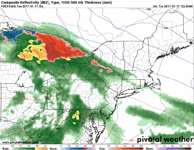
Along and south of the Mass Pike, this is mainly a rain storm. Rain will develop around dinner time this evening, might be heavy overnight, and will taper off to showers or drizzle Wednesday morning, but likely doesn’t end until Wednesday evening. For Western and Central New England, we have bigger issues.
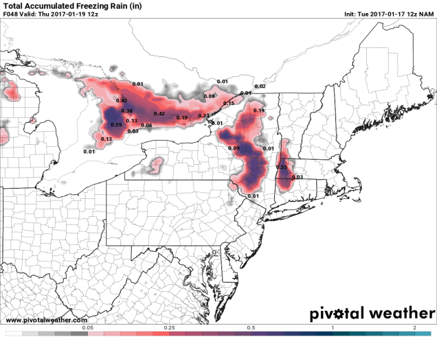
Across the Berkshires, Catskills, and Adirondacks (and possibly the higher elevations of the Monadnocks and Worcester Hills), we’re looking at freezing rain, possibly a lot of it. Temperatures aloft will warm above freezing, but a thin layer of colder air will remain just above the surface. Since that layer is the ground layer in the hills, it will fall as freezing rain. Driving along I-90 through the Berkshires and also west of Albany out to about Utica could be very slick later today into early Wednesday. As the secondary storm takes over early Wednesday, colder air will move back in, changing the freezing rain over to snow, with a little accumulation possible.
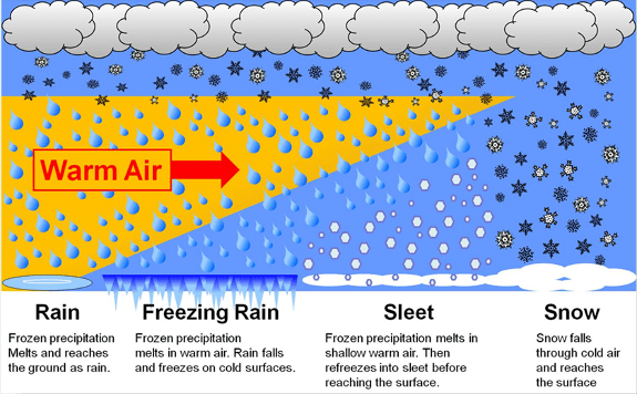
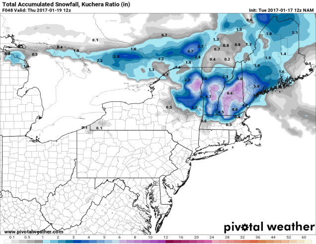
Meanwhile, we’re looking at some snow across portions of central and southern Vermont and New Hampshire and into southwestern Maine. In areas that stay all snow, mainly across central New Hampshire and Vermont, we could see as much as 4-8 inches fall by the time the storm winds down late Saturday. The tricky forecast is from coastal Maine and New Hampshire into southern New Hampshire and northern Massachusetts. In these areas, precipitation likely starts as snow this evening, but a change to sleet and eventually rain should take place overnight tonight or Wednesday morning, with a change back to snow possible late Wednesday as the system starts to wind down. How long that change takes will have a big effect on how much snow accumulates. Right now, it looks like we could see as much as 3-5″ near Manchester, NH, dropping down to 2-4″ around Nashua, and maybe an inch or less across the Merrimack Valley and the Seacoast, including Lowell, Lawrence, and Portsmouth. As you can see, with such a sharp gradient between several inches and virtually nothing, only a slight shift in the forecast can have a big difference in what actually falls across these areas.
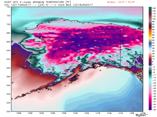
The good news is that there isn’t much colder air following this storm. Temperatures will remain near to a little above normal for much of the remainder of the week, with highs mainly in the 30s and 40s. Contrast that with Alaska, where low temperatures for the next several mornings will range from 25 to 55 below zero across much of the state.