Last night, we told you about the old adage “When in Drought, Leave It Out.” Well, a lot of meteorologists around here decided to ignore that because many of the computer models were forecasting heavy rain across Southern New England on Friday. If you checked out a forecast anywhere on TV, Radio, or the Internet, all you heard was that heavy rain was expected on Friday. However, our forecast, along with the one from our comrades at Woods Hill Weather, was for most of the heavy rain to remain to our south. Well, most of the computer models started leaning that way today as well, and all of the other forecasts started to backpedal off of their “heavy rain” forecasts.
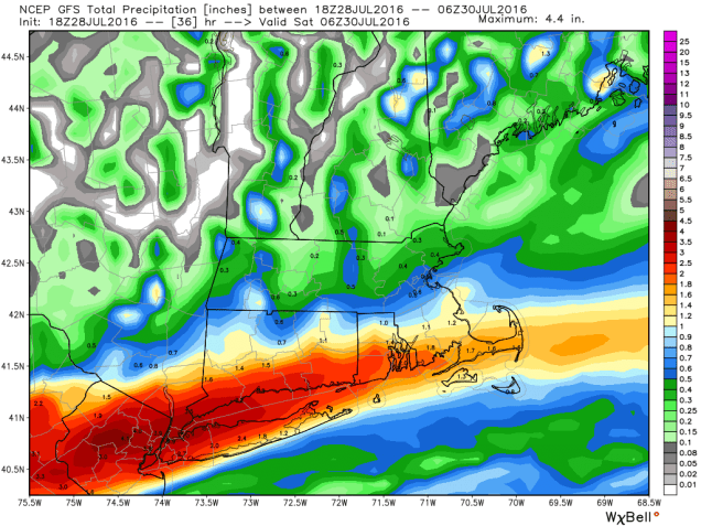
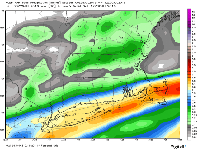
As you can see in the maps above there will be a sharp cutoff from heavy rain to very little rain across the region. We’re confident that heavy rain will fall along the south coast on Friday, and we’re fairly confident that the heavy rain shouldn’t make it as far north as Boston. Areas in between Boston and Providence? That’s a toss-up. A Flash Flood Watch is in effect for most of Southeastern Massachusetts, Rhode Island, and Connecticut through Friday evening. Some flooding is likely with some of the heavier downpours, especially in some of the places that usually experience flooding in heavy rain. Unfortunately, not much rain is expected in the areas that really need it, especially the Merrimack Valley.
In yesterday’s post, we also mentioned the possibility of the tropics heating up. We told you about the tropical disturbance that was being watched in the eastern Atlantic. Well, we’re still watching it today, but we also have our eyes on a second area of disturbed weather out there.
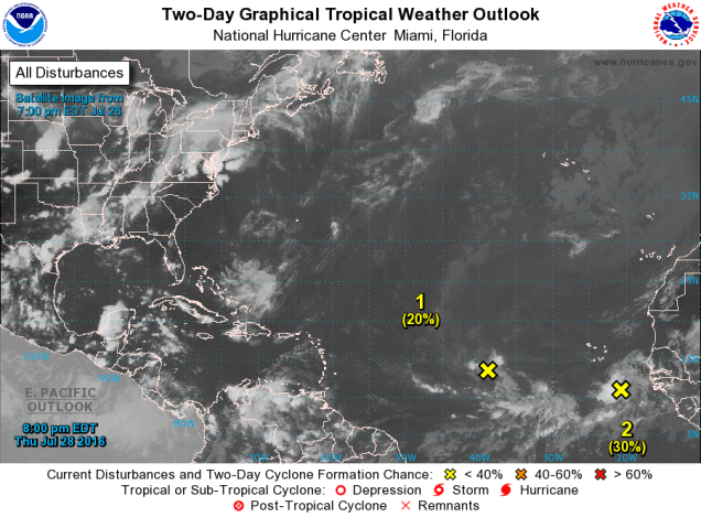
The first disturbance is passing south of the Cape Verde Islands this evening. It remains weak, but conditions are favorable for some development over the next few days. However, that window of opportunity will likely start to close as the system gets into the central Atlantic by the end of the weekend. Most of the forecast models don’t expect much development of this system, and frankly, neither do we. It’s something to keep an eye on through the weekend, but we’re not expecting much.
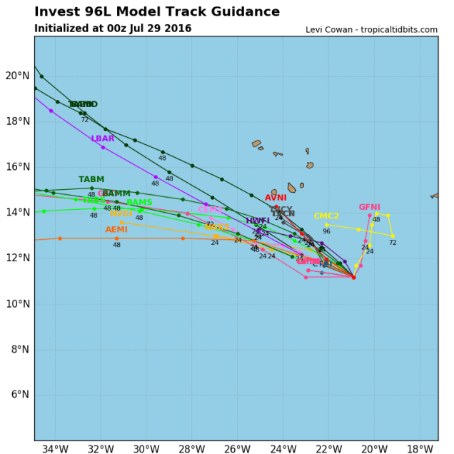
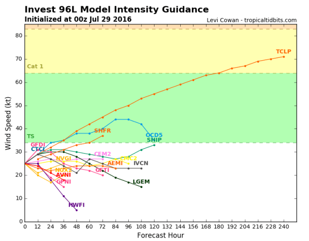
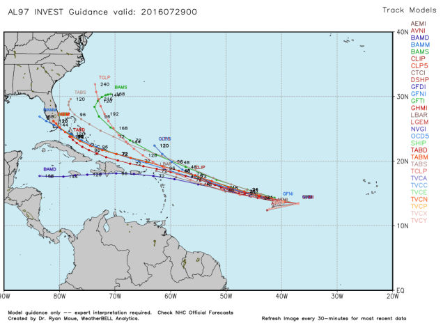
Meanwhile, farther to the west, another disturbance is about halfway between Africa and the Caribbean, and quickly heading westward this evening. The fast movement will likely preclude much development for now, but it should bring some gusty winds to the Lesser Antilles this weekend. Assuming it survives that long, we will need to keep an eye on it. As you can see below, many of the tropical models bring in just north of the Islands and into the Bahamas. There are other models that bring the system into the Caribbean and possibly the Gulf of Mexico well down the line. There are others that don’t expect the system to survive more than a few days.As the system gets closer to the Caribbean, we should start to get a better idea of what it might do and where it might go. Until then, it’s just something to keep an eye on.