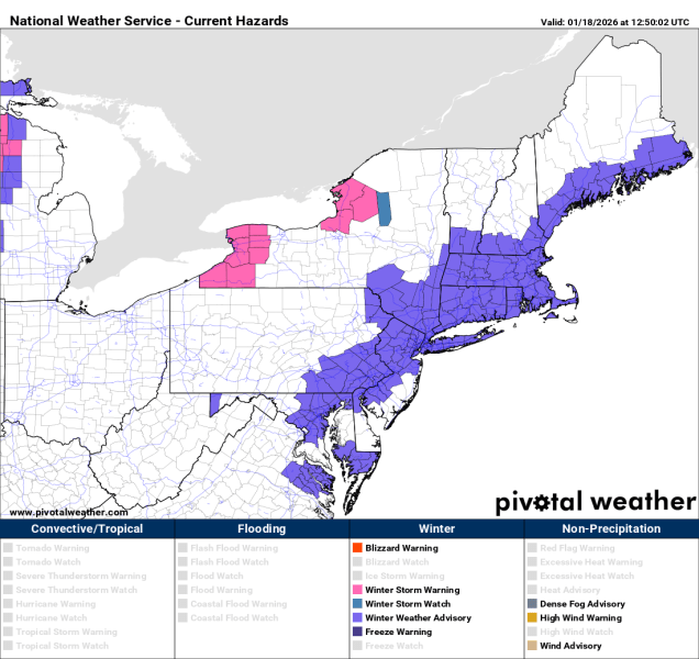
The biggest snowstorm this area has seen in a few years is on the way, with arctic air preceding it.
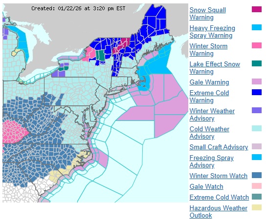
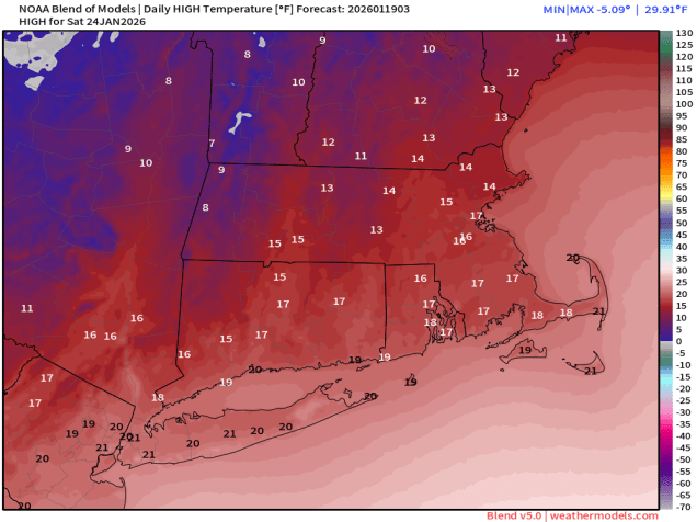
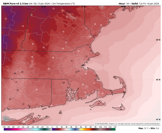
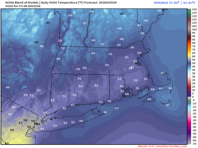
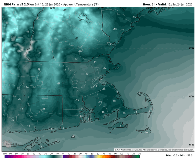
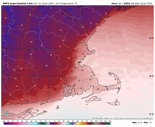
An arctic cold front will cross the region later today, producing a few snow showers or squalls, but gusty northwest winds behind the system will usher in the coldest air so far this winter for the weekend. Temperatures will plunge into the single numbers tonight with some subzero readings possible. When you factor in the wind, it will feel like it is 10 to 20 below zero if you are outside Saturday morning. Despite some sunshine, temperatures will struggle to reach the teens on Saturday, but the wind will subside. We’ll see high clouds start to stream in during the afternoon as a developing low pressure system heads our way.
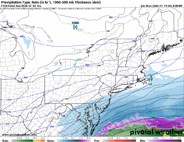
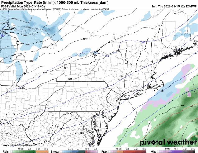
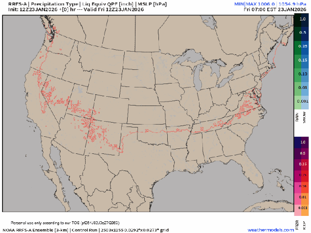
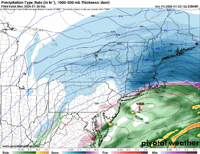
That system will move into the Deep South, and a secondary area of low pressure will develop near the Carolinas or Virginia Tidewater region. as it starts to strengthen it will move northeastward, passing south and east of New England Sunday night and Monday. There is still a little question as to how far north the low gets, which has some implications on the forecast, as it could result in some sleet near the South Coast, but for the bulk of the region, we’re looking at snow, thanks to the cold air already in place.
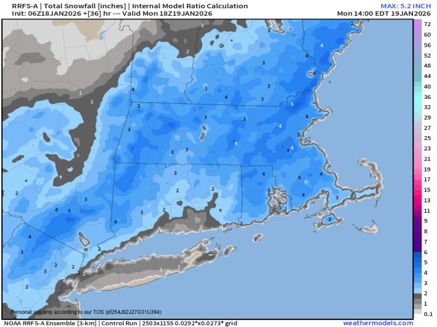
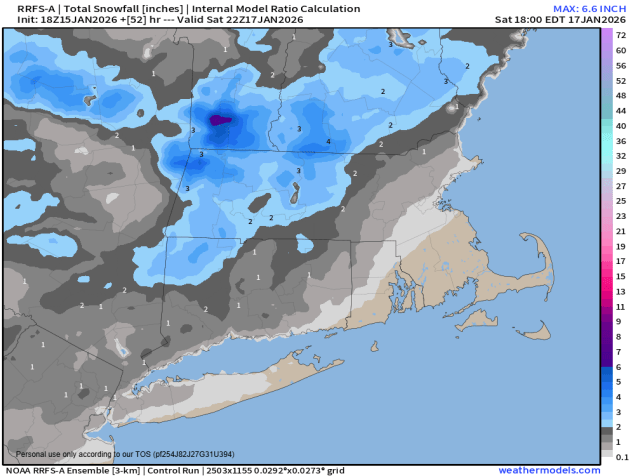
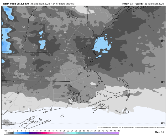
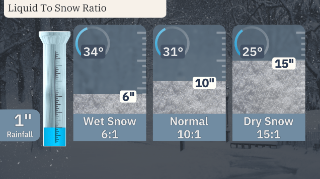
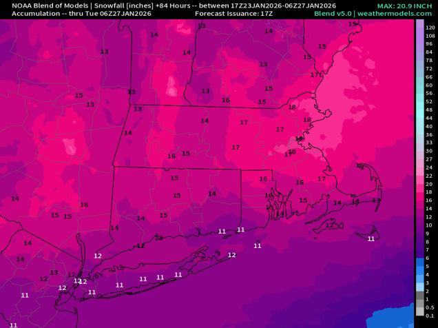
Because it will be so cold for much of the region, it will be a fluffier snow, which can pile up more quickly. The colder the air is, the less moisture it can hold. In general, 1 inch of liquid will result in 10 inches of snow when the temperature is near freezing. When temperatures are in the teens, as they will be across the interior for this storm, that ratio can change to as much as 15-20 inches of snow for 1 inch of liquid.
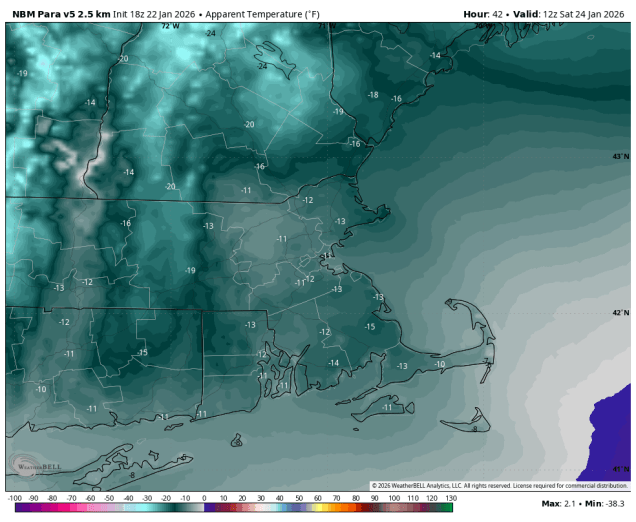
Closer to the coast, especially south of Boston, temperatures will not be nearly as cold, thanks to something meteorologists refer to as a “coastal front”. Ocean temperatures remain near or a little over 40, so as winds blow over that water and reach the coast, we will see temperatures moderate into the 20s, or even lower 30s, but that air usually doesn’t penetrate too far inland. So, you end up with a sharp boundary, or front, where temperatures go from the teens to the west and 20s to the east over a span of just a few miles. Exactly where that front sets up makes a big difference, not only because it’s the difference between fluffy snow and wet snow, but also because that front provides a little bit of lift, which usually results in some of the heaviest snow totals just to the west of that coastal front. As the system starts to pull away on Monday, that coastal front will quickly move southeastward, allowing the very cold air to quickly return to southeastern Massachusetts.
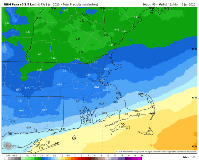
For the timing, it looks like the snow will move in near or just after midday on Sunday from southwest to northeast, reaching southern New Hampshire by mid-afternoon. The steadiest and heaviest snow is likely from about 6pm to 2am. If there is going to be any sleet near the South Coast, it will likely be between about 10pm and 3am. As the storm starts to pull away on Monday, we’ll still see occasional light snow for much of the day, with some additional accumulations possible. Everything should finally wind down and end Monday evening.
Now, the part you’re all waiting for – how much snow can we expect? There’s still a few details to be worked out that will impact the final numbers (where does the coastal front set up? will there be sleet near the South Coast?), but for the most part, we feel confident enough to put the pen to the paper so to speak. For most of the region, we’re looking at a general 12-18 inches. There will be some spots that get a little more, and there could be a little less near the South Coast, especially if there’s some sleet involved.
In case you’re curious, the last time some cities around here received a foot or more in a single storm:
Boston: January 29, 2022 – 23.6″
Blue Hill: January 29-30, 2022 – 27.6″
Lowell: January 6-7, 2024 – 15.8″
Worcester: January 6-7, 2024 – 15.5″
Providence: January 28-29, 2022 – 19.3″
Hartford: February 1-2, 2021 – 12.1″
Manchester: December 1-3, 2019 – 20.8″
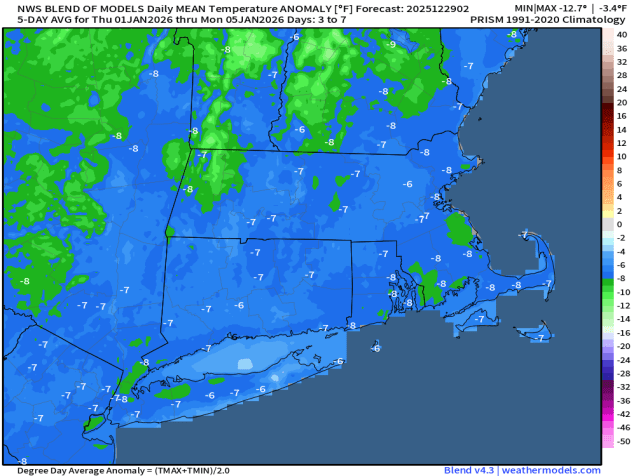
Once this storm pulls away, cold air will remain in place for much of the upcoming week, so don’t expect any melting any time soon.