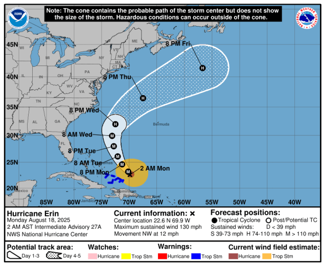
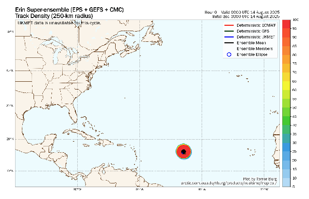
Hurricane Erin will pass well offshore over the next 24 hours while we enjoy some rather nice weather for most of the upcoming weekend.

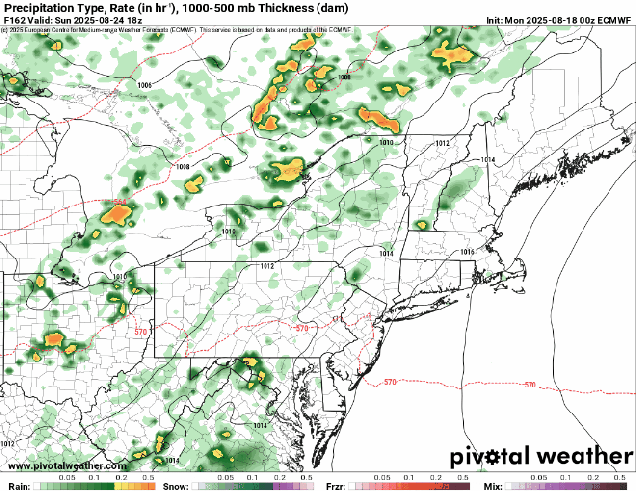
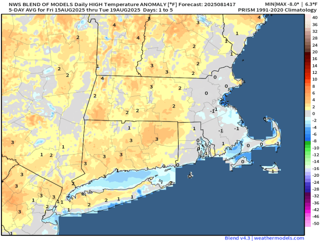
High pressure will slowly build into the region this evening, allowing skies to gradually clear out tonight. With the high in control on Friday we’ll have lots of sunshine, with temperatures getting back close to where they should be in the latter half of August. It will remain breezy, especially during the morning, due to the gradient between the high building in and distant Hurricane Erin pulling away offshore (more on that in a moment). As the high moves off to the east on Saturday, southwest winds will usher warmer air in, with many areas away from the coast likely topping 80 degrees. We’ll see things start to change on Sunday as a cold front begins to slowly approach the region. Clouds will increase, and gusty southerly winds will develop, increasing humidity levels across the area. Some showers and thunderstorms are expected ahead of the front, but they should hold off until evening, so don’t cancel any outdoor plans for Sunday. The front will take its time moving through, with showers and thunderstorms expected for Sunday night into Monday. We’ll also be watching a small area of low pressure moving up the East Coast on Monday. While most of the models keep it far enough offshore to have little to no impact here, some bring it close enough to bring in a periods of steadier rain to Cape Cod and possibly southeastern Massachusetts Monday afternoon and evening. We’re leaning towards it staying too far offshore to impact us, but we are keeping an eye on it just in case.

Hurricane Erin was centered about 400 miles northwest of Bermuda as of early Thursday afternoon, moving off toward the northeast at 18 mph. Maximum sustained winds were near 100 mph. Tropical Storm Warning are in effect for parts of the Mid-Atlantic coast as well as Bermuda. As Erin accelerates northeastward and steadily weakens conditions will improve across Bermuda and the East Coast, though rough seas and rip currents will still be a significant hazard into the weekend. With astronomically high tides, some minor coastal flooding is also still possible for the next day or two in parts of New England and Atlantic Canada.

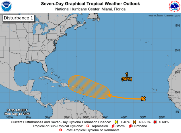
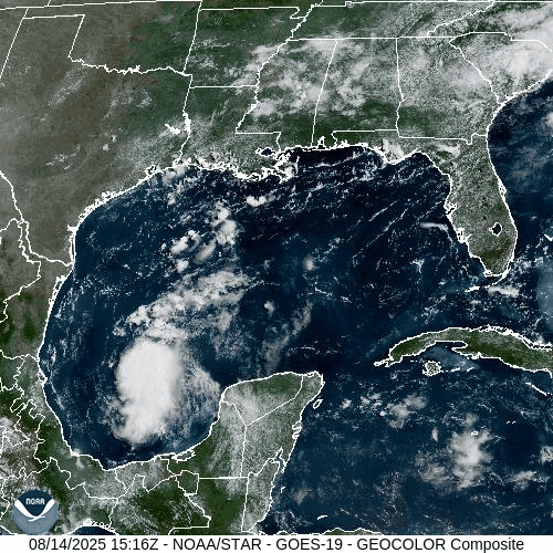
There are two other tropical waves we’re keeping an eye on this afternoon, but neither is a significant threat to land at this time. A tropical wave is approaching the Leeward Islands this afternoon. It remains disorganized, but as it heads northwestward, conditions will become more favorable for development, and it could become a tropical depression over the weekend or early next week as it turns northward out over the open Atlantic. It will bring squally conditions to the Leeward Islands as well as the Virgin Islands and possibly Puerto Rico over the next few days, but otherwise won’t be a threat to land areas, though it could threaten Bermuda by early next week. Another wave is in the central Atlantic, and shows some signs of organization. While conditions are favorable for some development right now, they will become more hostile by this weekend, which would effectively end any further chances for development.

Thursday night: Skies clear out from northwest to southeast, still breezy across Rhode Island, southeastern Massachusetts, and Cape Cod. Low 51-58, a little milder on Cape Cod.
Friday: Plenty of sunshine, winds diminish by early afternoon. High 77-84, a little cooler across Cape Cod.
Friday night: Clear to partly cloudy. Low 54-61.
Saturday: Sunshine and a few clouds. High 80-87, a little cooler across the South Coast and Cape Cod.
Saturday night: Becoming partly cloudy. Low 60-67.
Sunday: Morning sunshine fades behind increasing clouds, becoming breezy and more humid. High 76-83.
Sunday night: Mostly cloudy with showers and a few thunderstorms developing. Low 61-68.
Monday: More clouds than sun with some additional showers and thunderstorms. High 75-82.