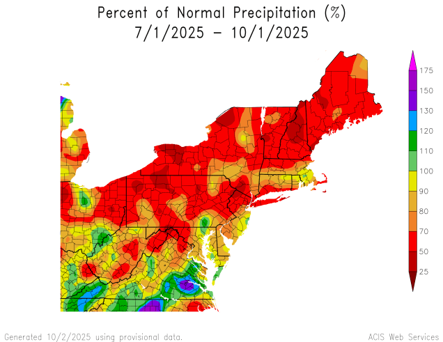
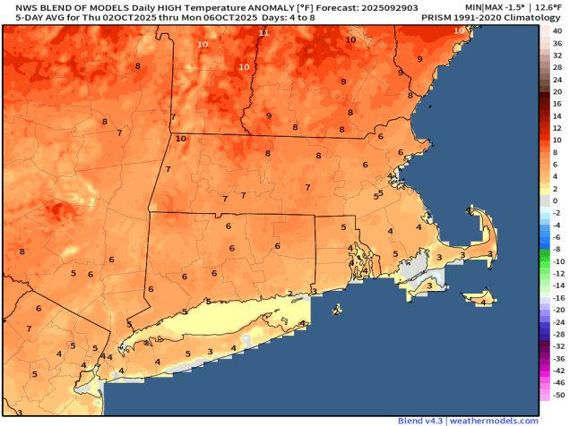
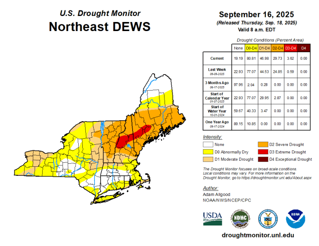
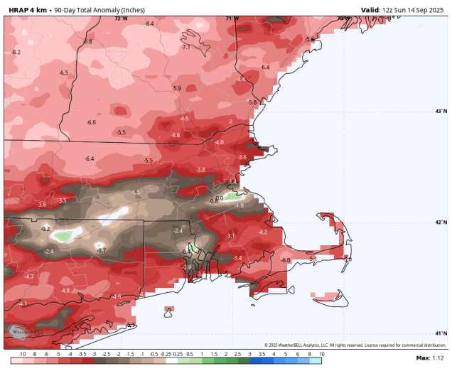
We’ve had warm and dry weather for much of the past few months, but that is going to change this weekend.

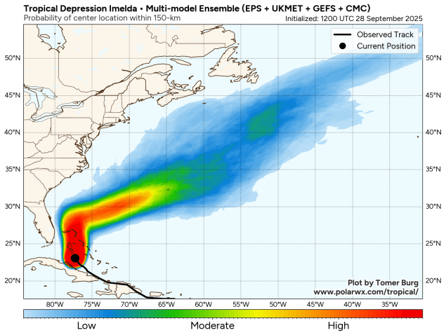
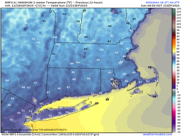
A large area of high pressure will settle across the region tonight, bringing us clear skies and light winds – the ideal setup for radiational cooling. As a result, we’re looking at the coolest night so far this fall, with widespread frost away from the coast and urban areas, with a freeze expected in the normally colder locations. Friday will feature plenty of sunshine, but we’ll remain on the cool side. As the high starts to slide off to the south and east, winds will shift into the southwest Friday night, so we won’t be as chilly as tonight. Saturday should be a milder day, but we’ll see clouds starting to move in as moisture streams northward from a low pressure area developing off the Carolina coast. That system will drift northward Sunday and Monday, but won’t get this far north, though it will still have a significant impact on the region.
We’ll see rain spreading northward from the system, likely moving in from south to north Sunday afternoon and evening. How far north the rain gets is still a bit of a question mark, but it looks like most of the region should receive some much-needed rainfall. How much rainfall is also a question, but at this point it looks like the heaviest rain will be near the South Coast and also east-facing coastal areas, which some spots could see 1-2 inches of rain, possibly more, before everything starts to wind down on Tuesday.
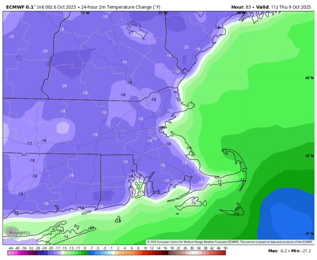
Rain isn’t the only impact from this system though. The pressure gradient between the developing low to the south and high pressure to the north will result in gusty east to northeast winds, especially near the coast, where some gusts in excess of 40 mph are possible, especially later Sunday into Monday. In addition, with tides still near the astronomical high for the month, persistent onshore gusty winds will result in some areas of coastal flooding, especially along east and northeast facing locations. Oh, and the combination of cloudcover, rainfall, and winds, will keep temperatures on the cool side again, especially on Monday.

Thursday night: Clear and chilly. Low 29-36, milder along the coast and in urban areas.
Friday: Plenty of sunshine. High 56-63.
Friday night: Clear during the evening, some clouds start to filter in from south to north after midnight. Low 38-45, a little milder along the coast and in urban areas.
Saturday: Partly sunny, clouds start to thicken up late in the day. High 60-67.
Saturday night: Mostly cloudy. Low 44-51.
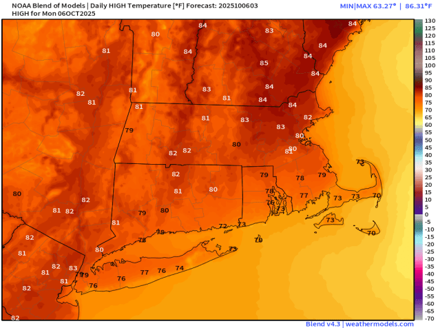
Sunday: Cloudy and becoming windy with rain developing from south to north. High 57-64.
Sunday night: Cloudy and windy with rain likely, possibly heavy at times. Low 48-55.
Monday: Cloudy and windy with more rain, possibly heavy at times. High 54-61, a little milder near the South Coast and Cape Cod.