It looks like we’ve got some snow coming in this weekend for at least part of the region, but that’s only part of a complex forecast for the next few days.
High pressure will slide offshore later today and tonight while clouds start to stream in ahead of a cold front. That front may produce a few showers on Friday, but most of us will just see some clouds as the front moves through. However, this will set the stage for the next storm.

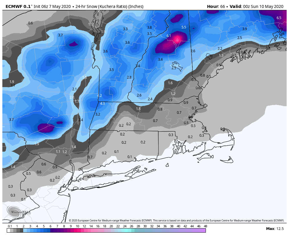
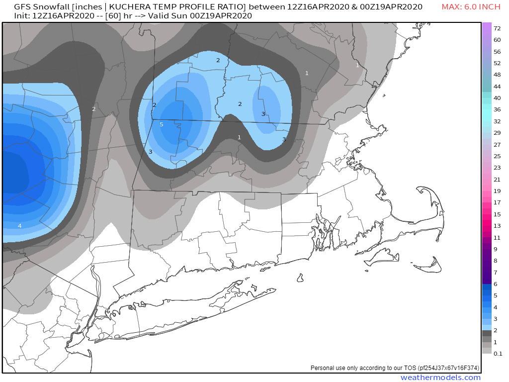
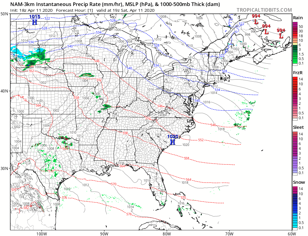
Low pressure currently near the Louisiana coastline will head northeastward tonight, moving up the Appalachians on Friday, then off the Mid-Atlantic coastline on Saturday. At the same time, an upper-level disturbance in Canada will dive southeastward. As these two systems meet up or “phase”, they will create a strengthening low pressure system. The track of that low will determine several things, but the two main ones are how much precipitation will fall, and whether it will be rain or snow. Most of the models bring the storm near Cape Cod or just south of it, but there are others that bring it across southeastern Massachusetts. The farther north and west the low travels, the farther north and west the rain/snow line ends up.

Before we get too far ahead of ourselves, let’s get to what we are fairly sure about. Rain will develop across the region early Saturday morning, and may fall heavy at times during the day on Saturday. This will help put another dent in our long-term rainfall deficit. As the low passes by, northerly winds will bring cooler air into the region. There’s not a lot of “cold” air to begin with, but temperatures will likely drop to near or below freezing, which will allow for a changeover to snow, at least north and west of Boston. That changeover is likely to occur Saturday night, but at least one model has it change over much earlier – during the afternoon. Others only have the changeover occur as the precipitation winds down and ends Sunday morning, and at least one other doesn’t have it changeover at all. Obviously when that changeover occurs will have an impact on how much snow (if any) accumulates.

Right now, we’re expecting a change to snow from northwest to southeast Saturday evening and night, with everything winding down around daybreak Sunday. The snow could be heavy at times during Saturday evening, but should taper off at night as the system starts to pull away. Several inches could accumulate well north and west of Boston, but this is still a bit uncertain. We’re not going to forecast any amounts yet, as there’s not enough confidence yet to come up with specific amounts. We’ll do another blog post just on the storm tomorrow, and at that point we’ll have a specific snowfall forecast.
Skies should start to clear out Sunday afternoon as gusty west to northwest winds will bring drier air in behind the storm. High pressure will start to build in on Monday, but with an upper-level low pressure system moving through, we’ll still have some clouds, and a few rain or snow showers are possible.
Thursday night: Becoming mostly cloudy. Low 32-39.
Friday: Mostly cloudy, becoming breezy, chance for a few showers, mainly south of the Mass Pike during the afternoon. High 49-56.
Friday night: Cloudy with some showers developing. Low 35-42.
Saturday: Cloudy and windy with rain, heavy at times, changing to snow from central Massachusetts into southern New Hampshire late in the day. High 39-46 early (47-54 across Cape Cod and the Islands), then temperatures drop during the afternoon.
Saturday night: Cloudy and windy with rain changing to snow from northwest to southeast before tapering off and ending toward daybreak. Low 25-32, a little milder across Cape Cod and the Islands.
Sunday: A few lingering rain or snow showers early, then clearing in the afternoon, breezy. High 33-40.
Sunday night: Clear to partly cloudy. Low 19-26.
Monday: A mix of sun and clouds, slight chance for a rain or snow shower. High 32-39.