If you’re dreaming of a White Christmas, you may just get your wish.
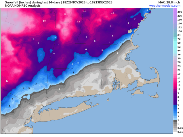
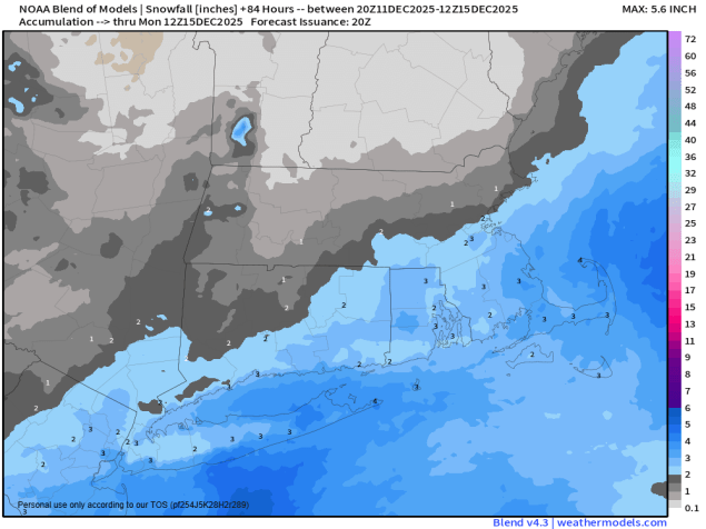
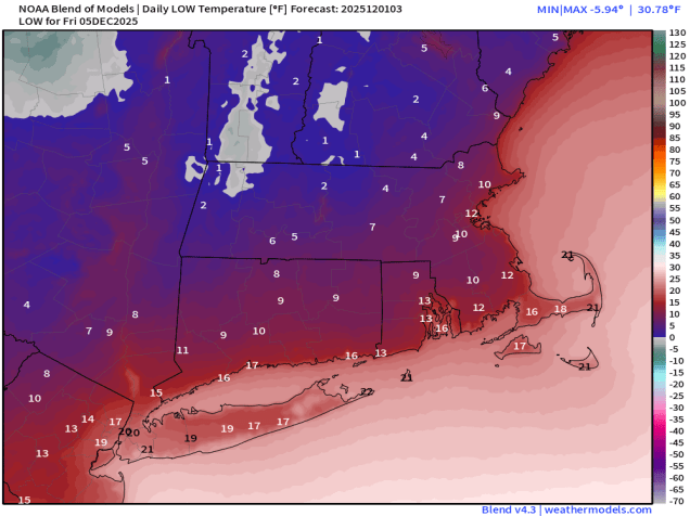
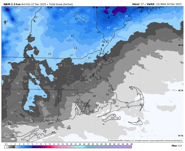
The week starts off with high pressure bringing us a breezy and dry and chilly day today, but that won’t last long. Clouds quickly return later today as a fast-moving storm system moves out of the Great Lakes. We’ll see some light snow developing Tuesday morning, continuing through much of the day, ending in the evening. Temperatures may be just mild enough for a mix or change to rain near the South Coast and across the Cape and Islands. While the system may not have much impact on the morning commute, it will impact the evening commute, so keep this in mind. Because it’s a fast-moving storm, and doesn’t have a lot of moisture with it, we’re only expecting 1-3 inches for most spots, a little less where rain mixes in.
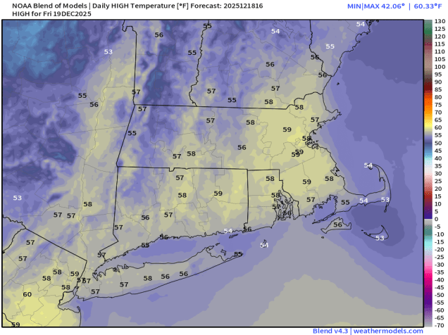
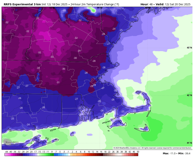
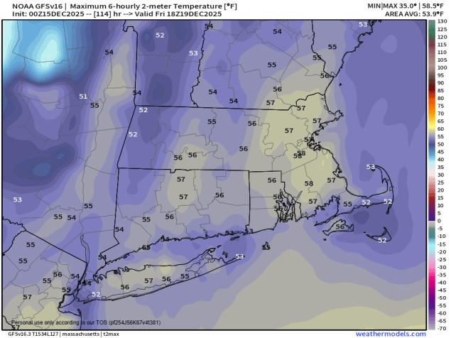
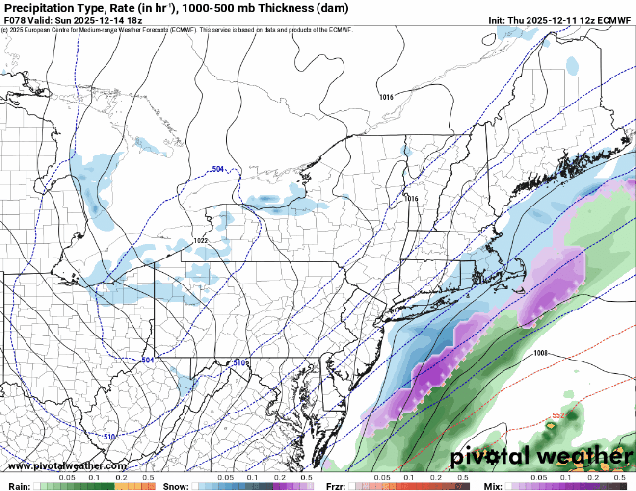
High pressure builds in for Christmas Eve and Christmas Day with generally dry and seasonably cold conditions, though we could still see a few snow showers on Christmas Eve, mainly near the coast thanks to an offshore low pressure system. The end of the week and the weekend presents more problems. A frontal boundary will be nearby, separating some rather chilly air to our north from unseasonably warm air to the south. We’re also going to have a low pressure system moving along that boundary toward the region. Where that boundary eventually settles has a HUGE impact on our forecast. Is it mild with rain? Is it colder with a wintry mix or even some moderate to heavy snow? As you might expect, the models are all over the place, and any of these scenarios could be plausible. For now, we’re going to go with the middle ground, but this is a low confidence forecast at this point. Oh, and another system could follow on Sunday with some similar issues. We’ll obviously go into a lot more detail on both the Friday and Sunday potential storms when we publish our Weekend Outlook, which will be on Wednesday this week.

Monday: Mostly sunny, clouds start to filter in during the afternoon, thickening up late in the day, breezy in the morning. High 28-35.
Monday night: Becoming cloudy. Low 20-27.
Tuesday: Cloudy with light snow developing in the morning, except rain near the South Coast and Cape Cod, tapering off towards evening. High 32-39.
Tuesday night: Any lingering snow or rain showers ending, some clearing possible late at night. Total snow accumulation 1-3 inches for most spots, less than 1″ near the South Coast and Cape Cod. Low 24-31.
Christmas Eve: Intervals of clouds and sun with a few snow showers possible along the coast, partly sunny inland, breezy. High 33-40.
Wednesday night: Clear to partly cloudy during the evening, clouds return overnight. Low 18-25.
Christmas Day: Partly to mostly cloudy. High 36-43.
Thursday night: Mostly cloudy. Low 20-27.
Friday: Cloudy with some snow or rain likely. High 31-38.
Saturday: A few snow showers early, becoming partly sunny. High 29-36.
Sunday: Mostly cloudy, breezy, chance for snow or rain. High 36-43.