Spring officially begins at 10:46am on Friday, but that doesn’t really mean that we’re done with winter weather.
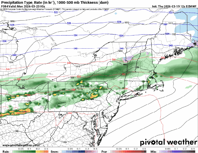
While the rest of the nation gets an early taste of summer for the next few days, here in New England, we’re reminded that Spring is usually delayed compared to everywhere else. A weak system will pass north of the region tonight generating some clouds and possibly a few flurries, favoring areas north of Route 2. We’ll clear out late at night, but clouds will quickly move back in Friday afternoon as another low pressure system heads our way. We’ll see some rain moving in by evening, ending around daybreak Saturday. We’re not expecting heavy rain from this, but every little bit helps put a dent in the ongoing drought. While we should see some sunny breaks developing Saturday afternoon, plenty of clouds will hang around as yet another system heads our way. This system could be a little trickier. Some models show a mild day with temperatures topping 60 before some rain moves in during the afternoon ahead of a cold front. Other say that it might be cold enough to start as some snow across parts of southern New Hampshire or even the Merrimack Valley, changing to rain, then back to snow or sleet behind the cold front from the Mass Pike northward before everything winds down early Monday. We’re going to lean towards the milder scenario for now, but with low confidence. Gradual clearing is expected during the day Monday as the cold front pushes offshore.
Thursday night: Partly cloudy, slight chance for a flurry north of Route 2. Low 27-34.
Friday: Morning sun, then clouds stream back in, rain developing late in the day, becoming breezy. High 47-54.
Friday night: Periods of rain and showers, ending before daybreak. Low 35-42.
Saturday: Intervals of clouds and sunshine. High 47-54.
Saturday night: Partly to mostly cloudy. Low 31-38.
Sunday: Plenty of clouds with showers developing in the afternoon. High 47-54.
Sunday night: Rain may change to snow and/or sleet before ending overnight, especially north of the Mass Pike. Low 30-37.
Monday: Gradual clearing, breezy. High 41-48.
