Even though the calendar says September it’s still astronomical summer, and it will feel like it for the next few days.
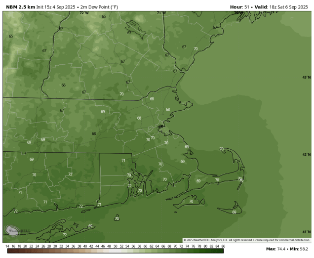
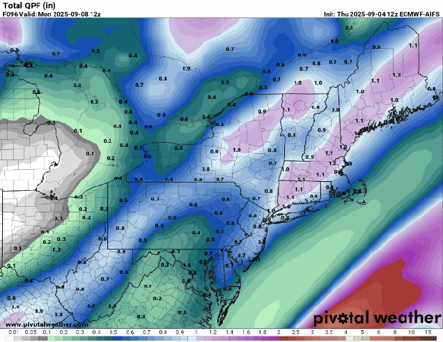
After a strong of rather nice days changes are on the way. A warm front will cross the region tonight, possibly accompanied by a few showers before daybreak on Friday. Once the front lifts northward, we’ve got warm and humid weather on the way for much of Friday and Saturday, with temperatures getting into the 80s along the coast, and dewpoints creeping back into the 60s or even lower 70s. For the most part it will be mostly sunny on Friday after the clouds move out in the morning, with some patchy fog Friday night. During the day on Saturday we’ll see clouds start to move back in ahead of an approaching cold front. The trend in the models recently has been to slow down this front, so for now, it looks like we’ll stay dry for most of the day Saturday. Some showers and thunderstorms will start to move in towards evening from west to east, with showers likely during the overnight hours. Sunday’s forecast is a little uncertain at this point. The showers should end during the morning, but some models continue to slow down the front with the showers not ending until afternoon from Boston southward, and possibly not until Sunday evening near the South Coast and Cape Cod. This will have an impact on temperatures as well, since the longer it rains, the less chance temperatures will warm up in the afternoon. With the Patriots season opener kicking off in Foxborough at 1:00 PM, any rain could impact not only playing conditions to start the game, but also tailgating beforehand. The front should push offshore at night, with high pressure building in for Monday with cooler and drier weather.
Thursday night: Increasing clouds, chance for a few late-night showers. Low 58-65.
Friday: Morning clouds, maybe a shower, then becoming partly to mostly sunny, breezy, and humid. High 78-85.
Friday night: Clear to partly cloudy, a little patchy fog may develop. Low 62-69.
Saturday: A sunny start, then clouds move in during the afternoon, showers and thunderstorms possible late in the day well north and west of Boston, breezy. High 81-88, cooler near the South Coast and Cape Cod.
Saturday night: Cloudy with showers and thunderstorms likely. Low 57-64, possibly a little warmer across southeastern Massachusetts and Cape Cod.
Sunday: Showers gradually ending from northwest to southeast, some late-day sunny breaks develop well north and west of Boston. High 67-74.
Sunday night: Gradual clearing. Low 50-57.
Monday: Partly to mostly sunny. High 68-75.
