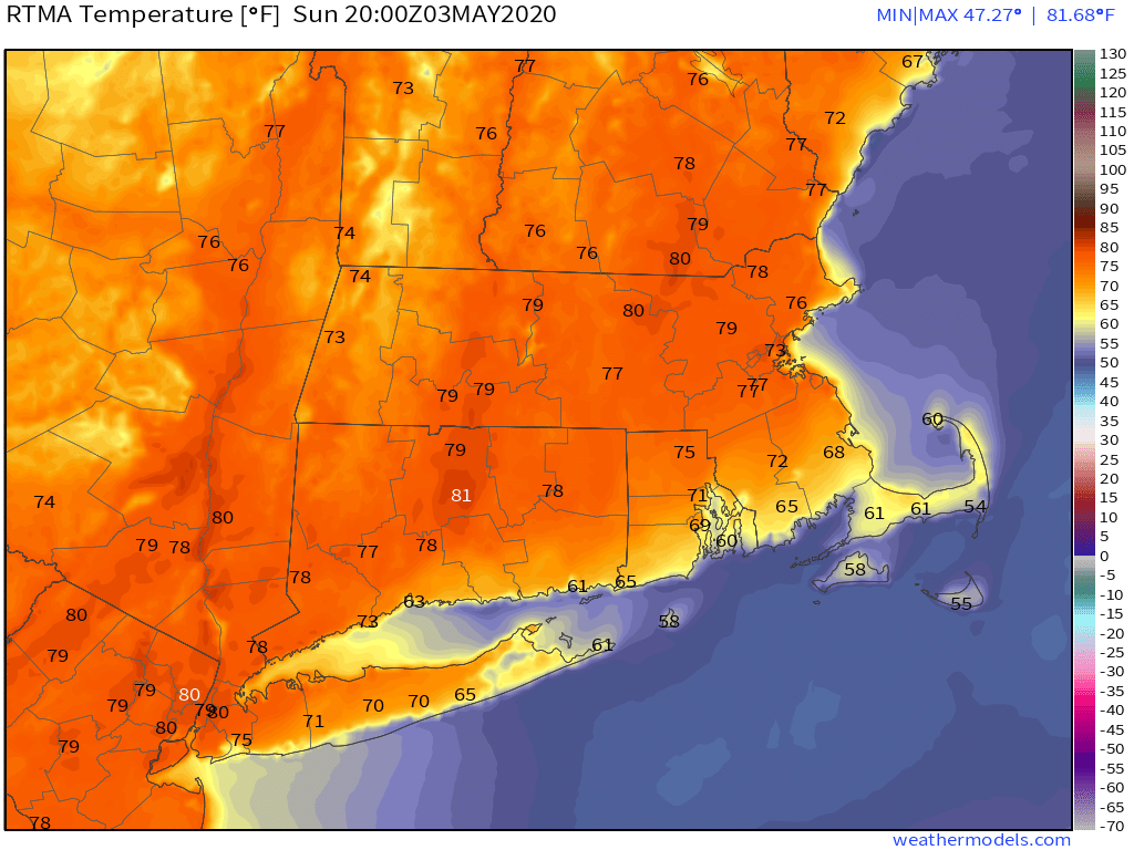
The weather really was fantastic this weekend, wasn’t it? Spring has finally arrived! Hope you enjoyed it, because you won’t see it again for a while, certainly not this week.
We’ll start the week off with what will probably be the best day of the week, certainly the warmest. It won’t be as warm as the weekend, but temperatures will still be close to normal for early May. The problem is, we’ll have a cold front moving through, with some clouds, and maybe a shower or two. Gusty northwest winds behind the front will usher some cooler air into the region. Winds will start to die down on Tuesday as high pressure builds in, but temperatures will be noticeably cooler.
Clouds return on Wednesday as another system moves into the Mid-Atlantic states. This system will pass south of the region Wednesday night into early Thursday, likely producing some showers. Another shot of colder air settles in behind that system as an upper-level low pressure area drops southward from Canada. This sets us up for a very chilly end of the week and weekend.

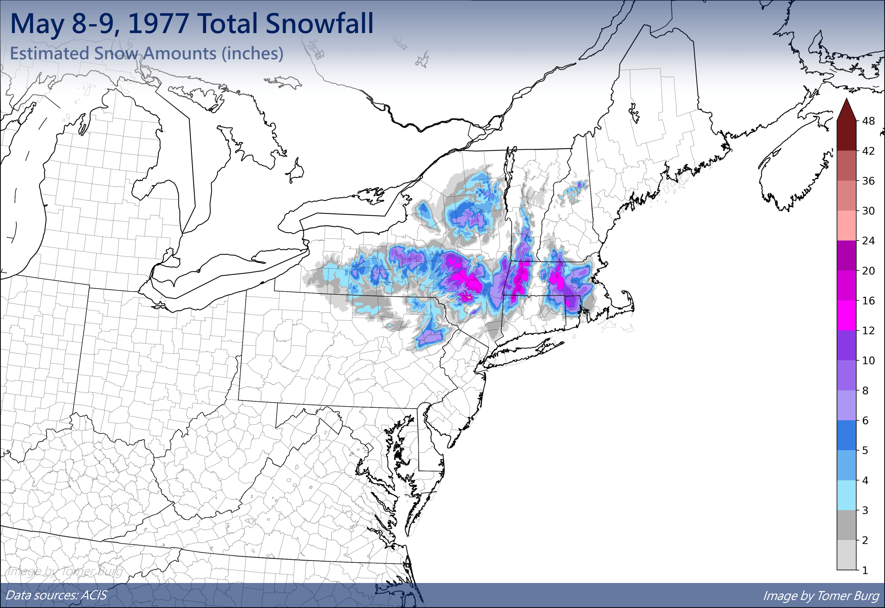
As the upper-level low settles in, a weak disturbance rotating around it will move in on Friday, with plenty of clouds, a few showers, and unseasonably chilly temperatures. Another low pressure area will then move off the Mid-Atlantic coast and head northeastward, passing south and east of the region late Saturday into early Sunday. This will bring in some more rain, but that might not be all. The airmass moving in for the weekend is one that is more typical of early March than early May. Daytime highs may not reach 50, and the rain will make it feel that much worse. At night, as temperatures drop, there’s even a chance that some wet snow could mix in, especially across the hills of Worcester County and Northern Rhode Island. While this is highly unusual, it is not unprecedented. On May 9, 1977, a late-season storm produced snow across a large portion of southern New England, away from the coastline, with 1-2 feet in the hills of Worcester County. We also had up to 1″ of snow in some of the northwestern suburbs of Boston on May 18, 2002.
The system pulls away early Sunday, then high pressure builds back in with clearing and chilly conditions for Sunday afternoon. Unfortunately, it looks like the cool pattern will continue into the following week. In fact, we may not see any sustained warmth until we get past the middle of May. We know that’s not what you want to hear, but it’s how we see things right now.
Monday: Intervals of clouds and sunshine, breezy, chance for a few showers, favoring the South Coast in the morning. High 60-67.
Monday night: Clearing, breezy. Low 34-41.
Tuesday: Sunshine and a few clouds. High 52-59.
Tuesday night: Clear to partly cloudy. Low 34-41.
Wednesday: Partly to mostly cloudy, showers develop at night. High 53-60, coolest along the coast.
Thursday: Plenty of clouds with showers likely, especially during the morning. High 50-57, coolest along the coast.
Friday: Early sun, then some afternoon clouds, breezy. High 52-59.
Saturday: Mostly cloudy with showers likely, possibly mixed with some wet snow across the hills of Worcester County and northern Rhode Island. High 45-52.
Sunday: Partly sunny and breezy. High 46-53.
