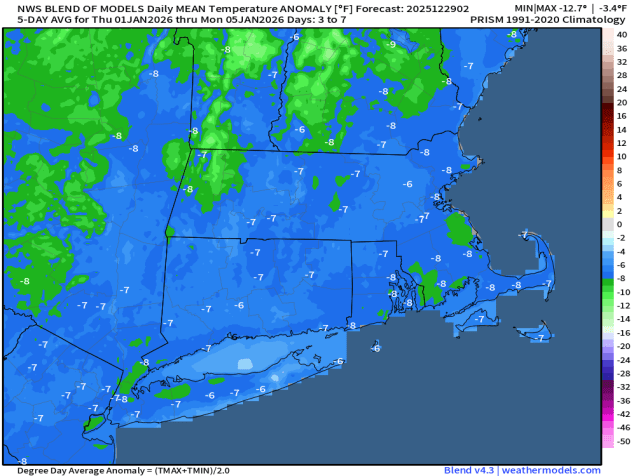
If you’re looking for a week for a tropical vacation, this may be the one, because we’re in for some very chilly air at times this week.
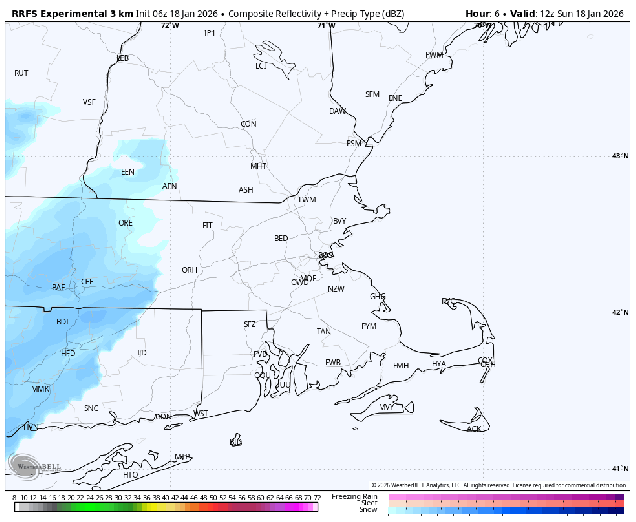
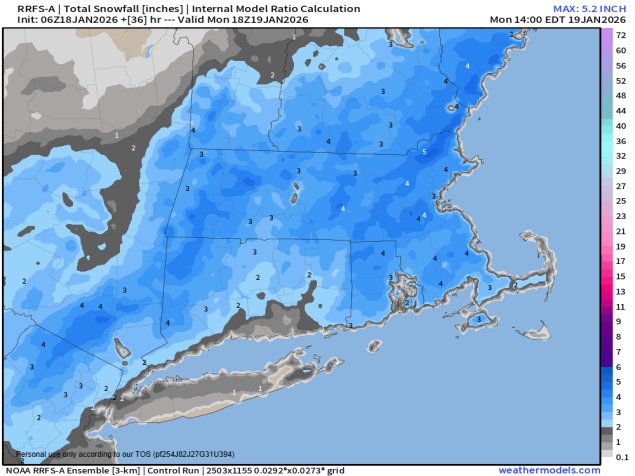
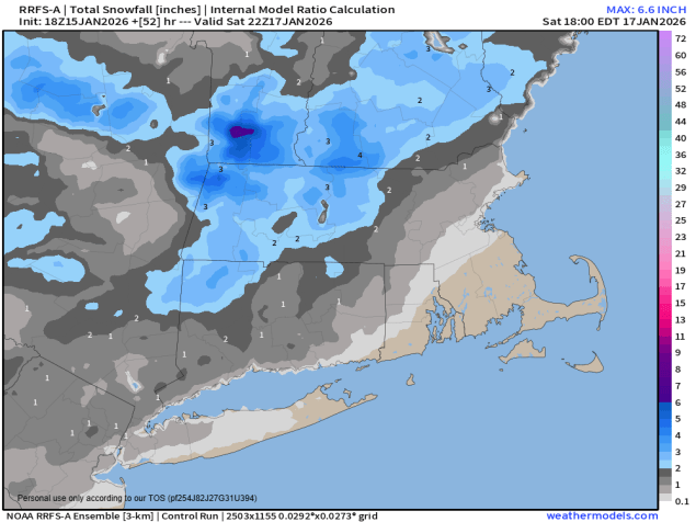
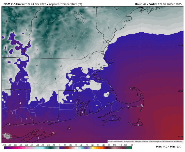
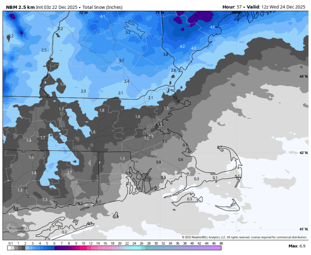
Snow will end this morning as low pressure pulls away from the region, with some clearing possible during the afternoon. However, an arctic cold front will move through this evening, possibly accompanied by a few snow showers or squalls. They shouldn’t be that widespread, but could cause a few issues if you have to get caught under one. Luckily they’ll be moving through during the night, when very few people will be on the roads. High pressure builds in on Tuesday, with a very cold day despite sunshine. Temperatures will only get unto the upper teens and 20s, with wind chills in the single numbers or below zero. As the high moves off to the east, temperatures will start to moderate, but we’ll also see some clouds start to move in during the day ahead of the next storm system. This storm will bring in some snow showers late Wednesday night and early Thursday, but it shouldn’t be that big of a deal. High pressure then builds in with some bitterly cold air for the end of the week and the weekend.
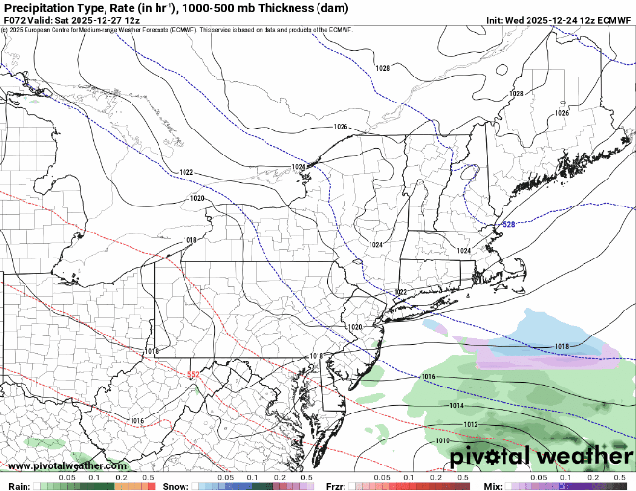
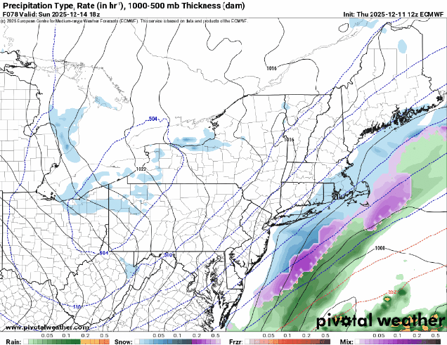
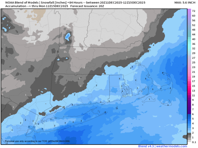
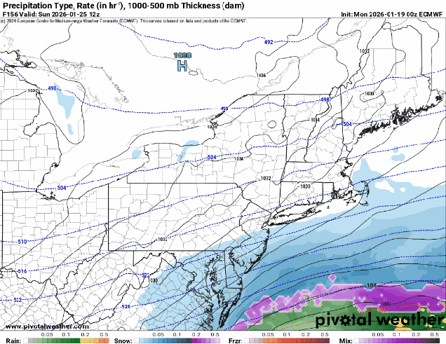
By the end of the weekend we’re going to be keeping an eye on a storm system passing south of the region. We’ll have plenty of cold air with a large area of high pressure in place, the question is, how far north does the precipitation get. Some models keep it well to the south, with the high to the north keeping us very cold but dry, others have the precipitation move in with some snow possible. At this point, it’s still nearly a week away, so it’s impossible to tell which, if either, solution will be right. For now, we’ll just keep an eye on it as the week goes on, but we’re leaning towards the bitterly cold and dry solution.
Monday: Snow showers ending in the morning, some afternoon sunny breaks develop, becoming breezy. High 29-36.
Monday night: Partly cloudy with a chance for a few snow showers before midnight, clearing after midnight, breezy. Low 12-19.
Tuesday: Partly to mostly sunny, breezy. High 19-26.
Tuesday night: Clear skies. Low 4-11.
Wednesday: Morning sun, then increasing afternoon clouds. High 25-32.
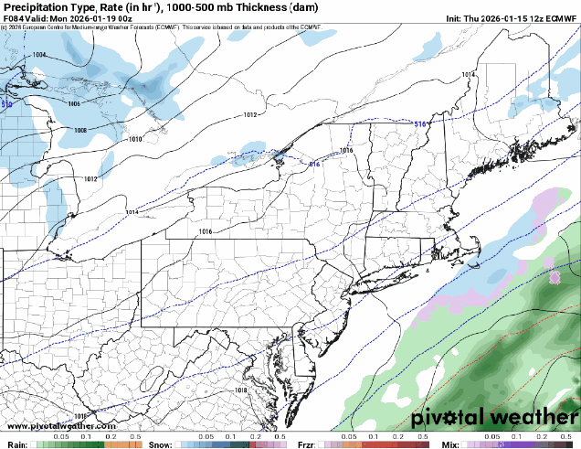
Wednesday night: Mostly cloudy, chance for snow showers after midnight. Low 21-28, temperatures may rise a little overnight.
Thursday: Partly to mostly cloudy, breezy, some snow showers possible in the morning. High 35-42.
Thursday night: Becoming clear. Low 14-21.
Friday: Partly sunny, breezy, colder. High 23-30.
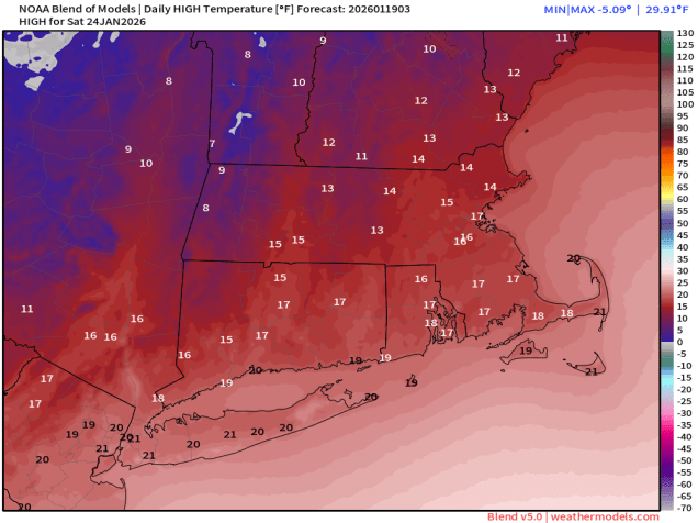
Saturday: A mix of sun and clouds, breezy. High 14-21.
Sunday: Partly sunny. High 11-18.