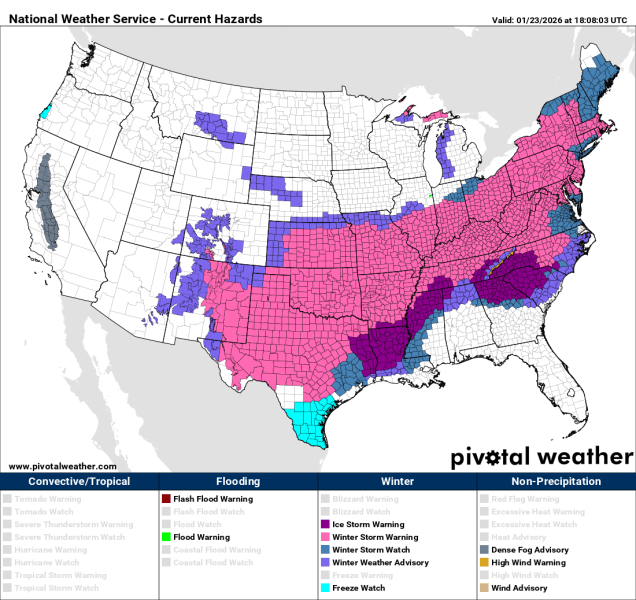
A pair of low pressure systems make for a complicate forecast across the region.
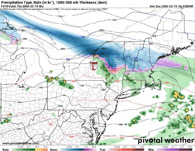
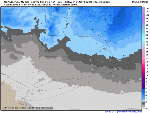
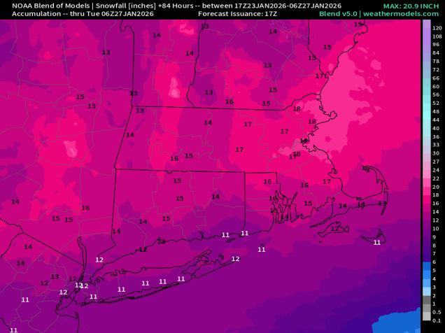
Clouds will stream back into the region tonight ahead of a low pressure system moving out of the Great Lakes. Precipitation will develop late Friday morning or early Friday afternoon. Temperatures will be close to freezing, but warmer air will move in aloft, so we’ll see sleet and some freezing rain across much of the region at the onset. The exceptions will be near the South Coast, where it will be plain rain as temperatures will be milder, and across central New Hampshire, where precipitation falls mainly as snow. During the day, a secondary area of low pressure will develop south of New England, and as it moves by at night, it will drag colder air southward, changing the precipitation over to snow from north to south. The system pulls away during the day Saturday, with some occasional snow showers likely not winding down until the afternoon. How much snow/sleet are we expecting? Much of Rhode Island and southeastern Massachusetts will see less than 1 inch. Areas roughly north of Route 44 up to the Mass Pike will see 1-2 inches. North of the Pike we’re looking at 2-4 inches, with a little more, possibly 3-6″ from the hills of Worcester County up into southern and central New Hampshire.
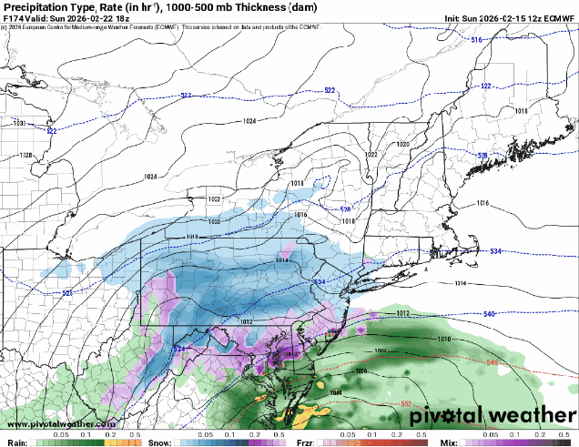
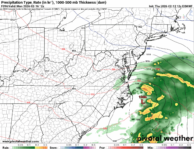
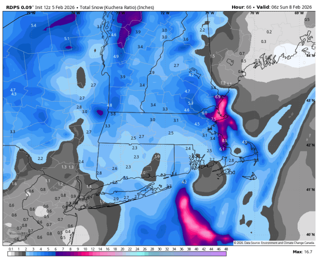
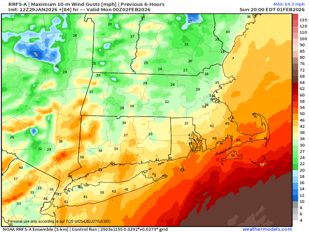
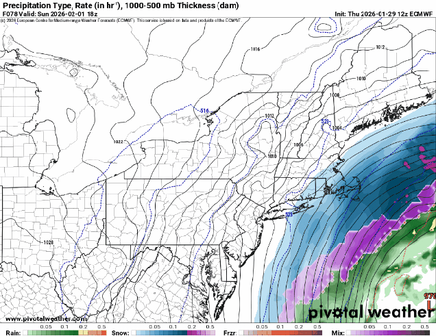
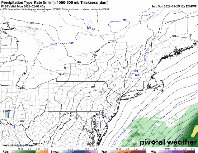
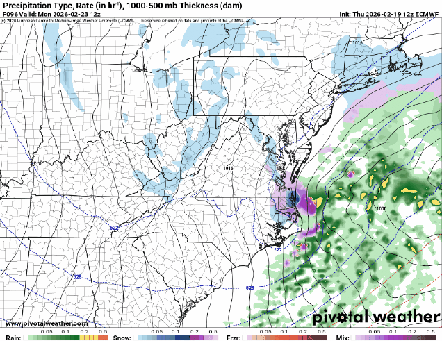
High pressure briefly builds in for Saturday night and Sunday, then we turn our attention to a low pressure system that will be developing near the Mid-Atlantic coastline. There is still considerable uncertainty with this storm in not only the track, but how strong it will get. This will determine how strong the winds get around here, whether there will be any coastal flooding, and of course, how much, if any, snow we’ll get. Right now, it looks like the storm will pass just far enough offshore so that the only places with a chance for some heavier snow will be across Cape Cod and southeastern Massachusetts. However, there are some models that do bring heavier snow farther inland, so we can’t discount that possibility just yet. Of course, this could also end up like last weekend’s storm that passes so far offshore that only Nantucket had any snow. Either scenario is plausible at this point, and if it looks like a significant storm is more likely, we’ll write a special blog post on Sunday.
Thursday night: Becoming partly to mostly cloudy. Low 22-29.
Friday: Cloudy with a wintry mix of snow, sleet, freezing rain, and rain developing around midday. High 33-40.
Friday night: Mix changing to light snow and show showers from north to south. Low 23-30.
Saturday: Cloudy with snow showers ending during the afternoon. High 31-38.
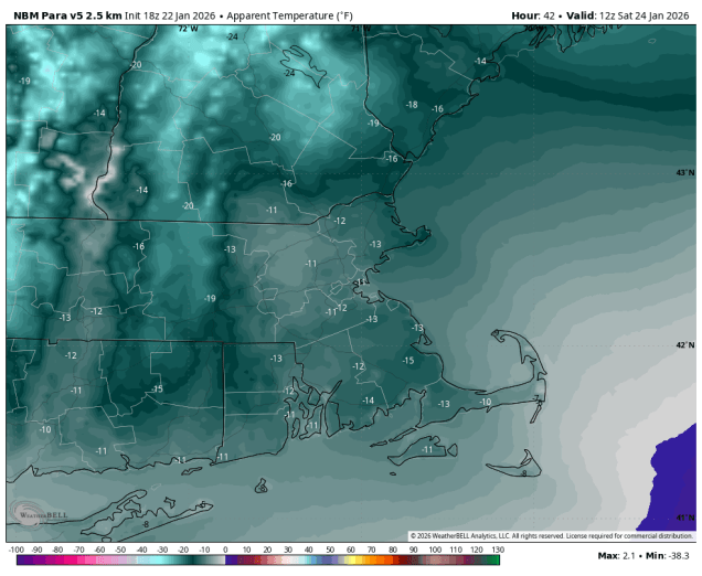
Saturday night: Some clearing after midnight. Low 14-21.
Sunday: Any morning sun disappears behind thickening clouds. High 30-37.
Sunday night: Cloudy and becoming windy with a chance of snow, mainly south of Boston. Low 21-28.
Monday: Mostly cloudy and windy with any snow ending. High 29-36.