Temperatures will be up and down this week as a couple of systems impact the region, but the weather looks great for the Red Sox home opener at Fenway on Friday.
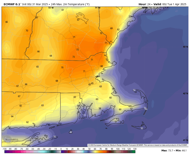
The week starts off with low pressure moving into the St. Lawrence Valley dragging a warm front across the region this morning, resulting in a rather mild day, except near the South Coast, where southerly winds blowing off the still-chilly Atlantic will keep things cooler. Cloudcover will keep temperatures in the 60s away from the South Coast, but if any sunny breaks develop, we could see temperatures jump into the lower 70s inland. A few showers are possible during the day, but they’ll become more widespread by evening as a cold front approaches from the west. Rain is likely during the evening and first part of the night, with some thunderstorms possible as well, before the cold front crosses the region, bringing an end to the rain. High pressure builds in for Tuesday, with clearing skies accompanied by breezy and much cooler conditions. High pressure remains in control for the start of the day Wednesday, but clouds will quickly stream back in during the day, as a low pressure system moving into the Midwest sends a warm front our way. We’ll see showers developing ahead of the warm front Wednesday night, but across southern New Hampshire and possibly the Merrimack Valley, there may be just enough cold air in place when the precipitation moves in for some snow or sleet at the start, but we’re not expecting any accumulation. Thursday looks like another mild day with some showers possible as another cold front moves through. That front will stall out just south of New England, allowing high pressure to build in for Friday. A wave of low pressure rides along the front on Saturday, bringing clouds back in, with some showers across southern portions of the region, especially late in the day and at night. Another wave will bring in more rain on Sunday, but temperatures will be dependent on whether the front remains to our south, or that wave lifts it back northward as a warm front.

The Red Sox open their home schedule at Fenway on Friday against the St. Louis Cardinals with first pitch scheduled for 2:05pm. Weather shouldn’t be an issue. Skies should be partly to mostly cloudy, winds out of the northwest at 5-10 mph, and temperatures likely near or above 60 degrees. For early April, you couldn’t ask for better baseball weather around here.

Monday: Lots of clouds and possibly a few sunny breaks, a few showers also possible, breezy, and milder. High 63-70, cooler along the South Coast and Cape Cod.
Monday night: Cloudy with rain and thunderstorms developing, ending before daybreak. Low 39-46.
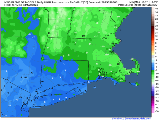
Tuesday: Early clouds and a few lingering showers, mainly across Cape Cod, then becoming partly to mostly sunny in the afternoon, breezy, and cooler. High 47-54.
Tuesday night: Clear skies, some clouds may start to move back in late at night. Low 25-32.
Wednesday: Morning sun, then increasing afternoon clouds. High 41-48.
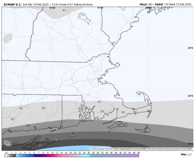
Wednesday night: Cloudy with showers developing, mainly north of the Mass Pike, possibly mixed with a little snow or sleet in southern New Hampshire. Low 31-38, temperatures may start rising after midnight.
Thursday: Cloudy, breezy, and milder with scattered showers. High 58-65, cooler along the South Coast and Cape Cod.
Thursday night: Mostly cloudy with periods of rain and showers, ending late at night. Low 48-55.
Friday: Morning clouds, some clearing in the afternoon. High 60-67, cooler across Cape Cod.
Saturday: Partly to mostly cloudy with a chance for some showers, mainly late in the day and at night, favoring areas south of the Mass Pike. High 44-51.
Sunday: Mostly cloudy with a chance of rain. High 47-54.