Hope you enjoyed our recent mild weather, because winter is about to return.
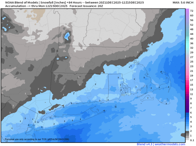
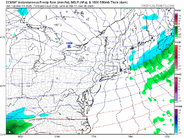
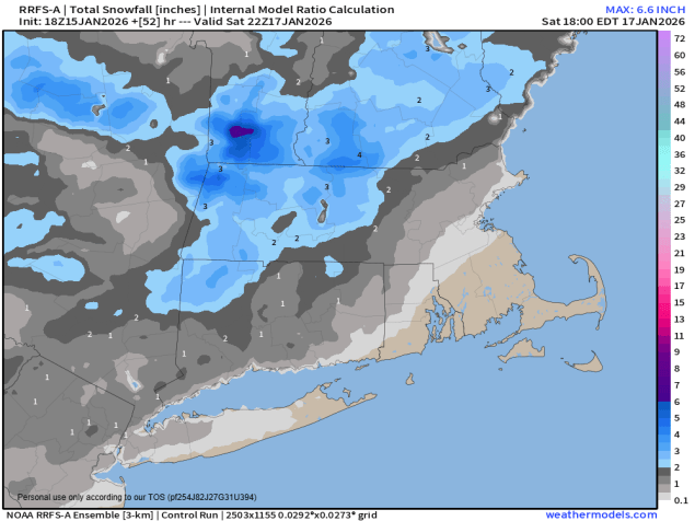
A cold front crossed the region earlier today, and cooler air has already started to move in. Another weak disturbance moves through tonight, possibly producing a few snow showers or squalls, followed by even colder air. High pressure builds in tomorrow, setting up a chilly day. With a large upper-level low pressure area settling into the Northeast we’ll see clouds pop up after some morning sunshine. Clouds thicken back up at night as another weak system heads out of the Great Lakes and towards New England. This one will bring in some precipitation on Saturday. South and east of I-95 it should be mostly rain, but north and west of there a period of light snow or snow showers is expected. We’re only looking at an inch, maybe 2 in spots, so it’s not that big of a deal, but if you’re going to be out and about during the day Saturday you’ll want to keep this in mind. This brings us to Sunday.
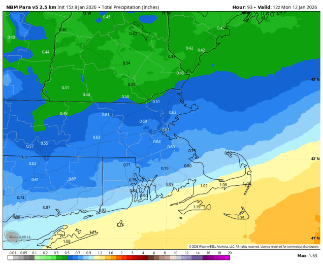
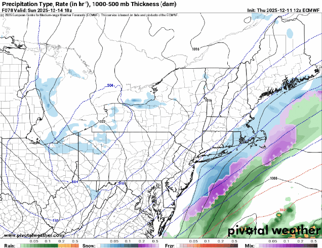
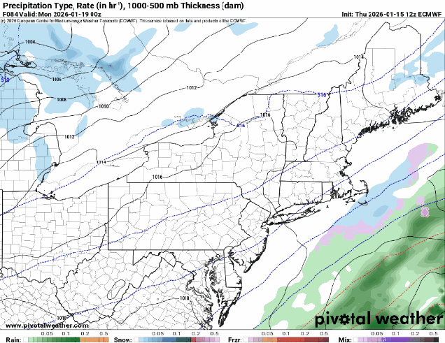
You may have seen or heard the hype on Wednesday about the “blockbuster” storm head our way for Sunday. Well, that is not likely to be the case. One run of one model (that hasn’t done so well lately) showed that yesterday afternoon, and all the Facebook Forecasters (and some of the local TV meteorologists) jumped all over it. We don’t do “wishcasting” here, we focus on actual forecasting. Yes, there will be a storm moving up the coast, but it is not likely to be a major snowstorm for the region. In fact, there are some models that keep it completely offshore with no impacts at all. We think it’ll be close enough to spread some light snow into parts of southeastern Massachusetts and Rhode Island, possibly as far north as the Boston area, but even that is not a lock by any means. In fact, the precipitation could end up as rain across parts of Cape Cod if the storm passes close enough. As for the timing, that’s also a question mark. Some models have the precipitation move in by early afternoon, some hold off until evening. With the Patriots kicking off at 3:00, a lot of people will be paying attention to the forecast. We wouldn’t be surprised at all if there is snow during the game, especially during the second half. We’ll likely do another blog post about this system on Saturday, once things are a little more locked in. At that point, we’ll go deeper into an accumulation forecast, but for now, we don’t anticipate anywhere picking up more than 6 inches. The system pulls away Sunday night, but another upper-level disturbance moves through on Monday with some clouds and possibly a few flurries.
Thursday night: A few snow showers or squalls possible, otherwise partly cloudy, breezy. Low 15-22.
Friday: Morning sun, increasing afternoon clouds, windy. High 27-34.
Friday night: Becoming mostly cloudy, snow showers possible towards daybreak. Low 21-28, temperatures may rise a little overnight.
Saturday: Mostly cloudy, light snow and snow showers developing north and west of I-95, rain, possibly mixed with a little snow, south and east. High 35-42.
Saturday night: Partly to mostly cloudy. Low 25-32.
Sunday: Cloudy with some snow developing in the afternoon, mainly south and east of I-95, possibly mixed with rain across Cape Cod. High 32-39.
Sunday night: Any snow ending, becoming partly cloudy after midnight. Low 18-25.
Monday: A mix of sun and clouds, chance for a few flurries, breezy. High 28-35.