The final weekend of March will be mostly dry, but on the chilly side.

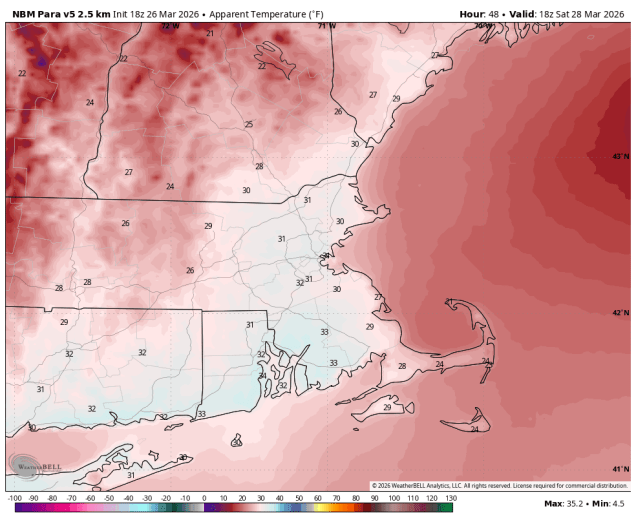
A cold front will drop southward across the region tonight, bringing some rain into the region, which is good, since we need as much as we can get with the drought ongoing. The rain will end Friday morning as the front settles offshore, then gusty northwest winds will usher much cooler air back in. Saturday will be a rather chilly day with an upper-level disturbance generating some afternoon clouds and possibly a few rain or snow showers. Temperatures will only be in the 30s, and wind chills will likely be in the 20s. High pressure then slides offshore for Sunday with sunshine and moderating temperatures, though still a little below normal for late March. We’ll continue the warmup with dry weather on Monday.
Thursday night: Cloudy with rain likely, tapering off late at night. Low 36-43.
Friday: Any lingering showers end in the morning, becoming partly to mostly sunny and breezy in the afternoon. High 43-50.
Friday night: Clear during the evening, partly cloudy overnight. Low 21-28.
Saturday: Partly sunny, breezy, chance for a few afternoon rain or snow showers. High 32-39.
Saturday night: Becoming clear. Low 21-28.
Sunday: Sunshine and some afternoon clouds, breezy. High 42-49.
Sunday night: Partly to mostly cloudy. Low 31-38.
Monday: Intervals of clouds and sun, breezy. High 54-61, a little cooler across Cape Cod and the South Coast.
