For a change, we’ve got a mostly quiet weekend coming up across the region.
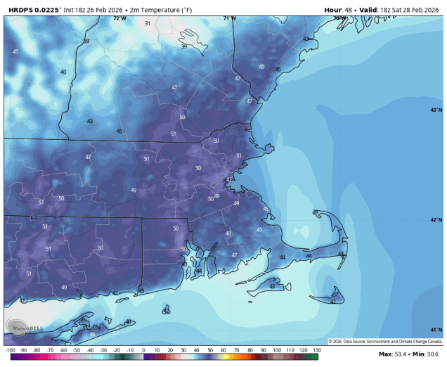
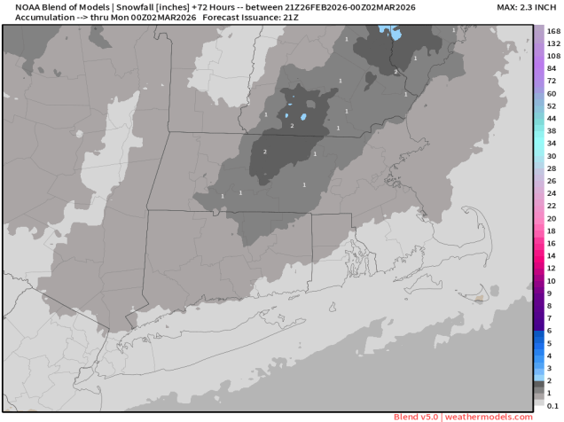
High pressure settles in for tonight into Saturday with mostly dry weather. Temperatures will remain seasonably cool into Friday, but as the high moves off to the east, southwest to south winds will send milder air in, with some places possibly reaching 50 on Saturday, helping to start melting the glacier currently occupying most of New England. A cold front will move in early Sunday, accompanied by some light snow or snow showers during the morning hours. A few spots could pick up an inch or even two, but overall this is not a big deal. Temperatures start to drop behind the front in the afternoon, then we’ll see some clearing for Sunday night. A wave of low pressure passes well south of the region along the front on Monday, but it will keep some clouds in place.
Thursday night: Evening clouds, then becoming clear. Low 9-16, a little milder across urban areas and Cape Cod.
Friday: Plenty of sunshine. High 33-40.
Friday night: Clear to partly cloudy. Low 22-29, temperatures start to rise after midnight.
Saturday: Partly to mostly sunny. High 42-49.
Saturday night: Partly cloudy. Low 24-31.
Sunday: Light snow or snow showers during the morning, a coating to 2 inches is possible, skies start to clear out late in the day. High 30-37. temperatures start to drop in the afternoon.
Sunday night: Clear skies, much colder. Low 4-11.
Monday: A mix of sun and clouds. High 21-28.
