Astronomical winter starts next Sunday, but leading up to it we’re going to have some days that are decidedly un-winterlike.
The storm that brought us the snow yesterday continues to pull away today with windy and chilly conditions in its wake today. A weak upper-level disturbance will bring in some clouds this afternoon and evening, but moisture will be limited, so aside from a few stray flurries, we’ll remain dry. The high slides off to our south for Tuesday into Wednesday, keeping us dry, but allowing temperatures to moderate. as we get to the latter half of the work week things start to change. A low pressure system heads into southern Canada, with gusty southwest winds ahead of it bringing milder air in on Thursday, with many places likely getting into the 40s. Windy and mild conditions are likely for Thursday night into Friday along with some rain as the system moves across the region. Some models show the potential for some heavy rain, which will not only melt the snow, but likely help a little with the drought conditions the persist in parts of the region. We’ll have more details on the potential for strong winds and heavy rain in our Weekend Outlook on Thursday. Temperatures drop quickly behind the cold front on Friday, with much colder air moving back in for Friday night and Saturday. For Sunday, astronomical winter begins with the solstice at 10:03am, but indications now are for a milder day with some rain possible ahead of another cold front.

Monday: Sunny in the morning, clouds move back in during the afternoon, breezy. High 21-28.
Monday night: Mostly cloudy, chance for a few flurries near the South Coast, skies start to clear out late at night. Low 13-20.
Tuesday: Partly to mostly sunny, clouds start to filter back in late in the day. High 28-35.
Tuesday night: Partly to mostly cloudy. Low 19-26, temperatures may start to rise after midnight.
Wednesday: Partly sunny, breezy. High 39-46.
Wednesday night: Partly cloudy. Low 22-29.
Thursday: Becoming mostly cloudy. High 42-49.
Thursday night: Cloudy and windy with rain developing. Low 34-41 during the evening, temperatures rise overnight.
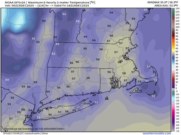
Friday: Rain likely during the morning, possibly changing to snow before ending across the interior, skies start to clear out in the afternoon, windy. High 48-55 in the morning, temperatures drop during the afternoon.
Saturday: Partly sunny. High 32-39.
Sunday: Intervals of clouds and sun, chance for a few showers. High 40-47.
