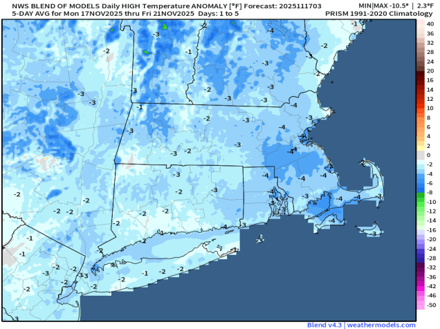
Most of the unsettled weather this outlook will happen during the latter half of the week.
The week starts off with low pressure continuing to slowly move away from the region and into Atlantic Canada. The result will be breezy and cool but dry conditions for Monday and Tuesday. A weak system passes south of the region later Wednesday, but high pressure will build in, so we’ll stay dry with lighter winds. Thursday should be another dry and cool day with high pressure in control. A low pressure system will bring some rain and slightly milder air in on Friday, with some gusty winds possible once again as the system pulls away Friday night. High pressure should build in for the weekend with drier and cooler conditions. We will be keeping an eye on a wave of low pressure riding along the cold front as it pushes offshore, but for now, it looks like it will pass too far south to have any impact here.
Monday: A mix of sun and clouds, windy. High 37-44.
Monday night: Clear skies, breezy. Low 28-35.
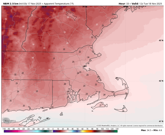
Tuesday: Sunshine and a few afternoon clouds, breezy. High 39-46.
Tuesday night: Clear to partly cloudy. Low 25-32.
Wednesday: Mostly sunny. High 40-47.
Wednesday night: Becoming partly to mostly cloudy. Low 25-32.
Thursday: More clouds than sun. High 42-49.
Thursday night: Mostly cloudy. Low 30-37.
Friday: Cloudy with showers likely. High 48-55.
Saturday: Intervals of clouds and sun. High 45-52.
Sunday: Partly sunny. High 42-49.
