If you picked this week to take a vacation, then you’re in luck, because most of the week will feature some fantastic mid-August weather.

Most of the week will feature seasonably warm temperatures, moderate humidity, and dry weather, with high pressure in control. There are a few exceptions though. One of them is today, when a weak upper-level disturbance moves across the Northeast. It will generate a few more clouds, and possibly a few showers, but they shouldn’t be too widespread. Thursday will be similar with another disturbance generating a few pop-up showers, but again, nothing to cancel outdoor plans over. The weekend is when things become a little more uncertain. A cold front will be moving in from the west. Saturday should be another dry, but likely warm and a bit more humid, day. Sunday, however, may not be as nice, depending on the timing of the front. We could see more clouds and a better chance for showers and thunderstorms, though at least one model delays the front until the beginning of next week, so there’s a chance Sunday could end up dry as well.

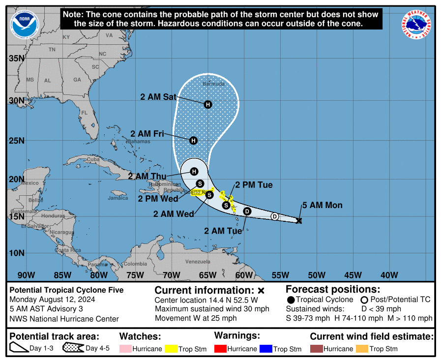
Finally, we’ll touch on the tropics. The hype train is already rolling down the tracks about “soon-to-be Ernesto”, and the threat is presents to the East Coast. Well, that’s not exactly the case. Yes, a couple of models a few days ago showed the potential for the storm to threaten the East Coast in about 10 days, but as of now, there is no actual storm to begin with. Sunday evening, the National Hurricane Centered designated the system as “Potential Tropical Cylone Five”. It still has a broad circulation, but it could become a tropical depression later today, assuming it can develop a low-level circulation. Conditions are not that favorable at the moment, but should become more conducive for development later today and Tuesday. The forecast calls for it to cross the Leeward Islands on Tuesday, then across the Virgin Islands Tuesday night and Wednesday, before turning northwestward and then northward. Tropical Storm Watches are in effect for the Leeward Islands and the British and US Virgin Islands as well as Puerto Rico. The forecasts calls for it to become a hurricane toward the middle of the week, and with additional strengthening possible, it could become a significant threat to Bermuda by next weekend. Of course, a lot can change between now and then, but at this point, the threat to the East Coast is minimal, despite all the recent hype. We’ll go into more detail on this system in a separate blog post once it has actually developed.
Monday: A sunny start, then some clouds move in with a few showers possible in the afternoon. High 75-82.
Monday night: Any lingering showers end in the evening, then skies become clear. Low 56-63.
Tuesday: Sunshine and some afternoon clouds. High 77-84.
Tuesday night: Partly cloudy. Low 58-65.
Wednesday: Partly to mostly sunny. High 78-85.
Thursday: A mix of sun and clouds, chance for a few showers. High 76-83.
Friday: Partly to mostly sunny. High 77-84.
Saturday: Partly sunny, a little more humid, chance for some late-day showers. High 76-83.
Sunday: Intervals of clouds and sun with a chance for showers and thunderstorms. High 74-81.
