
After a nearly month-long slumber, the Atlantic is waking up again with the formation of Tropical Storm Debby.
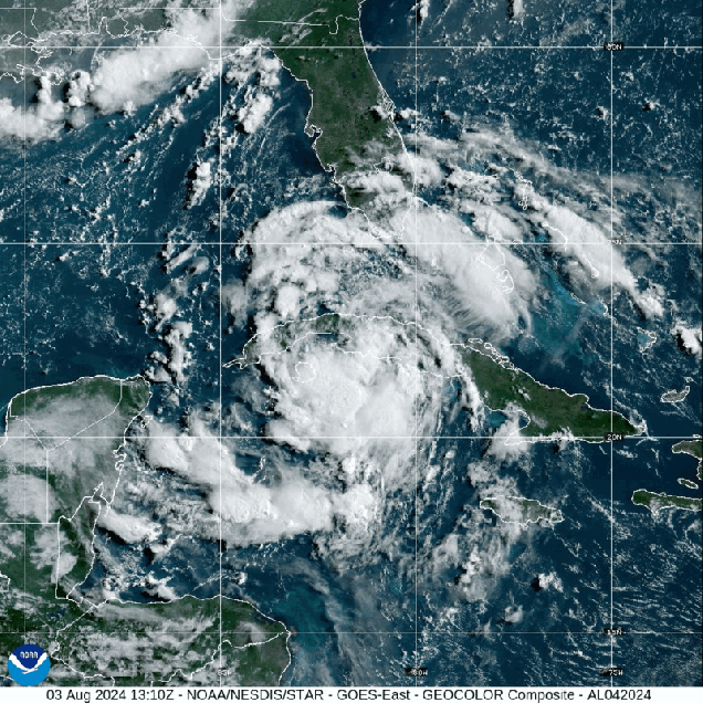
A tropical wave that we’ve been watching for nearly a week finally found some favorable atmospheric conditions as it moved into the eastern Gulf of Mexico, and became Tropical Depression Four Friday night, then was upgraded to Tropical Storm Debby Saturday afternoon. As of 8pm Saturday, Debby was centered about 100 miles west-southwest of Key West, Florida, moving toward the northwest at 14 mph. Maximum sustained winds were near 40 mph. Most of the west coast of Florida and the Florida Panhandle are under a variety of Tropical Storm, Hurricane, and Storm Surge Watches or warnings.

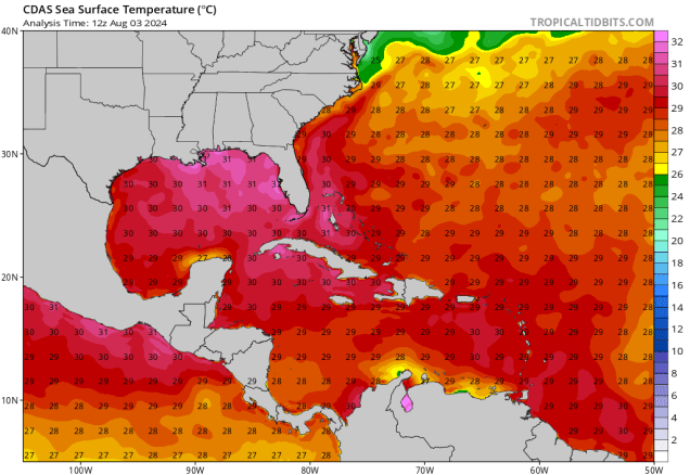
Debby’s immediate future is fairly simple – it will turn more toward the north while strengthening over the next day or so, heading towards the Florida Panhandle or the Big Bend area. The official forecast from the National Hurricane Center calls for Debby to reach minimal hurricane strength before making landfall early Monday. However, the models (and NHC) do a poor job forecasting rapid intensification, and the water in the eastern Gulf of Mexico is extremely warm, providing plenty of fuel for the storm. While the forecast doesn’t show it, we wouldn’t be surprised if Debby does intensify rapidly at some point on Sunday, and is a much stronger storm at landfall.
Once inland, the steering currents collapse, and Debby will slow down and meander around across parts of northern Florida, Georgia, or South Carolina during the first part of next week while weakening. This will increase the flooding threat across the region (more on that in a bit). After that, things get very uncertain. Some models keep the storm inland over the Southeast, steadily weakening before heading northeastward later in the week. Other models bring the storm back out into the Atlantic, with some strengthening, with a second landfall in the Carolinas, or a turn out to sea. At this point, it’s impossible to tell which scenario will happen, so we won’t even attempt to.

Debby will have significant impacts across Florida and parts of the Southeast over the next few days. Strong winds are obviously a threat near where the storm makes landfall. Storm surge is likely across most of the Florida Gulf Coast, with the highest surge and correspondingly highest chance for coastal flooding near and to the right of where the storm makes landfall. By far, the biggest threat is freshwater flooding from heavy rainfall. Widespread rainfall totals of 5-10 inches are expected from central Florida into southern North Carolina, with heavier amounts likely, especially if the storm does stall out. Rainfall totals in excess of 20 inches are not out of the question, especially in parts of Georgia and South Carolina.

While there are no other storms on the horizon at this time, we are getting closer to the peak of hurricane season, so it is likely just a matter of time until the next storm develops.

Thanks for the update.
LikeLike