We’ve got an extended stretch of dry weather coming up and as a bonus, it’s going to turn milder too.

We’ll start the week with some sunshine, but clouds move in this afternoon ahead of a weak disturbance. That system may produce a few rain or snow showers late this afternoon and evening, but they’ll be widely scattered and very light. Skies clear out behind that system as high pressure builds in, setting up a sunny but chilly day on Tuesday. There may be a few ocean-effect rain or snow showers across the Outer Cape, but the rest of us will stay dry. Wednesday and Thursday look dry as well with high pressure in control, but temperatures should start to moderate by Thursday as the high slides off to the east. Clouds return on Friday ahead of the next storm system. We’ll be fairly mild ahead of that storm, with some rain likely late Friday into early Saturday. Once that system moves offshore, high pressure returns with drier and cooler conditions again on Sunday.
Monday: Morning sunshine gives way to increasing afternoon clouds, a late-day rain or snow shower is possible. High 39-46.
Monday night: A rain or snow shower during the evening, some clearing after midnight. Low 26-33.
Tuesday: Becoming partly to mostly sunny, a rain or snow shower is possible across the Outer Cape. High 43-50.
Tuesday night: Clear skies. Low 27-34.
Wednesday: Sunshine and some afternoon clouds. High 44-51.
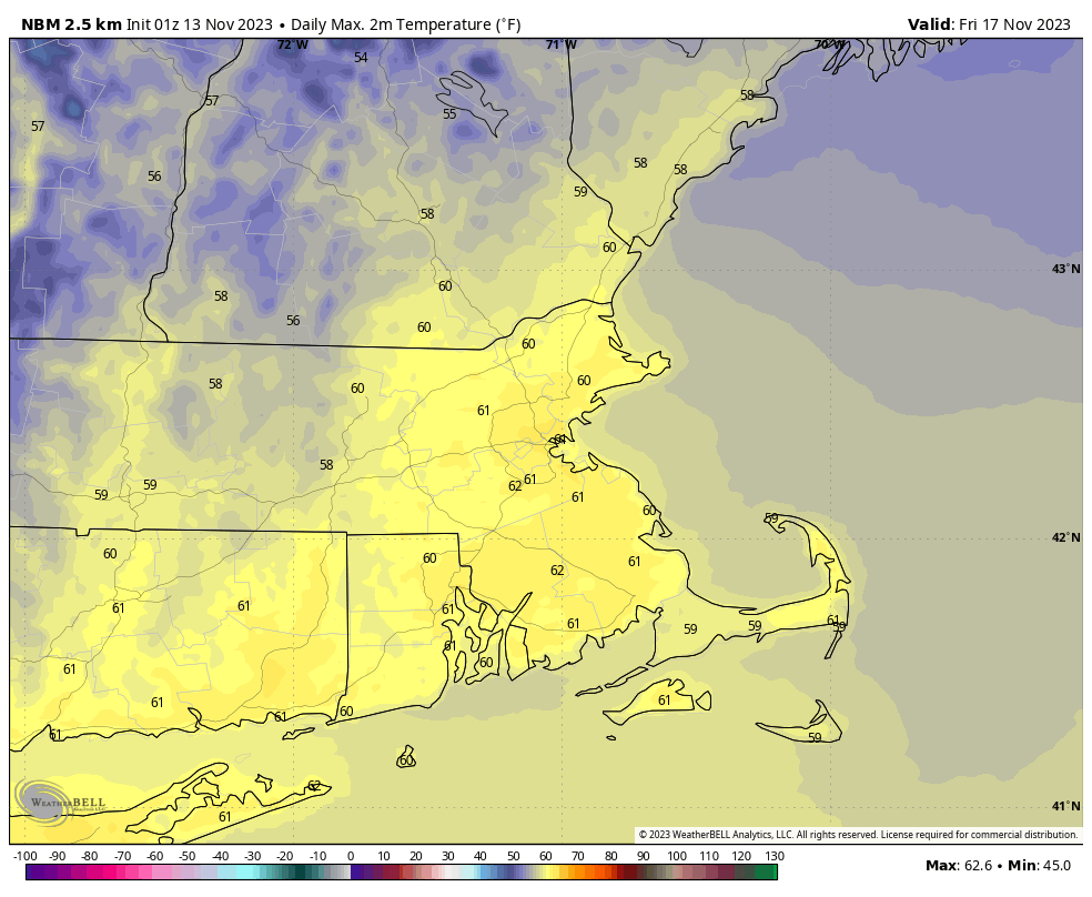
Thursday: Mostly sunny. High 53-60.
Friday: Becoming mostly cloudy, rain possible late in the day, more likely at night, windy. High 56-63.
Saturday: Rain ending early, some clearing in the afternoon, breezy. High 52-59.
Sunday: Partly to mostly sunny and breezy. High 44-51.
