Remember that weather pattern we had for most of the summer where it seemed to rain nearly every day? Yeah, it’s back for the first half of this week.

A frontal boundary remains stalled out nearby, meaning another day with warm and humid conditions along with showers and thunderstorms, some of which will produce heavy downpours. The front finally pushes offshore tonight, with some slightly drier air settling in for Tuesday. However, there will still be some moisture around, so cloudcover will be prevalent, but showers will be few and far between. A stronger cold front moves in on Wednesday, with more showers and thunderstorms likely, again some could be heavy, during the day Wednesday and into Wednesday night, ending early Thursday. High pressure builds in behind the front with drier and cooler conditions later Thursday into Friday. The weekend forecast will be dictated by the track that Hurricane Lee eventually takes.
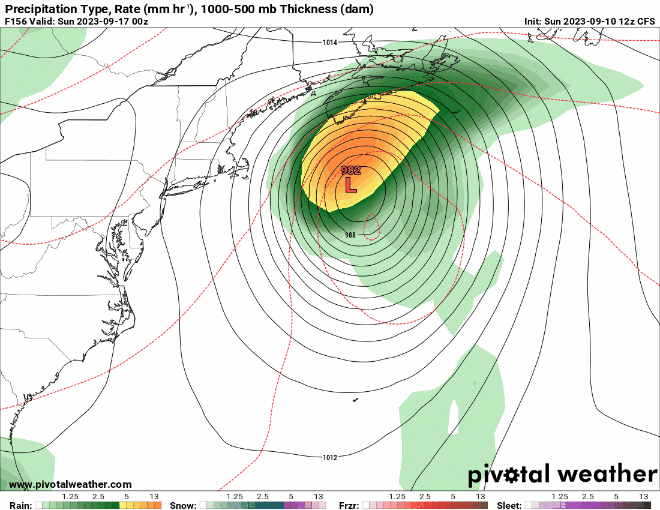
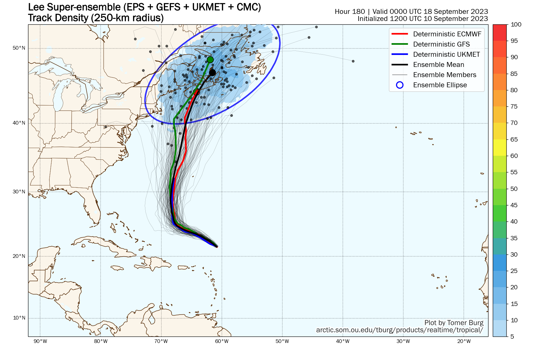
As of 11pm, Hurricane Lee, with maximum sustained winds near 120 mph, was centered about 690 miles south-southeast of Bermuda, moving toward the northwest at 8 mph. Lee may strengthen a little more over the next day or so as it continues northwestward. By mid-week, it should be turning northward as a trough of low pressure moves off the East Coast. Lee will also begin weakening as wind shear starts to increase again and it moves over cooler water that was brought to the surface in the wake of Hurricane Franklin. The question becomes – what does Franklin do at the end of the week? Does the combination of another trough of low pressure at upper levels and the high building in at the surface help to steer Lee more toward the northeast, toward Atlantic Canada or even out to sea, or does it keep Lee on a northward track, bringing in much closer to New England? The former is still the more likely scenario, but there are enough models showing the latter, or at least something similar, that it can’t be ruled out just yet. One thing is fairly certain, once Lee gets this far north, it will be much weaker than it is now, likely only tropical storm strength, but it could also be undergoing the start of a transition into an extratropical system. If there are to be any impacts across New England this weekend, they’d be most likely near the coast, with heavy rain the main threat. High surf is likely for much of the week along our shoreline no matter the track that Lee takes.
Tropical Storm Margot continues to slowly strengthen in the eastern Atlantic. As of 11pm Sunday, Margot had top winds near 65 mph, and was centered about 1185 miles west-northwest of the Cabo Verde Islands, moving toward the north at 8 mph. Margot should continue northward while strengthening for the next few days, likely reaching hurricane strength. By later in the week, high pressure building in to the north may slow Margot down, but it should remain over open water for much of the week.

We also need to keep a close eye on a tropical wave that just moved off the west coast of Africa. Conditions will be favorable for development as it makes its way across the Atlantic. If it continues to organize, it could become a tropical depression later this week. While it is still at least a week away from potentially impacting any land areas, some models show the potential for this system to continue developing into next week.
Monday: More clouds than sun with showers and thunderstorms developing, some could produce heavy rainfall. High 74-81.
Monday night: Mostly cloudy, showers ending, areas of fog likely. Low 62-69.
Tuesday: Intervals of clouds and sun, just a chance for a stray shower or two. High 72-79.
Tuesday night: Partly to mostly cloudy. Low 62-69.
Wednesday: Mostly cloudy, showers and thunderstorms developing, again some could be heavy. High 72-79.
Thursday: Showers ending early, becoming partly sunny. High 70-77.
Friday: Partly sunny, breezy. High 67-74.
Saturday: Intervals of clouds and sun, chance for showers, especially near the coast, breezy. High 65-72.
Sunday: Partly sunny, breezy. High 72-79.
