While the heat will fade away over the next few days, the humidity won’t, and there’s some rain in our future as well. Meanwhile, we’ve got Hurricane Lee and a new Tropical Depression in the Atlantic.
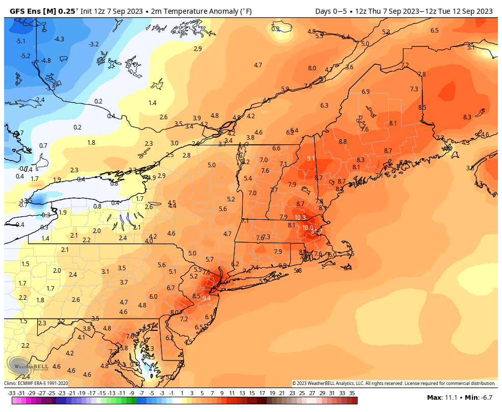
High pressure will move offshore and sit there for the next several days while a frontal system very slowly moves eastward from the Great Lakes. In between the two, southerly winds will keep us warm and rather humid right through the weekend. We’ll have a little more cloud cover over the next few days, which will keep temperatures a little lower, but still likely into the 80s each afternoon for many locations. A few showers or thunderstorms are possible during the next few afternoons and evenings, but most of them should stay north and west of our area. Sunday and Monday is the more likely timeframe for showers and thunderstorms to develop around here, as the cold front will finally be approaching our neighborhood. Sunday is the home opener for the Patriots, so a lot of people are interested in that forecast. While there will likely be some showers and possibly thunderstorms around, whether they will impact the game (or the tailgating) is a little tough to pin down at this point, so if you’re heading to Foxborough, best to plan for it, but hope it doesn’t materialize. Temperatures will likely be in the upper 70s at kickoff, and it will be quite humid.

Thursday night: Increasing clouds, patchy fog developing, slight chance for a shower during the evening from southern New Hampshire into central Massachusetts. Low 66-73.
Friday: Partly sunny, a shower or two possible during the afternoon, mainly from southern New Hampshire into central Massachusetts. High 83-90.
Friday night: Partly to mostly cloudy. Low 67-74.
Saturday: Intervals of clouds and sun, a few showers possible into the afternoon, mainly north and west of I-495. High 79-86.
Saturday night: Mostly cloudy, chance for a shower or two. Low 66-73.
Sunday: More clouds than sun with some showers and thunderstorms likely, mainly north and west of I-95. High 76-83.
Sunday night: Mostly cloudy with some showers around, mainly during the evening. Low 64-71.
Monday: Partly to mostly cloudy with scattered showers and thunderstorms likely. High 75-82.
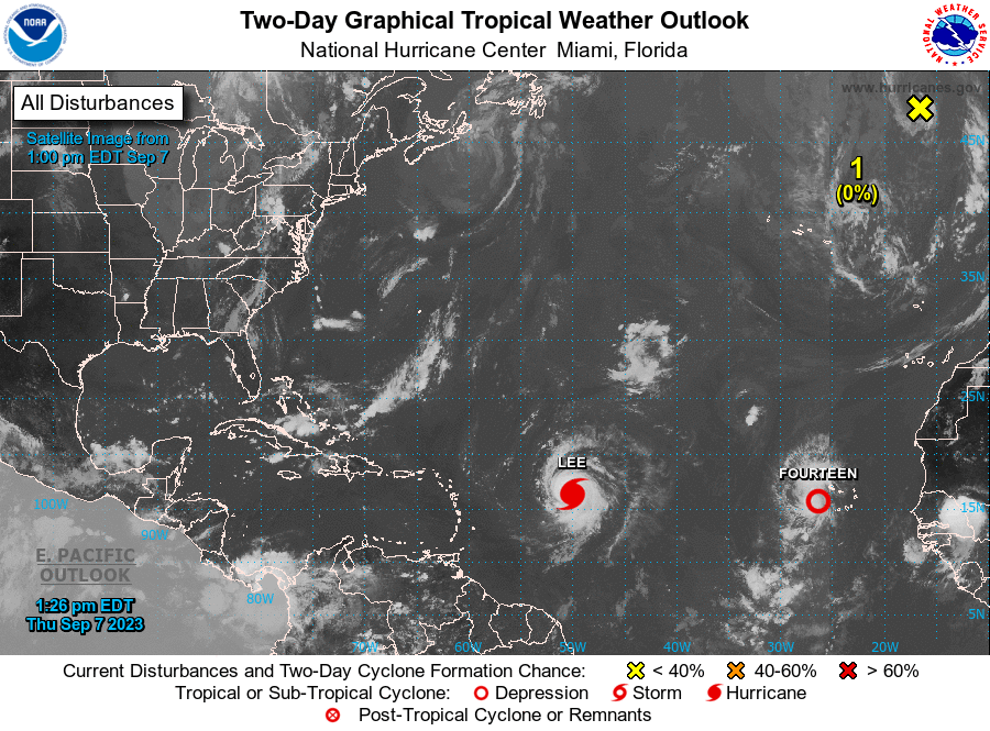
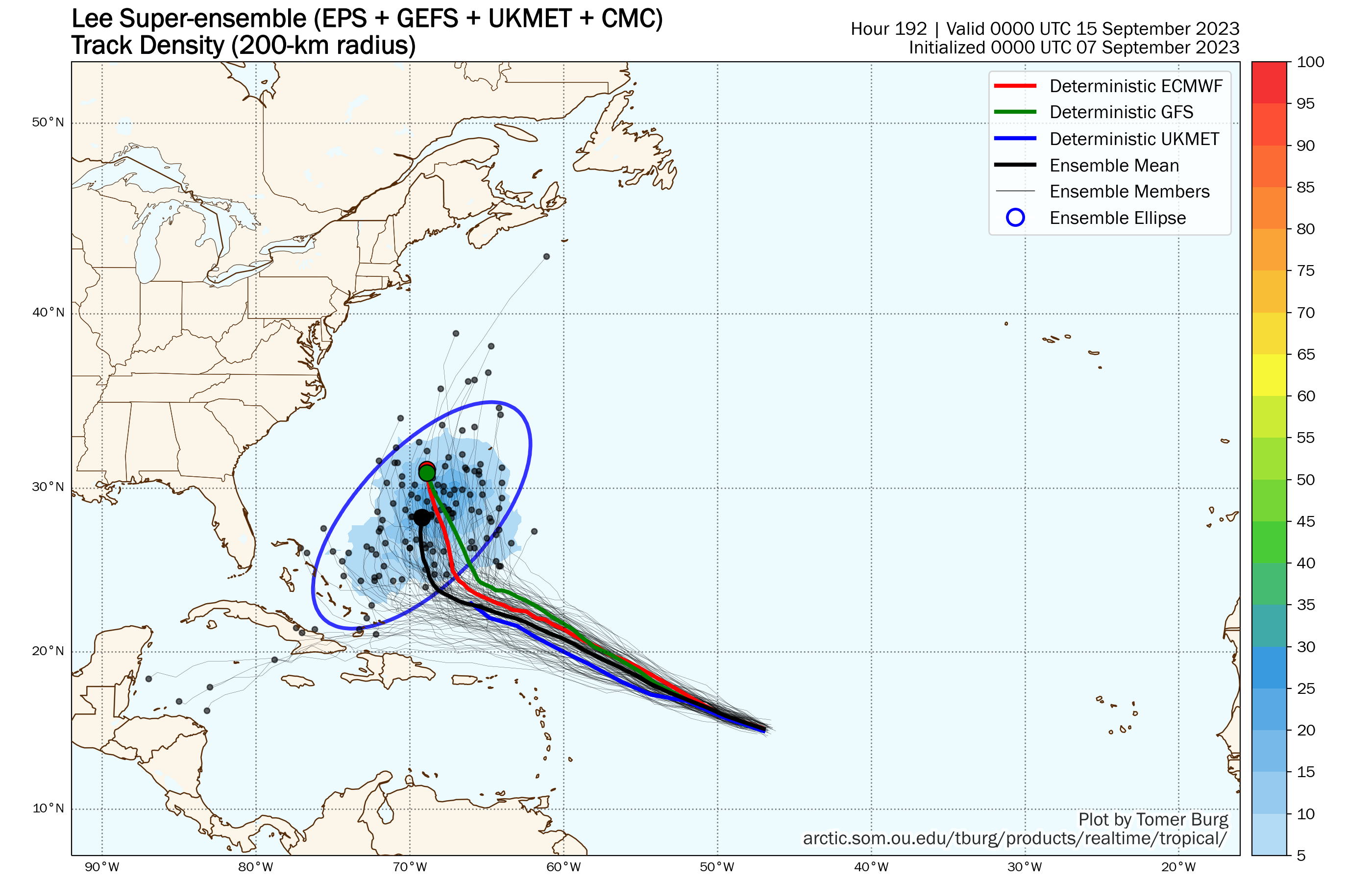
Hurricane Lee will be grabbing headlines for the next several days and rightfully so. As of 11am, Lee had maximum sustained winds near 105 mph, making it a Category Two hurricane. It was centered about 870 miles east of the Northern Leeward Islands, moving toward the west-northwest at 15 mph. There is little wind shear over Lee, and extremely warm waters that extend deep into the ocean, which means conditions are ideal for Lee to continue to rapidly strengthen, and the forecast from the National Hurricane Center calls for Lee to become a Category 5 hurricane with winds near 160 mph by Friday evening. Lee should continue on a west-northwest track, passing north of the Caribbean this weekend. After that, things get a little trickier. Lee will likely start to see its intensity fluctuate over the weekend as eyewall-replacement cycles begin to develop. As for its track, a west-northwest track will continue into the weekend, but it will start to slow down as it reaches the western edge of a ridge of high pressure. At this point, a turn more toward the northwest or north will likely develop. When that turn takes place will be key to the forecast next week. There has already been considerable hype on the internet about Lee threatening the East Coast next week. We’ll just say this. It is FAR too early to speculate on where Lee will be heading 7-10 days from now. Is there a chance Lee could threaten the East Coast or Atlantic Canada? Yes, there is, but it’s not a likely scenario at this point. Even if it does threaten the East Coast, it is not likely to be the Category 5 monster it will develop into this weekend.
Meanwhile, Tropical Depression 14 has developed in the eastern Atlantic. As of 11am, TD 14 was centered about 160 miles west of the Cabo Verde Islands, moving toward the west-northwest at 17 mph. Maximum sustained winds were near 35 mph. The system is expected to steadily strengthen, likely become a Tropical Storm tonight or Friday, and possibly reaching hurricane strength over the weekend. The forecast calls for it to eventually turn more toward the northwest and north, staying over open water the entire time.

We’ll post a special blog about the tropics with a deeper dive into Lee’s future either Friday or Saturday.
