We’ve got some unsettled weather to start and end the weekend, but in between, it should be rather nice.
A cold front is approaching the region, and we’ll have some rain and gusty winds ahead of it tonight into Friday. Some of the heavy could be heavy, especially from central Massachusetts into southern New Hampshire, where flood watches are in effect. The rain tapers off to showers Friday morning, ending from west to east during the afternoon and evening. Skies clear out Friday night, then high pressure builds in for Saturday with sunshine and mild temperatures. Sunday also looks mild, but clouds will start to increase ahead of the next system moving toward the region. That system will bring in showers and cooler weather for Monday into Tuesday. In fact, much of next week is looking cool at this point.
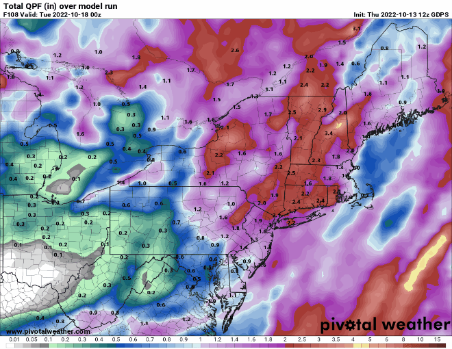
Thursday night: Breezy with periods of rain, possibly heavy at times. Low 57-64.
Friday: Rain tapers off to showers, ending during the afternoon. Winds diminish in the morning. High 65-72.
Friday night: Any lingering showers end during the evening, then skies clear out. Low 44-51.
Saturday: Sunny and mild. High 62-69.
Saturday night: Clear to partly cloudy. Low 45-52.
Sunday: A mix of sun and clouds. High 63-70.
Sunday night: Becoming cloudy. Low 43-50.
Monday: Scattered showers. High 56-63.
