Sunday isn’t looking that great around here, but things could be worse. Severe weather is likely across the Mid-Atlantic states on Sunday. Meanwhile, Tropical Storm Bonnie will head out into the open Atlantic this weekend, but another area is being watched for development near the Yucatan Peninsula.
We’re starting the weekend off with a fantastic Saturday here in New England, but big changes are coming. High pressure builds in today, so after some morning fog burns off we’ll have a mix of sunshine and clouds this afternoon. High temperatures will get into the upper 60s and 70s near the coastline, but away from the water, highs will be in the lower to middle 80s, with a few spots possibly reaching the upper 80s. Make sure you get outside and enjoy it because clouds will stream in late in the day ahead of a cold front moving across the Midwest.
Ahead of that front, with a warm, humid airmass in place, showers and thunderstorms will develop, some of which will become strong to severe. Widespread severe weather isn’t expected on Saturday, but there is a risk for some strong to severe storms from the Great Lakes into the Ohio Valley. Sunday will be a different story. The ingredients will be in place for a severe weather outbreak from the Mid-Atlantic states into the Carolinas.


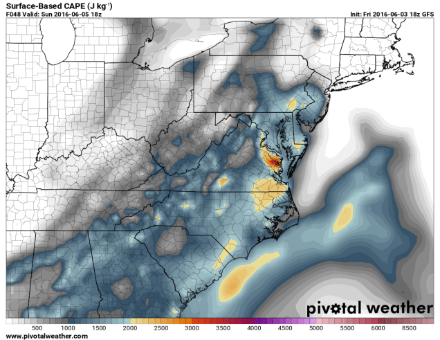
As temperatures rise into the 80s to lower 90s, the airmass will become increasingly unstable. CAPE, which is short for Convective Available Potential Energy, is a measure of instability through the atmosphere. CAPE values of 1000-3000 J/kg are expected from the Delmarva Peninsula into the Carolinas Sunday afternoon. These values are indicative of moderate instability in the atmosphere. The “Lifted Index” is the difference in temperature between the atmosphere at 500mb (about 18,000 feet up) and a parcel of air from the surface that is lifted to 500mb. A negative value is indicative of unstable conditions. On Sunday, forecast models are showing values between -4 and -9 across the Mid-Atlantic states.
While Sunday may start off cloudy with showers across parts of the region, breaks of sunshine should develop by early afternoon, with showers and thunderstorms developing along the eastern slopes of the Appalachians. Thunderstorm activity will likely organize into a line that will march eastward, reaching the Washington/Baltimore area by late afternoon, and the Richmond/Norfolk area towards evening. The main threats with any storms that do develop are strong winds, hail, and heavy downpours, with a few tornadoes also possible.
Up here in New England, we won’t have to worry too much about severe weather. That doesn’t mean we’ll have a great day. Rain will likely develop Sunday morning and continue for much of the day, ending late Sunday night or early Monday morning. We’re looking at an inch to an inch and a half of rain across the region, which we really need, as it’s been dry for the past few months. If you’ve got outdoor plans for Sunday, we’d start looking for alternate ideas. While the day may not be a complete washout, it’ll be cloudy, relatively cool (60s to lower 70s), and raining off and on for much of the day.

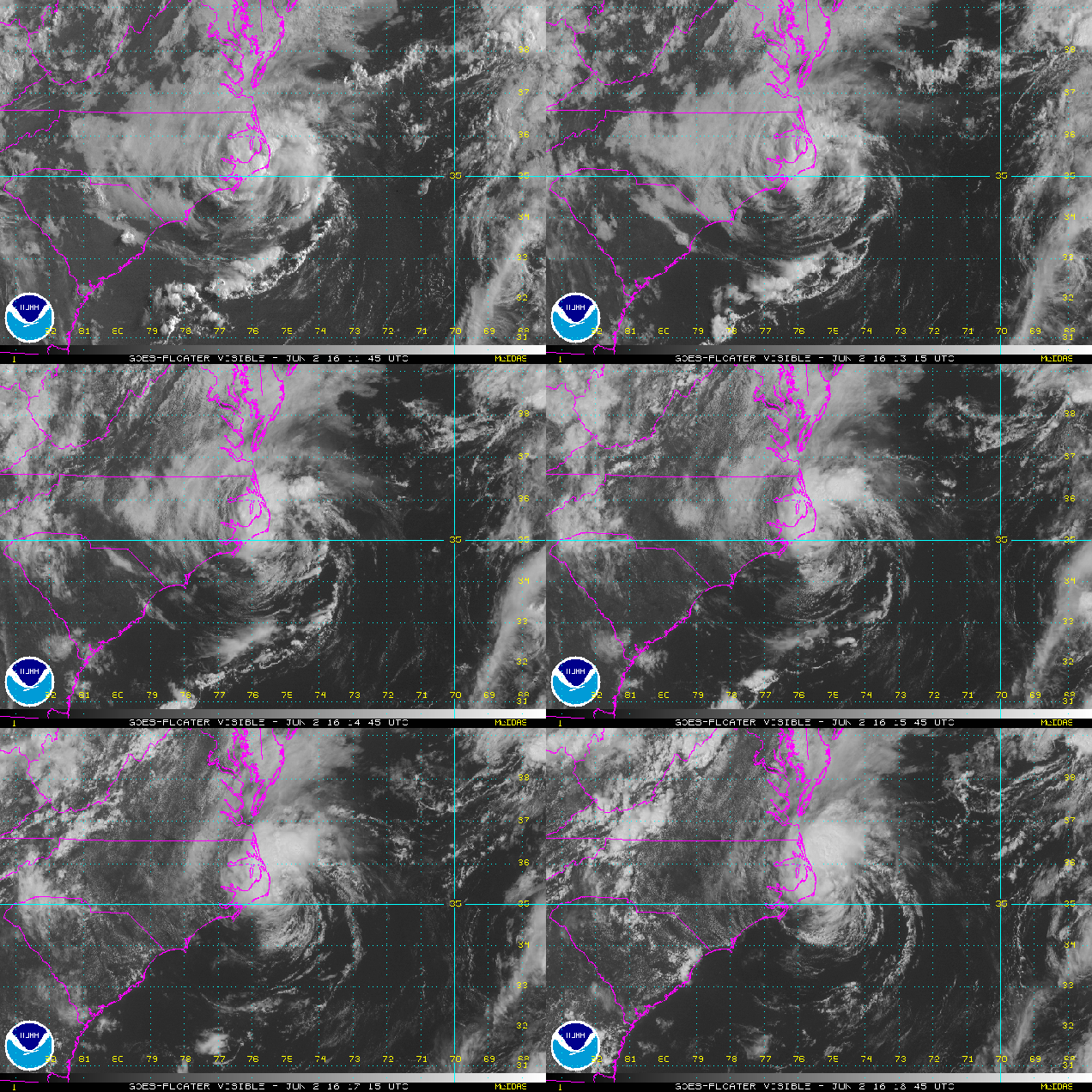
Meanwhile, Tropical Storm Bonnie has redeveloped east of North Carolina this evening. As of 5pm Friday, Bonnie was centered about 285 miles east of Cape Hatteras, NC, moving towards the east at 13 mph. Maximum sustained winds are near 40 mph. Bonnie is expected to head out into the open waters of the Atlantic over the weekend while steadily weakening.

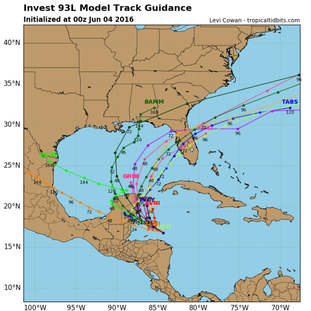
While June is usually quiet in the tropics, another area of disturbed weather in the western Caribbean is being monitored for development this weekend. A cluster of showers and thunderstorms will head towards the Yucatan Peninsula this weekend and then turn more towards the north and head into the Gulf of Mexico. For several days now, forecast models have been indicating that this system could become a tropical depression or tropical storm over the Gulf early next week.


Most forecasts are for the storm to turn more toward the northeast early next week and cross the Florida Peninsula as a tropical depression or weak tropical storm. While winds aren’t expected to be strong, the main impact will be heavy rainfall. The storm could drop as much as 4-8 inches of rain on the Sunshine State next week, especially the southern half of the state. Heavy rain fell on portions of the region during May, so additional heavy rain could lead to flooding in parts of the area.
After all that, we didn’t even talk about the potential tropical system in the Eastern Pacific, the record heat in the West, the flooding in Paris and parts of western Europe, or the powerful storm impacting southeastern Australia. Yup, things are pretty busy in the weather office.


