The active pattern will continue for most of the week with a few more chances for wintry weather.

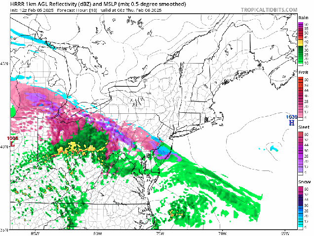
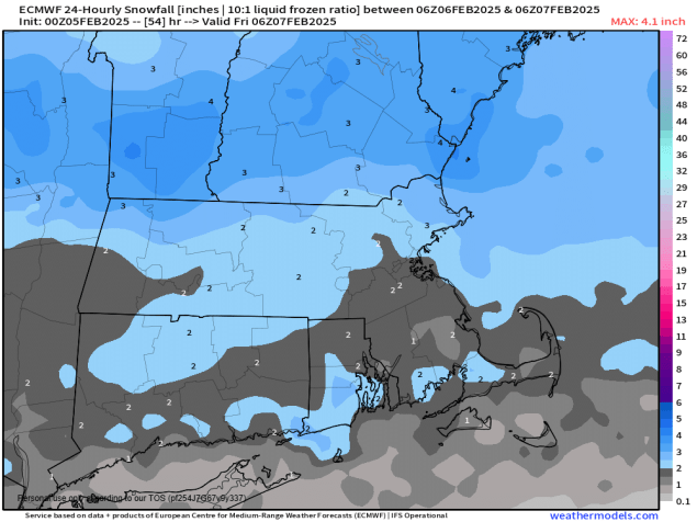
We’re starting the week out with high pressure in control, giving us sunshine and chilly conditions today. Many places will get above freezing allowing for snow to melt, but as temperatures drop this evening, icy conditions will likely develop on untreated surfaces, so keep that in mind if you are heading out this evening. Clouds will start to move in on Tuesday ahead of another low pressure system. This one will bring snow into the Mid-Atlantic states, but likely passes well south of New England. However, the precipitation field surrounding the storm could get far enough north Tuesday night to bring a little light snow into the South Coast, Cape Cod, and the Islands, possibly as far north as parts of Rhode Island and southeastern Massachusetts. We’re not looking at much snow, just a dusting to perhaps an inch, so it’ll be more of a nuisance than anything else if it happens. High pressure brings drier air in for Wednesday, then things get complicated.
Low pressure will move into the Great Lakes late Wednesday, then into the St. Lawrence Valley Wednesday night and Thursday. We’ll see snow developing ahead of the system Wednesday night, but as warmer air moves in aloft, a change to sleet and then freezing rain is likely. The question becomes – does a secondary area of low pressure develop and pass south of New England early Thursday? If it does, that will keep the cold air in place in the surface, resulting in sleet and freezing rain continuing across the interior, with a change to plain rain south of the Mass Pike. If it doesn’t, then the warmer air eventually moves in at the surface, with a change to plain rain across most of the region before the precipitation ends by midday Thursday. High pressure builds in with drier air for Friday and the first part of Saturday before things get complicated once again.

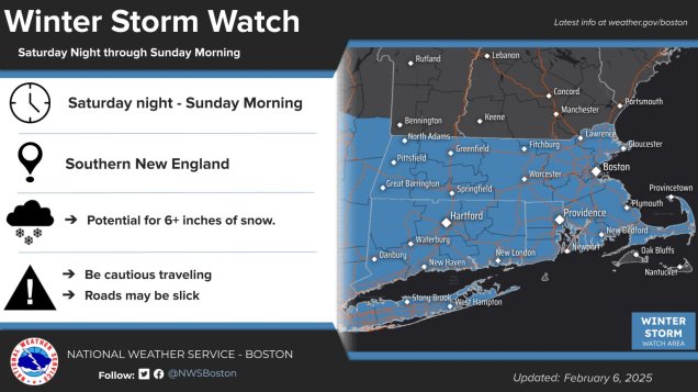
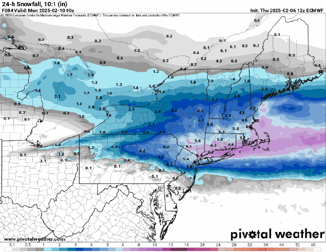
Another low pressure system will move out of the Great Lakes and into the St. Lawrence Valley later Saturday and Saturday night. We’ll see snow developing late Saturday, likely changing to rain at night. This time, we likely will see a secondary low pressure area develop, but the question is, where does it track. Does it pass south of the region, allowing some colder air to move back in with a change back to sleet or snow? Does it move right across the region, resulting in more rain for much of Sunday? At this point, it’s far too early to try and pin down these type of details, but it does look like, for now at least, that Sunday won’t be a nice day around here.
Monday: Partly to mostly sunny. High 28-35.
Monday night: Clear to partly cloudy. Low 7-14, north of the Mass Pike, 15-22 south of the Pike.
Tuesday: Morning sun, then increasing clouds. High 28-35.
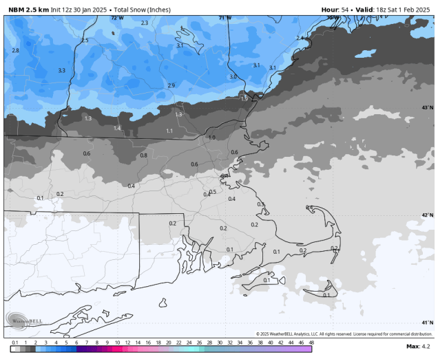
Tuesday night: Mostly cloudy, chance for a little light snow near the South Coast, Cape Cod, and the Islands. Low 9-16 north of the Mass Pike, 17-24 south of the Pike.
Wednesday: Intervals of clouds and sun. High 26-33.
Wednesday night: Cloudy with light snow developing, changing to sleet and freezing rain late at night, possibly all rain south of Boston. Low 18-25, temperatures start rising after midnight.
Thursday: Snow, sleet, freezing rain, or rain ending by midday, some clearing towards evening. High 36-43.
Thursday night: Becoming partly cloudy. Low 16-23.
Friday: Mostly sunny, breezy, colder. High 25-32.
Saturday: Becoming mostly cloudy, light snow developing in the afternoon, changing to rain at night. High 29-36.
Sunday: Cloudy and breezy with rain likely, possibly changing back to sleet, freezing rain, or snow, especially north and west of Boston. High 35-42.