We’ve got some better weather on the way for the first half of the upcoming week. Unfortunately, the second half of the week isn’t looking that great once again.

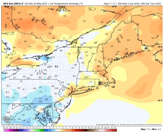
The upper-level low pressure area that kept the clouds and showers around through the weekend will finally pull away today and high pressure will start to build in, bringing us drier and milder weather. There will still be some clouds around, especially during the afternoon, and even though a couple of models still show the potential for a few stray popup showers, we expect it to remain dry, so any outdoor activities should be fine. Tuesday should be the best day we’ve had in a while, with sunshine and temperatures close to or a little above normal for the end of May. Wednesday will also be mild, but we’ll see clouds starting to move back in as another low pressure system heads our way. We may see some rain move in as early as Wednesday night, but Thursday looks like a day with some showers, though it probably won’t be a washout, and it likely won’t be as chilly as the past few days have been.
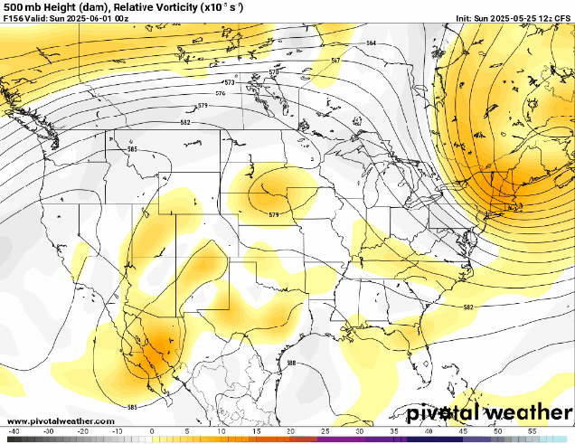
After that, another upper-level low pressure system settles into the Northeast, and likely remains there into the weekend. Now this upper-low isn’t as strong as the one we just dealt with, so it shouldn’t be as chilly as the end of last week, but temperatures will likely be near to below normal for the latter half of the week and the weekend. In addition, there will be a daily chance for showers. None of the days will be a washout, and the activity will be scattered about each day, but we’re not expecting any completely dry days from Thursday into Sunday. There are some indications that drier and much warmer air could make an appearance for the start of the following week, but whether that happens and how long it may last if it does, are questions we can’t answer at this point.
Monday: Sunshine and some afternoon clouds. High 63-70, cooler across Cape Cod.
Monday night: Clear to partly cloudy. Low 45-52.
Tuesday: Partly to mostly sunny. High 71-78, cooler across Cape Cod.
Tuesday night: Partly cloudy. Low 49-56.
Wednesday: Becoming partly to mostly cloudy. High 70-77, cooler across the South Coast and Cape Cod.
Wednesday night: Mostly cloudy, chance for showers late at night, mostly near the South Coast. Low 49-56.
Thursday: Plenty of clouds with some showers likely. High 64-71.
Thursday night: Mostly cloudy with some additional showers. Low 52-59.
Friday: Partly sunny, chance for a few showers. High 68-75, cooler across Cape Cod.
Saturday: Intervals of clouds and sunshine with a chance for more showers. High 67-74.
Sunday: Partly sunny with more showers possible. High 66-73.
