The last full week of March will be a reminder that although it’s now Spring, it won’t always feel that way.

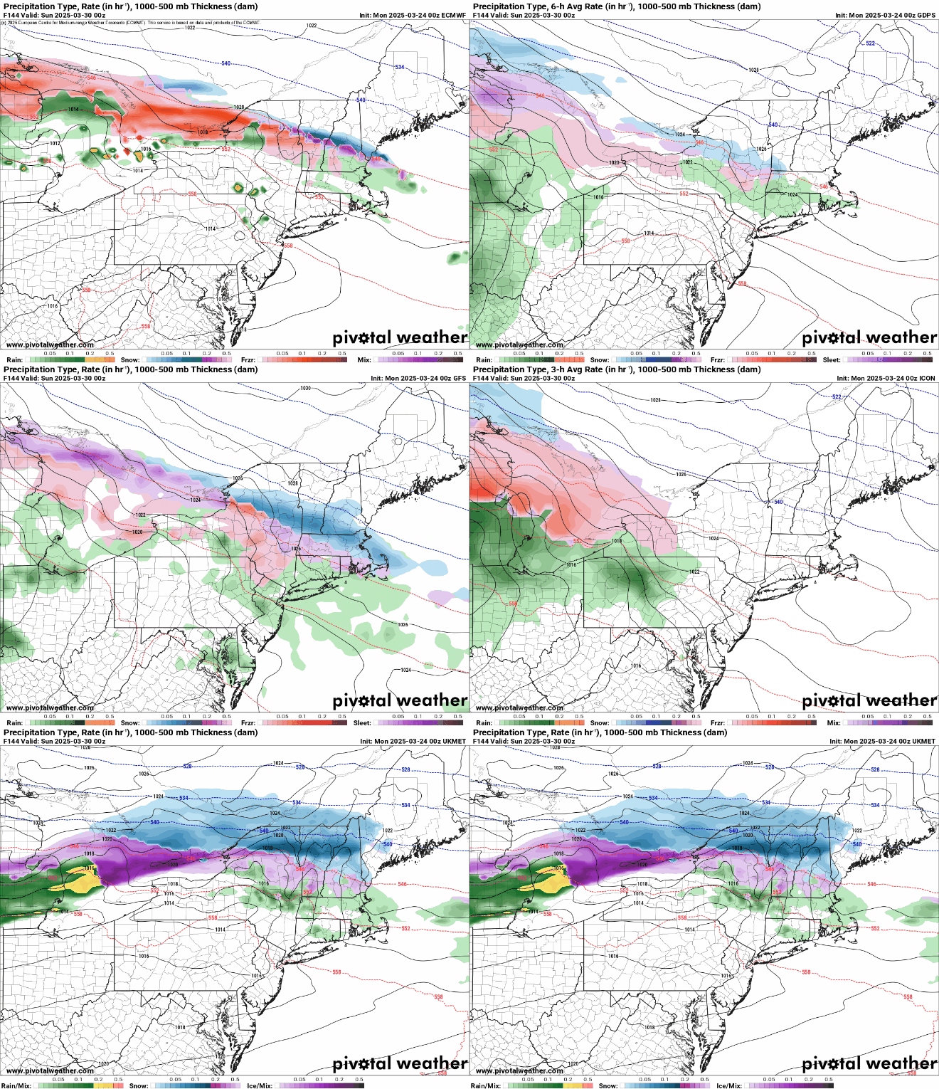
The week starts off with a low pressure system heading across the Great Lakes, sending some rain in for much of the day. However, in the morning, we’ll have just enough cold air in place for some snow, mainly well north and west of Boston, but there won’t be much, if any, accumulation before the change to rain, except possibly in the Worcester Hills and the Monadnocks. That system pulls away, and an upper-level low moves in for Tuesday, resulting in a cool day with clouds, and possibly a sprinkle. Another system will pass by to the south Tuesday night and Wednesday, generating some rain across Cape Cod and southeastern Massachusetts, and possibly a fit farther north and west. There could even be enough cool air in place that if the rain penetrates far enough inland it could change to snow. This is something we’ll be watching over the next day or two. High pressure builds in for Thursday with a sunny and cool day. Another cold front moves in on Friday with a few showers. The weekend looks unsettled at the moment, but full of questions marks. Another low pressure system will head into the Great Lakes, with a warm front extending eastward from it. Ahead of that front we’ll see some precipitation on Saturday, but whether it is rain or snow changing to rain remains to be seen. If the warm front moves through, then, Sunday could be a mild day, but with a cold front moving in from the west, we could see more rain showers before the day is done. If the warm front doesn’t move through, then it will be quite a bit cooler, with the potential for more rain as a wave of low pressure rides along the front to our south.

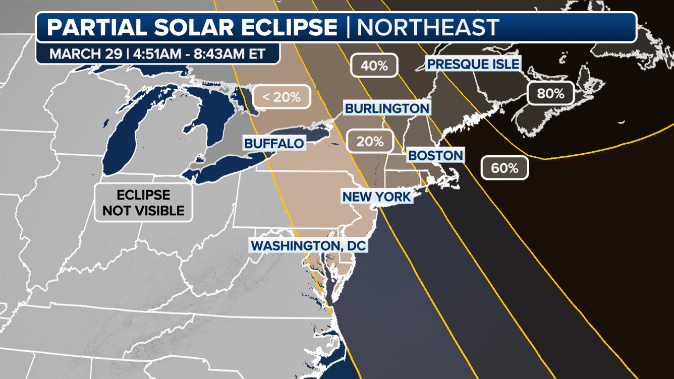
The Saturday morning forecast is of interest for another reason. We will have a partial solar eclipse at sunrise Saturday (around 6:30am), so we’re hoping for clear skies, at least on the eastern horizon. The eclipse will actually reach its maximum before sunrise, but as the sun comes up, it will be 50-70% covered by the moon until the eclipse ends just after 7:00am. We’ll keep an eye on this as the week goes on, but right now, hope for some clear skies and set your alarm to get up early on Saturday for another rare celestial event.

Monday: Cloudy with light rain likely, possibly some morning snow across southern New Hampshire and the Worcester Hills. High 44-51 south of the Mass Pike, 36-43 north of the Pike.
Monday night: Any lingering showers end in the evening, becoming partly cloudy overnight. Low 31-38.
Tuesday: Partly sunny, breezy, chance for a sprinkle. High 47-54.
Tuesday night: Partly cloudy. Low 29-36.
Wednesday: Partly to mostly cloudy, chance for rain across southeastern Massachusetts and Cape Cod, possibly some rain or snow farther inland. High 41-48.
Wednesday night: Clearing. Low 25-32.
Thursday: Sunshine and some afternoon clouds. High 42-49.
Thursday night: Partly cloudy. Low 29-36.
Friday: Partly sunny, breezy, chance for a few showers, mainly early. High 47-54.
Saturday: Partly to mostly cloudy with a chance of rain or snow. High 40-47.
Sunday: Cloudy with a chance of rain. High 41-48.