The final days of January and first few of February are going to feature some typical winter weather with chilly temperatures and a few chances at some light snow.
We start the week out with a sunny, breezy, and chilly day with temperatures close to where they should be in late January. Things start to change on Tuesday as a cold front moves through in the morning. This front may be accompanied by some snow showers or squalls, which could drop a quick half an inch to an inch in spots, possibly as early as the morning commute, so keep this in mind for your drive to work or school.
An Alberta Clipper will quickly follow on Wednesday. There is still some uncertainty with the exact track this system will take, which has an impact on the forecast. Some models bring the system across Northern New England, which would mean some rain or snow showers for most of us. Some bring it right across the region, with some light snow mainly north of the Mass Pike, and rain or snow showers to the south, and some bring it south of New England, with light snow for everyone. For now, we’re going to play the middle ground, with some light snow or snow showers for much of the region, possibly mixed with rain across parts of Rhode Island and southeastern Massachusetts. An inch or two of snow could accumulate, in most spots from this storm. Once this system moves by, we get another arctic blast for Thursday with very cold temperatures and gusty winds, but it only lasts for one day as temperatures quickly moderate on Friday.

The weekend is a bit of a question mark at this point. Most of the models all have a system moving in at some point later Friday into Saturday, though at least one model now keeps the storm south of New England. Some have milder air moving in ahead of it, with some rain, changing to snow as the system moves by, some have just occasional rain or snow showers through the weekend, and some have nothing at all. It’s far too early to tell which solution (if any of these) will be right, so we’ll just keep monitoring it, and will hopefully have a bit more clarity when we get to our Weekend Outlook on Thursday. Right now, it looks like high pressure will build in for Sunday with drier weather.

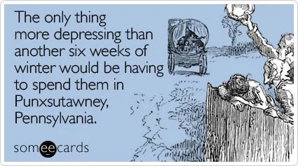
Sunday is also Groundhog Day. According to tradition, if the groundhog emerges from its burrow and sees its shadow, and will go back inside and winter will last for 6 more weeks. If it doesn’t see its shadow, spring will arrive early. The most famous celebration of this day takes place in Punxsutawney, PA, where Punxsutawney Phil is brought out every year. He has only seen his shadow 20 times in the 138 years this has been recorded.
Monday: Plenty of sunshine with a few afternoon clouds, breezy. High 32-39.
Monday night: Becoming partly to mostly cloudy, breezy. Low 25-32.
Tuesday: Intervals of clouds and sun, chance for some snow showers or squalls during the morning, windy, especially through early afternoon. High 31-38 in the morning, temperatures start dropping in the afternoon.
Tuesday night: Mostly cloudy, light snow or snow showers develop before daybreak. Low 12-19, though temperatures may hold steady or rise a little after midnight.
Wednesday: Mostly cloudy with some light snow or snow showers likely, possibly mixed with rain across parts of Rhode Island and southeastern Massachusetts. High 32-39.
Wednesday night: Clearing, breezy. Low 10-17.
Thursday: Sunshine and a few clouds, breezy, colder. High 23-30.
Thursday night: Partly cloudy. Low 12-19, but temperatures may start rising after midnight.
Friday: Intervals of clouds and sun, breezy, rain or snow possible late in the day. High 33-40.
Saturday: Partly to mostly cloudy with a chance of rain or snow. High 30-37.
Sunday: Partly sunny. High 27-34.
