Colder weather is on the way as get to the first weekend of the year.
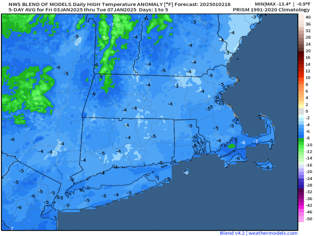
The forecast through Sunday is pretty straightforward. High pressure builds in with progressively colder weather through Sunday, exacerbated by gusty winds at times, but it will remain dry. Things could get a little complicated on Monday. Low pressure will move off the Mid-Atlantic coastline, producing a decent-sized snowstorm for Washington, D.C. and nearby locations. The storm will pass south of New England, but could get close enough to produce a little light snow or some snow showers near the South Coast, but this is far from a lock.

Thursday night: Clear to partly cloudy, breezy. Low 24-31.
Friday: Mostly sunny, breezy. High 32-39.
Friday night: Clear to partly cloudy. Low 18-25.
Saturday: A mix of sun and clouds, breezy. High 26-33.
Saturday night: Partly cloudy. Low 15-22.
Sunday: Partly sunny, breezy. High 25-32.
Sunday night: Partly cloudy. Low 14-21.
Monday: Intervals of clouds and sun, slight chance for a few snow showers near the South Coast. High 25-32.
