Weekend Outlook: January 31 – February 3, 2025

An active weather pattern will continue through the weekend but our first signs of Spring will also show up.

We’re still in a drought and need all the rain (and snow) we can get. Image provided by the National Drought Mitigation Center.

Clouds will stream into the region tonight ahead of a low pressure area moving into the Ohio Valley. A warm front ahead of the system will move in on Friday, with some rain developing ahead of it, though there may be enough cold air in place for a little freezing rain or snow as you get into parts of central and southern New Hampshire at the start. Much of the afternoon will feature some light rain and mild temperatures, but as the system passes by, colder air will start to work its way in, with rain changing to snow across southern New Hampshire during the evening, with the rain/snow line likely getting down to the Mass Pike before the precipitation ends a little after midnight. We’re not expecting much accumulation, just an inch or two, mainly north of Route 2. The bigger issue might be icy conditions developing on the roads. Temperatures will drop below freezing during the overnight, and the roads will still be wet from the rain, so they could ice up pretty quickly once the rain changes over, and before road crews have a chance to treat the roads. Keep this in mind in you will be out late Friday night.

We’re not expecting much snowfall accumulation from the Friday night system. Image provided by WeatherBell.

High pressure builds in for Saturday with sunshine and colder conditions, but it will be short-lived. Clouds come right back in by Sunday morning as an Alberta Clipper makes its way across southern Canada. We’ll see this system spread in some light snow Sunday evening and night, but again, we’re not expecting more than an inch or two, and again it will be mainly north of the Mass Pike. In fact, there may not be any precipitation from this system south of the Pike. The snow ends Monday morning, then we’ll turn partly sunny and rather milder for the afternoon. However, a cold front trailing the system will move in by late in the day, possibly producing a few more rain showers.

Sunday night’s system will not produce a lot of snow across the region. Image provided by Weathermodels.com.

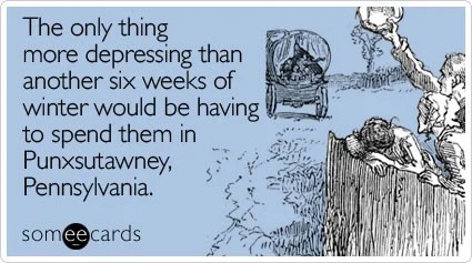
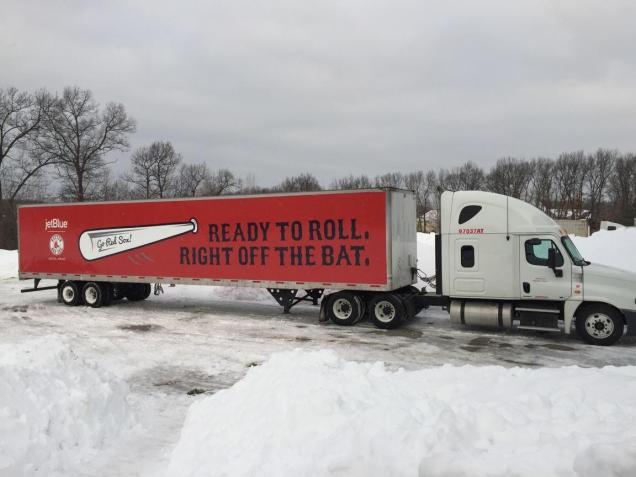
We also have two signs that Spring is nearly here coming this weekend. First, Sunday is Groundhog Day. According to tradition, if the groundhog emerges from its burrow and sees its shadow, and will go back inside and winter will last for 6 more weeks. If it doesn’t see its shadow, spring will arrive early. The most famous celebration of this day takes place in Punxsutawney, PA, where Punxsutawney Phil is brought out every year. He has only seen his shadow 20 times in the 138 years this has been recorded. Secondly, Monday is Truck Day. That is the day the Red Sox equipment truck gets loaded up at Fenway Park and begins the drive southward to Fort Myers, Florida. Pitchers and catchers will have their first workout of Spring Training on February 12.

One of the first signs of spring is upon us – Monday is Red Sox Truck Day, when all of the equipment gets loaded up and shipped down to Fort Myers for spring training. Image provided by Boston.com

Thursday night: Becoming mostly cloudy. Low 17-24 during the evening, temperatures start rising after midnight.

Friday: Cloudy with rain developing by early afternoon, possibly mixed with a little freezing rain or snow across central and southern New Hampshire at the start. High 37-44.

Friday night: Mostly cloudy with rain changing to snow from north to south during the evening, ending shortly after midnight. Low 24-31.

Saturday: Becoming partly to mostly sunny, breezy, and colder. High 30-37.

Saturday night: Clear during the evening, clouds start to move back in after midnight. Low 4-11.

Sunday: Becoming cloudy, some light snow or snow showers may develop by evening. High 28-35.

Sunday night: Cloudy with light snow or snow showers likely. Low 21-28 during the evening, temperatures rise overnight.

Monday: Plenty of clouds with some sunny breaks developing, a few rain showers possible late in the day, breezy. High 42-49.

Weekly Outlook: January 27-February 2, 2025

The final days of January and first few of February are going to feature some typical winter weather with chilly temperatures and a few chances at some light snow.

We start the week out with a sunny, breezy, and chilly day with temperatures close to where they should be in late January. Things start to change on Tuesday as a cold front moves through in the morning. This front may be accompanied by some snow showers or squalls, which could drop a quick half an inch to an inch in spots, possibly as early as the morning commute, so keep this in mind for your drive to work or school.

A line of snow showers or squalls will likely cross the region Tuesday morning. Loop provided by WeatherBell.

An Alberta Clipper will quickly follow on Wednesday. There is still some uncertainty with the exact track this system will take, which has an impact on the forecast. Some models bring the system across Northern New England, which would mean some rain or snow showers for most of us. Some bring it right across the region, with some light snow mainly north of the Mass Pike, and rain or snow showers to the south, and some bring it south of New England, with light snow for everyone. For now, we’re going to play the middle ground, with some light snow or snow showers for much of the region, possibly mixed with rain across parts of Rhode Island and southeastern Massachusetts. An inch or two of snow could accumulate, in most spots from this storm. Once this system moves by, we get another arctic blast for Thursday with very cold temperatures and gusty winds, but it only lasts for one day as temperatures quickly moderate on Friday.

Most spots will only see an inch or two of snow from Wednesday’s Clipper system. Image provided by Weathermodels.com.

The weekend is a bit of a question mark at this point. Most of the models all have a system moving in at some point later Friday into Saturday, though at least one model now keeps the storm south of New England. Some have milder air moving in ahead of it, with some rain, changing to snow as the system moves by, some have just occasional rain or snow showers through the weekend, and some have nothing at all. It’s far too early to tell which solution (if any of these) will be right, so we’ll just keep monitoring it, and will hopefully have a bit more clarity when we get to our Weekend Outlook on Thursday. Right now, it looks like high pressure will build in for Sunday with drier weather.

The models all have differing ideas about a potential storm for Friday night. Images provided by Pivotal Weather.

Sunday is also Groundhog Day. According to tradition, if the groundhog emerges from its burrow and sees its shadow, and will go back inside and winter will last for 6 more weeks. If it doesn’t see its shadow, spring will arrive early. The most famous celebration of this day takes place in Punxsutawney, PA, where Punxsutawney Phil is brought out every year. He has only seen his shadow 20 times in the 138 years this has been recorded.

Image provided by Someecards

Monday: Plenty of sunshine with a few afternoon clouds, breezy. High 32-39.

Monday night: Becoming partly to mostly cloudy, breezy. Low 25-32.

Tuesday: Intervals of clouds and sun, chance for some snow showers or squalls during the morning, windy, especially through early afternoon. High 31-38 in the morning, temperatures start dropping in the afternoon.

Tuesday night: Mostly cloudy, light snow or snow showers develop before daybreak. Low 12-19, though temperatures may hold steady or rise a little after midnight.

Wednesday: Mostly cloudy with some light snow or snow showers likely, possibly mixed with rain across parts of Rhode Island and southeastern Massachusetts. High 32-39.

Wednesday night: Clearing, breezy. Low 10-17.

Thursday: Sunshine and a few clouds, breezy, colder. High 23-30.

Thursday night: Partly cloudy. Low 12-19, but temperatures may start rising after midnight.

Friday: Intervals of clouds and sun, breezy, rain or snow possible late in the day. High 33-40.

Saturday: Partly to mostly cloudy with a chance of rain or snow. High 30-37.

Sunday: Partly sunny. High 27-34.

Weekend Outlook: January 24-27, 2025

The coldest weather is past us and it will remain mostly dry through the weekend.

High temperatures should be in the middle 30s across the region in late January. Image provided by weathermodels.com

High pressure will build in with dry weather into Saturday. The bitterly cold air has moved out, and temperatures will moderate over the next couple of days, but will still be below normal for late January. Clouds will move in on Sunday as a weak system heads toward the region. This system has little moisture to work with, so aside from a few widely scattered flurries or snow showers, it will remain dry. Temperatures will moderate a bit more ahead of the system, but once it moves by, colder air will filter back in on Monday.

Much of the region has received a foot or less of snowfall so far this winter, and we’re not adding to that in the near future. Image provided by WeatherBell.

Thursday night: Clear to partly cloudy. Low 10-17, milder across Cape Cod.

Friday: Sunshine and some afternoon clouds. High 26-33.

Friday night: Clear skies. Low 5-12, milder across Cape Cod.

Saturday: Mostly sunny, clouds start to move in late in the day. High 24-31.

Saturday night: Partly to mostly cloudy. Low 14-21, milder across Cape Cod.

Sunday: Intervals of clouds and sun, slight chance for a snow shower or flurry, breezy. High 31-38.

Sunday night: Clear to partly cloudy. Low 16-23.

Monday: A mix of sun and clouds, breezy. High 30-37.

Weekly Outlook: January 20-26, 2025

Some rather cold air is on the way, and it will hang around for a few days.

Temperatures will be well below normal over the next several days. Image provided by Weathermodels.com

The storm that brought us some snow last night will pull away today with any lingering snow ending early this morning and skies rapidly clearing by afternoon. As the colder air floods in on gusty northwest winds, temperatures may only get back up into the lower to middle 20s in the afternoon, with wind chills in the teens and single numbers. Winds die down during the evening, and with clear skies and fresh snowcover, it’s going to be a rather cold night, with lows dropping into the single numbers, possibly even below zero in a few of the colder spots. High pressure builds in with cold temperatures for Tuesday into Thursday, with many places not reaching 20 degrees on Tuesday or Wednesday. Wind chills will be in the single digits during the day and below zero at night. We are going to have a low pressure area passing well south of the region Tuesday night into early Wednesday, sending some clouds in, but we should remain dry, except for possibly a few flurries across the Outer Cape and Islands. Thursday looks dry and cold as well, but temperatures may be a few degrees milder than the previous couple of days.

Subzero wind chills are expected when you head out the door Wednesday morning. Image provided by WeatherBell.

We’re watching another system that will pass south of the region Thursday night and early Friday. Right now, this one looks like it will stay a little too far offshore to have much impact, but again, there could be some snow in parts of Cape Cod and possibly southeastern Massachusetts. It’s too early to tell how close it will get, so we’ll keep an eye on it, and should have a much better idea when we publish our Weekend Outlook on Thursday. Temperatures will moderate a bit more for Friday and Saturday, then a cold front may produce a few snow showers on Sunday.

Some snow is possible across southeastern New England Thursday night. Images provided by Pivotal Weather.

Monday: Any lingering snow ends early, then becoming mostly sunny with a few afternoon clouds, breezy, especially during the morning and early afternoon with some blowing snow. High 19-26. (Wind chill 5-15).

Monday night: Partly cloudy during the evening, then becoming clear overnight. Low 1-8, a little milder across the Cape and Islands. (Wind chill -5 to +5)

Tuesday: Morning sunshine, then increasing afternoon clouds. High 15-22. (Wind chill 5-15)

Tuesday night: Evening clouds, possibly a few flurries across the Outer Cape and Islands, then clearing. Low -2 to +5, a little milder across the Cape and Islands. (Wind chill -10 to 0)

Wednesday: Mostly sunny and cold. High 14-21. (Wind chill 5-15)

Wednesday night: Partly cloudy. Low 1-8, a little milder across the Cape and Islands. (Wind chill -5 to +5)

Thursday: Partly sunny, not as cold. High 24-31. (Wind chill 15-25)

Thursday night: Partly cloudy, slight chance for some light snow or snow showers across southeastern Massachusetts and Cape Cod. Low 8-15, a little milder across the Cape and Islands.

Friday: A mix of sun and clouds. High 26-33.

Saturday: Sunshine and some late-day clouds. High 27-34.

Sunday: More clouds than sun, chance for a few snow showers. High 32-39.

Sunday Night Snowstorm on the Way

Our first snowstorm of the winter is on the way for Sunday night and early Monday.

A cold front is moving offshore this morning, setting the stage for our snowstorm tonight. Image provided by the Weather Prediction Center.

The cold front that brought us some rain Saturday evening has moved offshore and it will slow down today, with a wave of low pressure riding up along it tonight and early Monday. Clouds will move back into the region this afternoon ahead of this wave, with snow developing from southwest to northeast by late afternoon/early evening. Temperatures will be warm enough for the precipitation to start as rain across Cape Cod and parts of southeastern Massachusetts, but even there, the rain/snow line will collapse southward tonight. With temperatures dropping during the evening and overnight, the snow will be more fluffy, especially north and west of Boston. During the evening hours, we could see a burst of moderate to even heavy snow, with some places picking up an inch or so per hour. The snow should taper off to snow showers after midnight, but likely won’t end until shortly before daybreak on Monday.

Low pressure will pass south and east of the region tonight. Loop provided by Tropical Tidbits.

So, how much can we expect? North and west of I-95 most places will see 4-8 inches by the time everything winds down Monday morning. South and east of I-95, we’re looking at 3-6 inches, since there may be a little rain to start, and the snow won’t be as fluffy with temperatures a little milder. Once you get down to the South Coast, it’ll be more like 2-4 inches due to the rain at the start, with 1-3 inches across Cape Cod, heaviest towards the Canal.

A light to moderate snowstorm is expected for most of us tonight. Image provided by WeatherBell.

Make sure you clean up your driveway Monday morning. Gusty winds behind the system will result in a little blowing and drifting snow, but it’s going to turn much colder for a few days. Temperatures on Monday may not get back up to 20 in the afternoon, and we’ll likely stay in the teens during the day on Tuesday and Wednesday, with wind chills near or below zero. Night time lows will also be in the single digits or below zero for many of us as well. We’ll have more details on this in our Weekly Outlook early Monday.

Weekend Outlook: January 17-20, 2025

We’ve got good news and bad news for the weekend forecast. Good: It’s going to turn milder and rain, to get rid of some of the snow on the ground. Bad: It’s going to turn colder and snow again.

A little “nuisance snow” is expected this evening. Image provided by the NWS office in Norton, MA.

Lots of rapid changes will be happening over the next several days across the region. First, we have a weak system swing through tonight, producing some flurries and snow showers through the evening. They may coat the ground in some spots, with a little more than a coating near the South Coast and the Cape, but this is not a big deal. High pressure builds in for Friday with sunshine and seasonably chilly temperatures, but then the changes really begin. Clouds move in Friday night ahead of a strong cold front. Saturday looks to be a mild day ahead of that front, with much of the region topping 40 degrees in the afternoon. However, we’ll have some rain moving in, though it won’t be that heavy. The rain ends Saturday night as the front moves through, but that front will slow down or stall out just offshore. Sunday looks to be colder, but still near normal for mid-January with some breaks of sun in the morning, but we’ll quickly cloud back up in the afternoon.

Highs should top 40 across much of the region on Saturday. Image provided by Weathermodels.com

A wave of low pressure will ride along that front Sunday night, but exactly where the front stalls out will be a key part of this forecast. With that wave moving back, we’ll have a period of light snow Sunday night into early Monday. The farther offshore the front is, the lighter the amounts as you head farther inland. The closer to the coast, the better chance for some rain at the start late Sunday. In general, it’s not going to be a big storm, but many of us could see 2-4″ of new snow on the ground when you wake up Monday morning. There is the potential for a little more, especially south of Boston, but those are details we can iron out over the next couple of days. As the system pulls away on Monday, much colder air will flood into the region, with temperatures dropping during the day. Tuesday and Wednesday are going to be very cold days, with many places likely not reaching 20 for highs, and nighttime lows dropping into the single numbers or below zero. We’ll have much more detail on that in our Weekly Outlook early Monday.

You will probably need to do some shoveling Monday morning. Image provided by WeatherBell.

Thursday night: Some flurries or snow showers this evening, skies start to clear out late at night. Low 14-21.

Friday: Becoming sunny. High 30-37.

Friday night: Clear during the evening, clouds start to move back in after midnight. Low 20-27 during the evening, temperatures may rise a little after midnight.

Saturday: Cloudy and breezy with rain showers developing in the afternoon. High 40-47.

Saturday night: Showers end in the evening, partial clearing after midnight. Low 27-34.

Sunday: Some morning sun, then clouds return with light snow developing before evening, some rain could be mixed in at the start across Cape Cod. High 36-43.

Sunday night: Light snow likely, ending by daybreak. Low 14-21.

Monday: A mix of sun and clouds, breezy, and turning colder. High 20-27, except 27-34 across Cape Cod and southeastern Massachusetts, but temperatures may start dropping in the afternoon.

Weekly Outlook: January 13-19, 2025

Dry weather is expected for much of the upcoming week.

Little to no precipitation is expected through Saturday morning. Image provided by Weathermodels.com

We’re starting the week off on a mild note, but that won’t last too long. A cold front moves through this evening, with some rain or snow showers accompanying it. Behind it, windy and colder weather moves back in for Tuesday and Wednesday, possibly Thursday as well. A couple of upper-level disturbances will move through over the next few days which may trigger a few widely scattered flurries, but for the most part it will be dry. Temperatures will start to moderate on Friday as high pressure moves offshore. A storm system moves through on Saturday with some rain or snow showers, then a second one follows late Sunday with some more rain or snow likely.

High temperatures may top 40 across most of the region on Saturday. Image provided by WeatherBell.

Monday: Mostly cloudy, a few rain or snow showers possible late in the day. High 36-43.

Monday night: A few rain or snow showers during the evening, clearing overnight. Low 19-26.

Tuesday: Sunshine and some afternoon clouds, breezy. High 27-34.

Tuesday night: Partly cloudy. Low 16-23.

Wednesday: Mostly sunny, breezy. High 24-31.

Thursday: Partly sunny. High 26-33.

Friday: Partly to mostly sunny. High 32-39.

Saturday: Mostly cloudy, showers likely late in the day and at night, possibly changing to snow well north and west of Boston. High 40-47.

Sunday: Intervals of clouds and sun, snow or rain possible at night. High 35-42.

Weekend Outlook: January 10-13, 2025

There is a little bit of snow in our future, but also a slight moderation in our temperatures as well.

High temperatures should be in the mid-to-upper 30s at this time of year. Image provided by Weathermodels.com
High temperatures should be in the middle-to-upper 30s at this time of year. Image provided by Weathermodels.com

The large storm system that has been sitting over Atlantic Canada for much of the week giving us gusty winds, cold temperatures, and occasional snow showers/flurries will finally loosen its grip on the region over the next day or so. Winds will finally start to diminish during the day on Friday, and temperatures will start to moderate, getting back to near to even a little normal for early January on Friday. On Saturday, the low pressure system that some of the models tried to develop into a blockbuster blizzard will pass well south of the region, with no impact at all here. However, an upper-level disturbance will move through, with some light snow or snow showers Saturday morning and into part of the afternoon. For most of the region, accumulations will be an inch or less, but a few spots could pick up 2 inches or so. Once that system pulls away, high pressure builds in with seasonably cold and dry conditions for Sunday and Monday.

Most places will receive less than 1″ of snow om Saturday. Image provided by WeatherBell.

Thursday night: Clear skies, still breezy. Low 18-25.

Friday: Lots of sunshine, winds diminish during the afternoon. High 33-40.

Friday night: Increasing and thickening clouds. Low 19-26.

Saturday: Light snow or snow showers develop in the morning, ending in the afternoon. A coating to 2 inches of accumulation is expected. High 29-36.

Saturday night: Clearing. Low 18-25.

Sunday: Mostly sunny. High 31-38.

Sunday night: Partly cloudy. Low 19-26.

Monday: Partly sunny. High 33-40.

Weekly Outlook: January 6-12, 2025

Some chilly weather, even by January standards, is expected for much of the week, but things could get complicated next weekend.

Low pressure will pass south of New England today, producing a snowstorm in Washington, DC. Loop provided by Tropical Tidbits.

A low pressure system will pass south of New England today. This is the same storm that brough blizzard conditions to Kansas City over the weekend, and a decent-sized snowstorm to Washington, DC today. Around here, it’ll just bring in clouds, and maybe a few flurries to the Cape and Islands. That storm will combine with another one over Newfoundland and remain in place for much of the week, resulting in generally dry but breezy and chilly conditions through Friday. Some weak upper-level disturbances may move through at times, generating a few snow showers here and there, but they’ll be on the light side.

Temperatures will be 5-10 degrees below normal this week. Image provided by Weathermodels.com

By the end of the week, a storm system will begin taking shape that could produce wintry weather from Texas into the Tennessee Valley at the end of the week. What it does next weekend is still a big question mark, and dependent on a few upper-level features that are still out over the Pacific Ocean, which makes things highly uncertain at this point. You may have seem some of the usual characters on social media (a.k.a. Facebook Forecasters) posting maps showing a massive blizzard impacting New England. Yes, some of the models have shown this, and yes it’s possible, but the odds of it happening at this point seem fairly low to us. There are two other scenarios shown on the models that seem more likely, at least for now. One scenario is that the system moves off the Carolina or Mid-Atlantic coastline and stays well to the south, with no impacts up here at all, similar to today’s system. A second scenario is that the storm does develop, and moves off the Mid-Atlantic coast, but stays just far enough offshore that we are only on the fringe of the storm, with some light snow for part of the region. For now, we’re going to lean towards these latter scenarios, while keeping a close eye on the development of the system, just in case, the initial scenario becomes more likely (though we don’t expect at that to be the coast). We’ll obviously have much more clarity when we publish our Weekend Outlook Thursday afternoon.

The ensembles only indicate a slight chance for a little snow next weekend. Image provided by WeatherBell.

Monday: More clouds than sun, slight chance for a flurry across Martha’s Vineyard and Nantucket, skies may start to clear out late in the day. High 23-30.

Monday night: Clouds hang around across the Outer Cape, clearing elsewhere, becoming breezy. Low 11-18.

Tuesday: A mix of sun and clouds, a stray snow shower is possible, breezy. High 22-29.

Tuesday night: Clear to partly cloudy, breezy. Low 12-19.

Wednesday: Sunshine and some afternoon clouds, maybe a snow shower, windy. High 21-28.

Thursday: Partly sunny, slight chance for a flurry, breezy. High 24-31.

Friday: Mostly sunny, not as chilly. High 31-38.

Saturday: Intervals of clouds and sun, slight chance for some light snow at night, favoring areas south of Boston. High 30-37.

Sunday: Intervals of clouds and sun with a slight chance for some light snow, mainly south of Boston. High 30-37.

Weekend Outlook: January 3-6, 2025

Colder weather is on the way as get to the first weekend of the year.

Temperatures will be below normal through the weekend. Image provided by Weathermodels.com

The forecast through Sunday is pretty straightforward. High pressure builds in with progressively colder weather through Sunday, exacerbated by gusty winds at times, but it will remain dry. Things could get a little complicated on Monday. Low pressure will move off the Mid-Atlantic coastline, producing a decent-sized snowstorm for Washington, D.C. and nearby locations. The storm will pass south of New England, but could get close enough to produce a little light snow or some snow showers near the South Coast, but this is far from a lock.

There is a very low chance for some light snow near the South Coast on Monday. Image provided by WeatherBell.

Thursday night: Clear to partly cloudy, breezy. Low 24-31.

Friday: Mostly sunny, breezy. High 32-39.

Friday night: Clear to partly cloudy. Low 18-25.

Saturday: A mix of sun and clouds, breezy. High 26-33.

Saturday night: Partly cloudy. Low 15-22.

Sunday: Partly sunny, breezy. High 25-32.

Sunday night: Partly cloudy. Low 14-21.

Monday: Intervals of clouds and sun, slight chance for a few snow showers near the South Coast. High 25-32.