The coldest air so far this season will move in this week and there’s a chance for some snow as well.

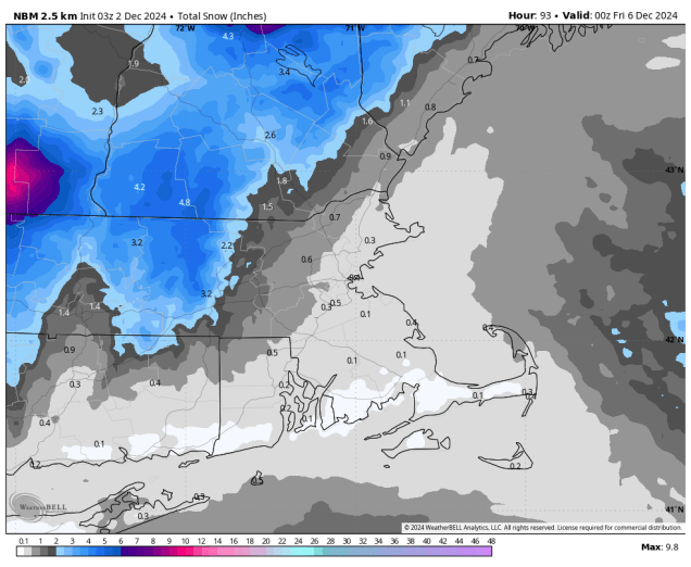
We start the week off with high pressure in control, keeping us dry and cool for the most part. The exception will be across parts of Cape Cod and the Islands, where colder air flowing over the still relatively mild Atlantic may result in some ocean effect rain or snow showers during the next few days. Clouds start to move in on Wednesday ahead of a storm system moving across Southern Canada. This system have just enough moisture accompanying it to produce some snow or rain showers across the region Wednesday night into part of Thursday. Any accumulating snow will likely be confined to the interior, and even there we’re only talking about the potential for a couple of inches, mainly across the hills. Behind that system, some of the coldest air so far this season settles in for Friday into Saturday. Another weak system may produce some snow showers Saturday night into part of Sunday.
Monday: Partly to mostly sunny, chance for a rain or snow shower across the Outer Cape and Islands. High 33-40.
Monday night: Clear skies, except partly cloudy with a chance for a rain or snow shower across the Outer Cape and Islands. Low 19-26, a little milder across the Outer Cape and Islands.
Tuesday: Sunshine and some afternoon clouds, again a chance for a rain or snow shower across the Outer Cape and Islands. High 33-40.
Tuesday night: Clear to partly cloudy. Low 17-24, a little milder across the Outer Cape and Islands.
Wednesday: Increasing clouds, snow or rain showers likely at night. High 37-44.
Thursday: Snow or rain showers end, some late-day clearing, breezy. High 39-46.
Friday: Mostly sunny, breezy, and chilly. High 29-36.
Saturday: Morning sun, then increasing clouds, chance for some snow showers at night. High 29-36.
Sunday: Chance for some morning snow showers, becoming partly sunny. High 35-42.
