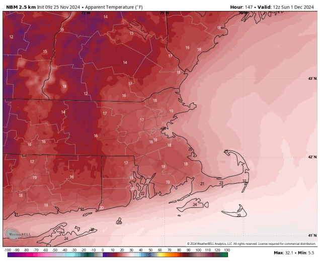
We’ll get right to the point – despite the hype over the past several days, the vast majority of the region will NOT be having a White Thanksgiving. However, we are expecting more much-needed rainfall this week.

We start the week off with high pressure in control, providing us with sunshine and seasonably cool temperatures. Clouds start to move in tonight as low pressure moves from the Great Lakes towards Northern New England. This system will bring us some rain Tuesday morning and afternoon, but we’re a little concerned about Tuesday morning in particular. Temperatures will cool off pretty quickly Monday evening before the clouds arrive, and by the time the rain moves in near or just after daybreak, temperatures may be near freezing across parts of southern New Hampshire. The ground remains fairly warm, but if it’s near 32 and starts to rain, there could be a little icing, especially on elevated surfaces like bridges and overpasses. Temperatures should quickly rise above 32 after daybreak, but if you’re going to be out in southern New Hampshire around daybreak Tuesday, use a little extra caution, especially if the rain moves in a little earlier than currently expected. Rain ends Tuesday afternoon and we clear out at night as high pressure builds in Tuesday night. Wednesday starts off with sunshine, but clouds stream right back in during the afternoon as low pressure begins to move out of the Tennessee Valley.

The latest indications are that this low pressure system will pass south of New England or possibly across Cape Cod during Thanksgiving and into Friday morning. The result will likely be a rainy Turkey Day, so keep this in mind if you are traveling for the holiday. Of course, this is far from locked in, as there is still some uncertainty in the models. Some show the storm passing far enough south that it misses the region entirely. Some bring in a period of heavier rain, and some have enough cold air in place at the start that the rain may start as snow across the interior on Thanksgiving Day, before quickly changing to rain. None of the models show a major snowstorm around here any more, despite a couple of runs of the models doing so last week. One or two show some decent accumulations for ski country, but even that is far from certain at this point. We’ll have much more detail in our Weekend Outlook which will be published on Wednesday this week with the holiday on Thursday. The storm pulls away Friday morning, and there’s the possibility that the rain could change over to snow before ending across areas north and west of Boston, but again, this is far from certain at this point. Blustery and colder weather moves in behind that storm for the weekend, with a few flurries possible at times.

Monday: Mostly sunny, clouds start to filter in towards evening, breezy. High 44-51.
Monday night: Becoming mostly cloudy, showers developing late at night, possibly as some freezing rain across southern New Hampshire. Low 30-37.
Tuesday: Rain likely, ending during the afternoon, some clearing late in the day. High 42-49 north of the Mass Pike, 50-57 south of the Pike.
Tuesday night: Becoming clear. Low 31-38.
Wednesday: Breezy with sunshine during the morning, then clouds start to move back in during the afternoon. High 43-50.
Thanksgiving Day: Cloudy with rain developing, possibly starting as a little wet snow across the interior. High 42-49 north and west of I-95, 50-57 south and east of I-95.
Friday: Showers ending in the morning, possibly changing to snow before ending across the interior, some clearing may develop in the afternoon. High 41-48.
Saturday: Partly sunny, breezy, colder, chance for a few flurries. High 37-44.
Sunday: A mix of sun and clouds, breezy, chilly, chance for a few flurries. High 35-42.